
Figures & data
Figure 1. Location map of the study area.
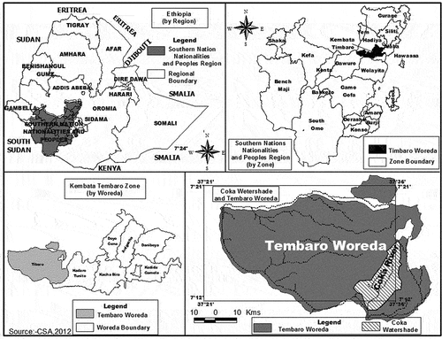
Figure 2. Processing flowchart for modeling soil erosion in the catchment.
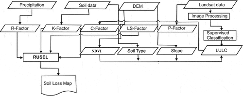
Table 1. Observation data set and source.
Table 2. (K) factor values corresponding to the soil texture and organic matter content Randolph (Citation2004).
Table 3. Description of land-use and land-cover classes in the Coka watershed.
Figure 3. Thematic maps of R-factor (a), K-factor (b), LS-factor (c), C-factor (d), and P-factor (e) of the Coka watershed.
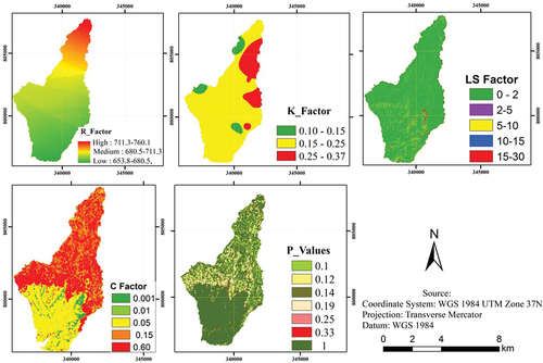
Table 4. Area distribution of RUSLE factors values in Coka watershed.
Table 5. Soil erodibility (K) factor values of different textures and organic matter content.
Figure 4. Spatial distribution of soil loss within the study area.
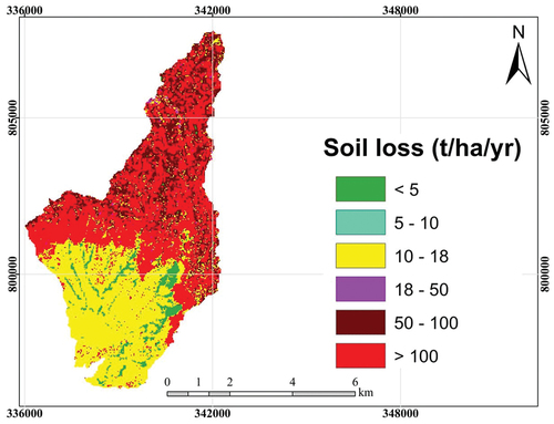
Table 6. Estimation of soil erosion rates.