Figures & data
Figure 1. Illustration map of oil and gas-bearing basin in the SCS.
Source: The drawing of this map referenced the following sources: Wang, Ocean Geography of China, 415; China Geological Survey of Ministry of Land and Resources, Marine Geological Work Memorabilia of P.R. China (1949–1999), 26; Li, World Atlas of Oil and Gas Basins, 47.
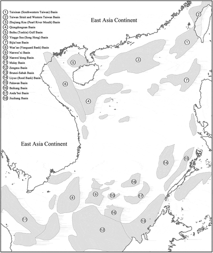
Table 1. Three types of China’s policy choices on the SCS joint development.
Figure 2. Map of the operation locations of the HYSY 981.
Source: Chinese Ministry of Foreign Affairs, “The Operation of the HYSY 981 Drilling Rig: Vietnam’s Provocation and China’s Position,” Accessed August 31 2019. http://www.fmprc.gov.cn/mfa_eng/zxxx_662805/t1163264.shtml.
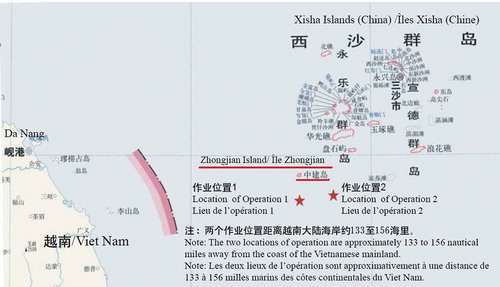
Figure 3. Illustration map of the claims of SCS coastal States.
Source: Qi, “China’s Presence and Challenges in the South China Sea in Recent Years and China’s SCS Policies in the Future,” 9; Permanent Mission of China to the UN, Note Verbale CML/18/2009; Damrosch & Oxman, “Agora: The South China Sea, Editors’ Introduction”, 96; U.S. Department of State, Spratly Islands in the South China Sea; United Nations Division for Ocean Affairs and the Law of the Sea, Brunei Darussalam’s Preliminary Submission concerning the Outer Limits of its Continental Shelf.
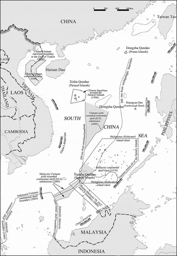
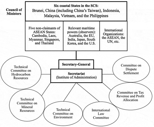
Figure 4. Possible organizational structure of a spratly resource management authority.
Source: Qi, et al., Cooperative Research Report on Joint Development in the South China Sea: Incentives, Policies & Ways Forward, 22; Valencia, et al., Sharing the Resources of the South China Sea, 207.