
Figures & data
Table 1. Four categories of rewilding proponents in the UK, as found and defined by Thomas (Citation2022).
Figure 1. Map of the county of Surrey.
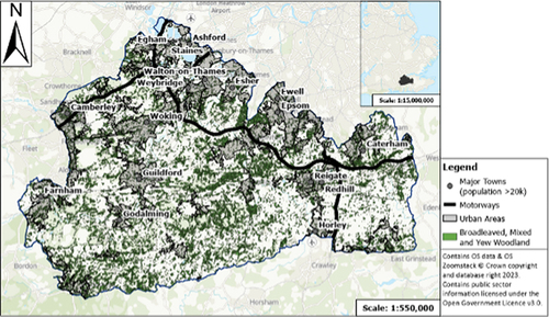
Figure 2. Stakeholder map representing relevant stakeholders based on their levels of interest and influence about rewilding in Surrey.
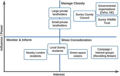
Table 2. Summary of the characteristics of the landholder participants.
Figure 3. Overview of the thematic analysis process, based on Braun and Clarke’s methodology (Citation2006).
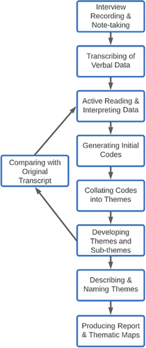
Figure 4. The arising thematic map of landholder perceptions of rewilding in Surrey, UK.
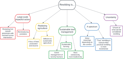
Table 3. The number of landholders interviewed who expressed specific perspectives on agricultural reduction through rewilding.
Figure 5. The different forms of rewilding within the existing literature (principally the X-axis) are given a further dimensionality emerging from Surrey landholder views which add the relevance of impacts affecting existing human activities.
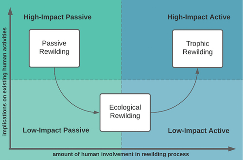
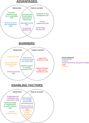
Figure 6. Thematic map of the perceived advantages of rewilding expressed by landholders in Surrey, UK.
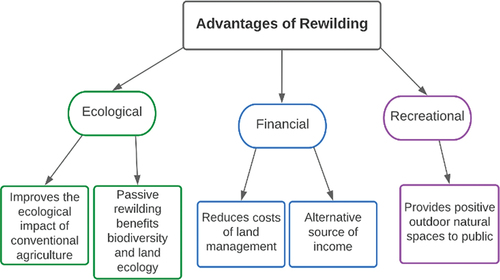
Figure 7. Thematic map of the perceived barriers to rewilding expressed by landholders in Surrey, UK.
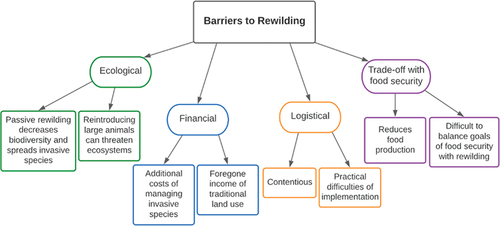
Table 4. The number of landholders interviewed who expressed perspectives relating to the ecological barriers of rewilding.
Figure 8. Thematic map of the perceived enabling factors of rewilding expressed by landholders in Surrey, UK.
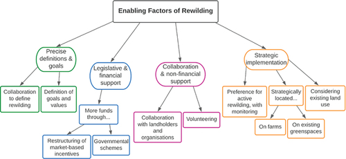
Figure 9. Thematic overlaps of landholder views on the advantages, barriers, and enabling factors of public access and rewilding in Surrey, UK. Colours represent themes, text describes sub-themes, numbers indicate how many landholders expressed each view.
Supplemental Material
Download PDF (526 KB)Data availability statement
The participants of this study did not give written consent for their data to be shared publicly, so due to the nature of the research supporting data is not available.