Figures & data
Figure 1. Location map of study area.
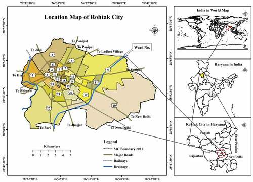
Table 1. Information about satellite data
Table 2. Classification of land use/ land cover
Table 3. Growths in population and municipal area of Rohtak City, 1901–2021
Table 4. Land use and land cover in Rohtak City
Table 5. Land use/land cover change statistics in Rohtak city from 1991 to 2021
Figure 2. Quantitative changes in land use/land cover of Rohtak City 1991–2021.
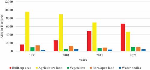
Figure 3. Land use/land cover mapping for Rohtak city.
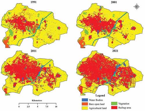
Figure 4. Gain and loss of area from 1991 to 2021.
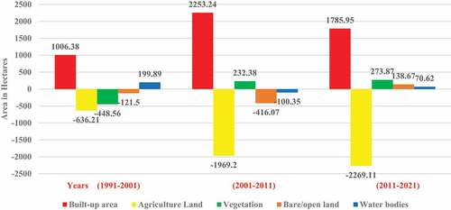
Table 6. Growth rates of population and sprawl in Rohtak city
Figure 5. Spatial expansion of Rohtak city (1991–2021).
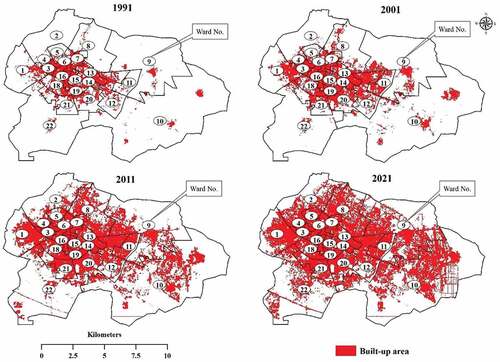
Table 7. Change in Shannon’s entropy values of Rohtak city
Data Availability Statement
The study is based on open-source satellite data (Landsat satellite data), which have been downloaded from the United States Geological Survey (https://www.usgs.gov/) (Table ). Other information related to the study area was derived from the city headquarters and census of India.