Figures & data
Figure 1. Project location index diagram.
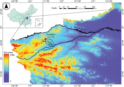
Figure 2. Model plane layout.
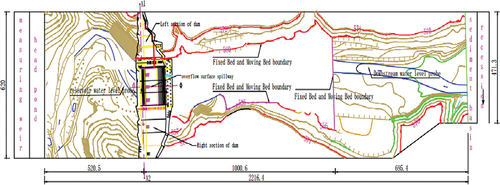
Figure 3. Model on-site layout.
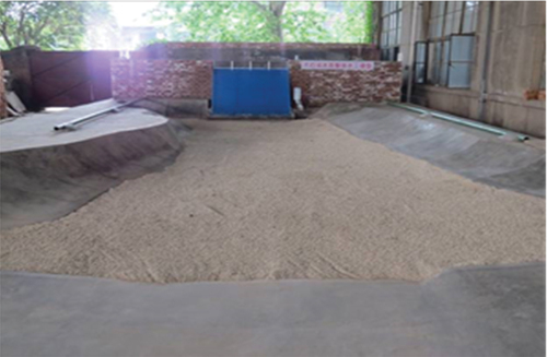
Figure 4. Measurement devices.
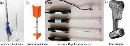
Figure 5. Overflow dam open discharge capacity Q~H relationship curve.
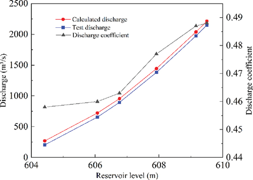
Figure 6. Original design of overflow surface hole and arrangement of pressure measuring points.
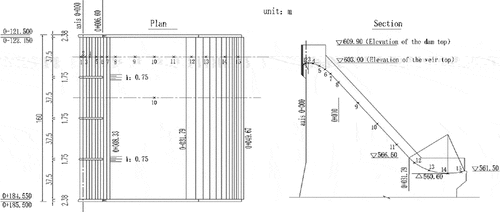
Figure 7. The original design of overflow surface hole performances: (a) pressure, (b) velocity, (c) water depth.
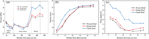
Figure 8. Scouring and deposition topography of riverbed downstream of the original scheme.
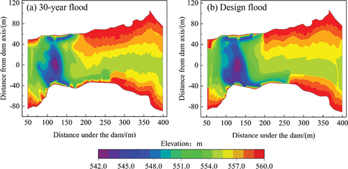
Figure 9. Modification scheme flip bucket shape and its parameters.
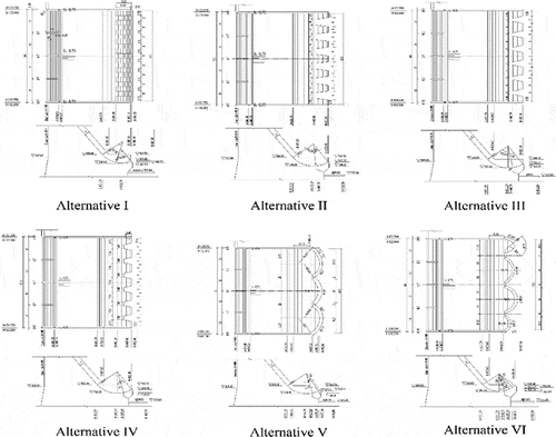
Figure 10. Different schemes of water tongue shape.
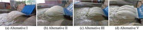
Figure 11. Downstream riverbed scouring and deposition topography of alternative schemes.
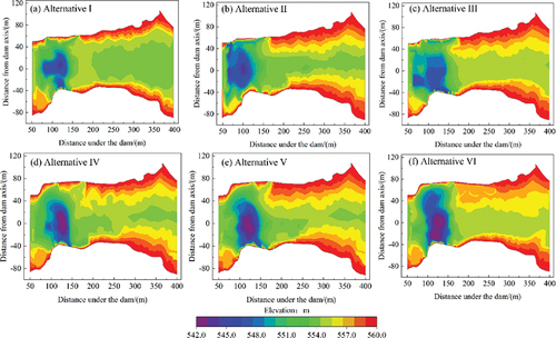
Table 1. Characteristic values of scouring results for each modification scheme.
Figure 12. Recommended scheme overflow dam water surface line.
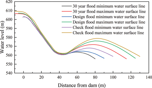
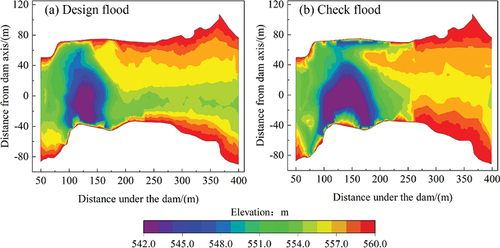
Figure 13. Recommended scheme river scouring and deposition terrain.
Data availability statement
All data used during the study are available from the corresponding author by request ([email protected]).