Figures & data
Figure 1 Location and characteristics of the study site, Ikushunbetsu River basin.
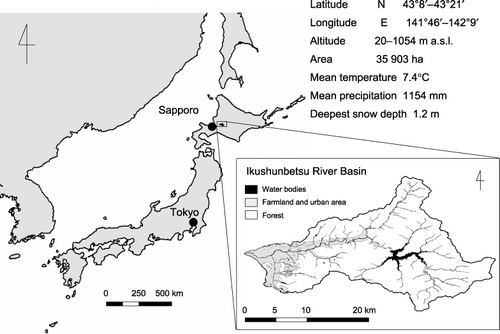
Table 1 Investigated land use management numbers
Table 2 Area and proportion of the major land use types of farmland in the Ikushunbetsu river basin in 2005
Table 3 Calculated nitrogen balance per unit area (kg N ha−1) of farmland for major land uses
Table 4 Greenhouse gas emissions from major land uses
Figure 2 Global warming potential (GWP) of the major six farmland land uses and the weighted mean of the watershed. Numbers in the figures are the sum of GWP for each land use. Values in parentheses are the standard error.
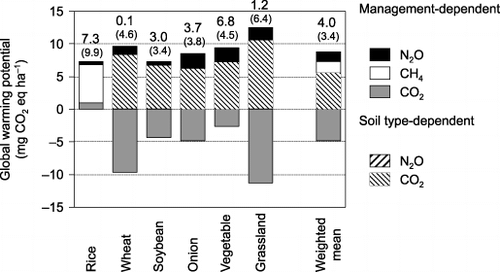
Figure 3 Range in global warming potential (GWP) and farmland surplus N as a proportion of land use changes at 10% intervals. The black circle represents the land use proportion at 2003 and the white circles represent the 100% proportion of a single land use type. Error bars indicate standard deviation.
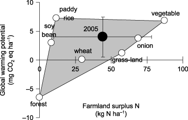
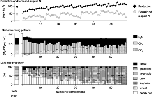
Figure 4 Amount of production, farmland surplus N, global warming potential (GWP) and the proportion of land use types for all 59 land use combinations able to reduce a GWP of more than 6%, but less than 7%, of the value in 2005.