Figures & data
FIGURE 1 Generalized distribution of glacial deposits in Taylor Valley (compiled from CitationWilch et al., 1993; CitationHall and Denton, 2000b; CitationHiggins et al., 2000a, Citation2000b; and unpublished data of Prentice and Bockheim). Colluvial, lacustrine, eolian, Alpine II, and Alpine I deposits are not shown. Blank patches are either the latter, bedrock, or snow.
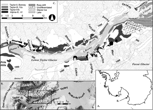
TABLE 1 Properties of soils of Taylor Valley, Antarctica.
FIGURE 2 Preliminary permafrost map of Taylor Valley. Place names referred to in the text are given in the caption of .
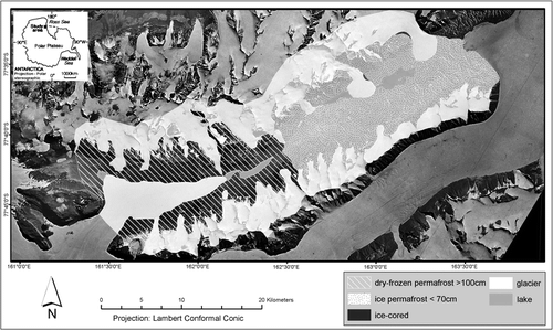
FIGURE 3 Preliminary soils map of Taylor Valley. Place names referred to in the text are given in the caption of .
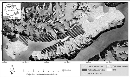
FIGURE 4 Landforms and soils on key drifts in Taylor Valley, including (A) a Typic Haploturbel on Ross Sea drift in eastern Taylor Valley, (B) a Typic Anhyorthel on Taylor II drift between the Sollas and Hughes Glaciers, (C) a Typic Anhyorthel on Taylor III drift below the Hughes Glacier, and (D) a Petrosalic Anhyorthel on Taylor IVa drift in Pearse Valley.
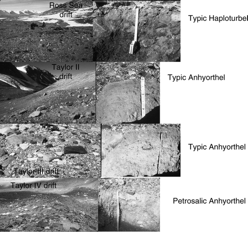
TABLE 2 Comparison of soil development on approximately equivalent-aged drifts in Taylor Valley (TV) and Wright Valley (WV).1