Figures & data
FIGURE 1 Logger 9 (5470 m a.s.l.), showing the horizontal positioning of the radiation shield, oriented north-south to prevent shortwave radiation influx. The shield's diameter:length ratio was chosen to permit adequate shading yet sufficient ventilation of the sensor.
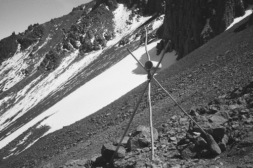
FIGURE 2 Map showing location of the 10 logger sites on the south-western slopes of Kilimanjaro.
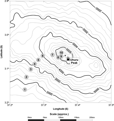
TABLE 1 Details of logger sites.
FIGURE 3 Photographs showing exemplar altitudinal zonation on Kilimanjaro. (a) Montane forest, (b) subalpine heathland, (c) alpine, and (d) icefield. These correspond to the upper three zones of CitationHemp (2002) and the nival zone.
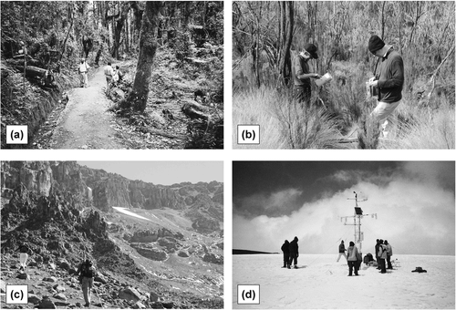
FIGURE 4 Comparison of average 02:00 EAT logger temperatures with radiosonde data launched at the same time at Nairobi, with ±1 standard deviation bars.
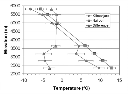
TABLE 2 Overall mean temperatures, mean daily minimum and maximum temperatures and mean relative humidity at each location. Lapse rates (°C km−1) are derived based on comparison with the immediate station below.
FIGURE 5 Vertical profiles of (a) mean temperature, (b) relative humidity, and (c) absolute vapor pressure. Percentiles are taken from hourly observations.
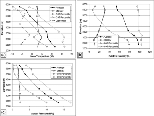
FIGURE 6 The relationship between air temperature and relative humidity at four selected sites.
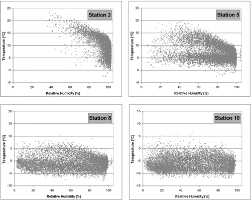
TABLE 3 Hourly anomaly correlations between pairs of logger sites.
FIGURE 7 Monthly variation of (a) mean air temperatures, (b) mean relative humidity, and (c) mean absolute vapor pressure.
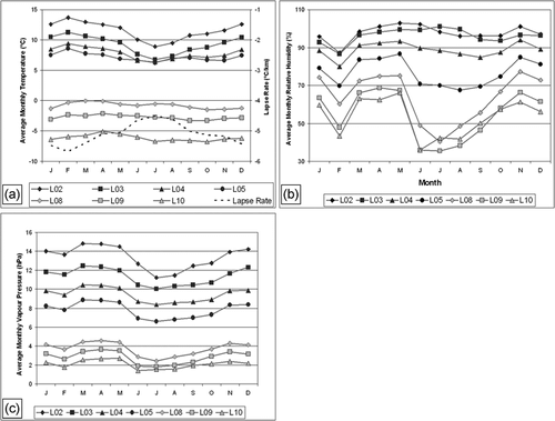
FIGURE 8 Mean diurnal regime of differences (January minus July) of (a) air temperature, (b) relative humidity, and (c) vapor pressure.
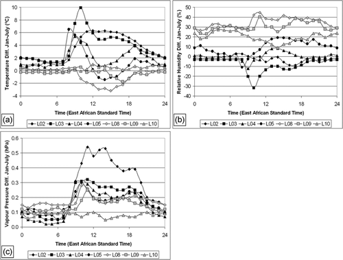
FIGURE 9 Mean diurnal regimes of (a) air temperature, (b) relative humidity, (c) absolute vapor pressure, and (d) rate of change of vapor pressure.
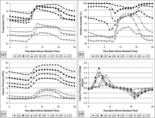
FIGURE 10 Vertical profiles of relative humidity by time, showing increased levels at higher elevations through midday and into early afternoon.
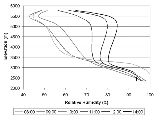
FIGURE 11 The percentage of days with cloud cover (RH > 95%) at each location for all months.
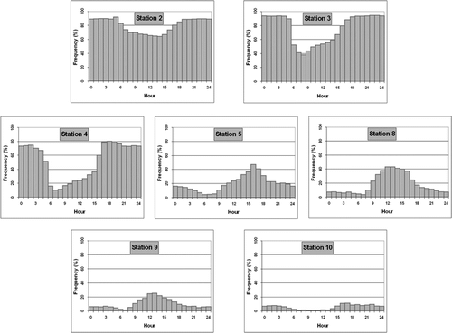
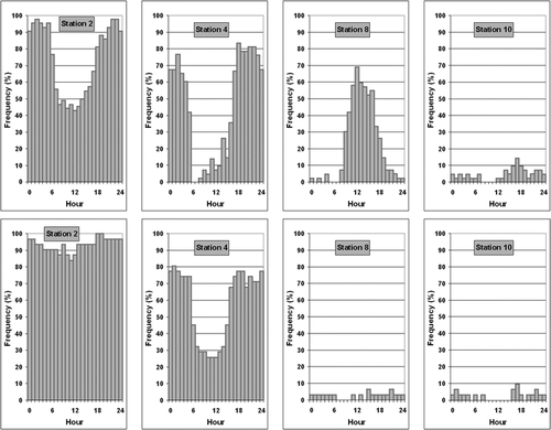
FIGURE 12 As in but for January (top row) and July (bottom row) for selected stations. The total number of January days with data is 42 and for July is 31.