Figures & data
TABLE 1 General overview of the study sites.
FIGURE 1 Map showing the location of the study sites. Refer to for station numbers.
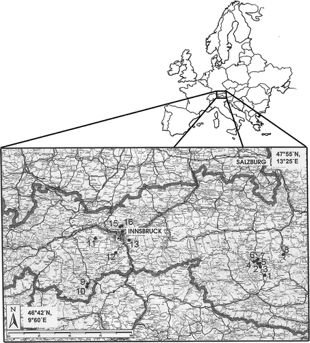
FIGURE 2 Inter-annual variability of cumulative evapotranspiration (left) and daily evapotranspiration (right) of a low-elevation mountain grassland (study site Neustift, 970 m a.s.l.).
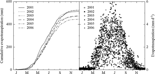
FIGURE 3 Annual evapotranspiration normalized with precipitation against precipitation for a low-elevation mountain grassland (study site Neustift, 970 m a.s.l.).
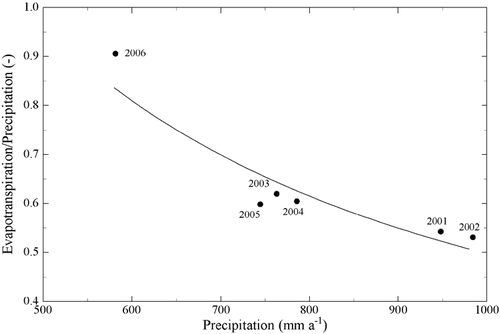
FIGURE 4 Daily evapotranspiration of a low-elevation mountain grassland (study site Neustift, 970 m a.s.l.) as a function of incident daily photosynthetically active radiation (left) and the air vapor pressure deficit (right). Solid lines show best fits to data using linear (r 2 = 0.74, p = 0.00, left) and logarithmic (r 2 = 0.61, p = 0.00, right) models, respectively.
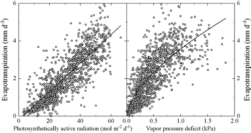
FIGURE 5 Total annual evapotranspiration (r 2 = 0.86, p = 0.00, solid line, left) and snow sublimation (r 2 = 0.62, p = 0.00, dotted line, left) and daily mean evapotranspiration (right) of grassland ecosystems located on the southern outer rim of the Austrian Alps (•), the inner Alpine region (○), and the Northern limestone Alps (□) between 580 and 2550 m a.s.l. (after CitationWieser, 1983, and Wieser et al., 1984).
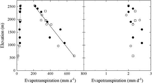
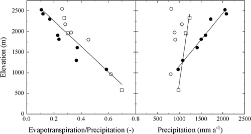
FIGURE 6 Annual evapotranspiration normalized with precipitation (left) and precipitation (right) with respect to elevation of grassland ecosystems located on the southern outer rim of the Austrian Alps (•), the inner Alpine region(○), and the Northern limestone Alps (□) between 580 and 2550 m a.s.l. Solid lines show best fits to data using linear models (left: all data pooled; r 2 = 0.83, p = 0.00; right: southern outer rim of the Austrian Alps: r 2 = 0.97, p = 0.00, Northern limestone Alps: r 2 = 0.98, p = 0.04).