Figures & data
FIGURE 1. Western side of Volcán Chimborazo with the sparse, desert-like páramo vegetation of the Arenal Grande (4200 m). The clouds coming from the east apparently cannot penetrate above the Arenal and form a “climatic” border.
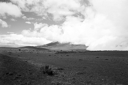
FIGURE 2. Patchy vegetation on the western base of Volcán Antisana resembling the Arenal of Chimborazo (4200 m). The clouds coming from the east flow around the mountain and leave its western side cloudless.
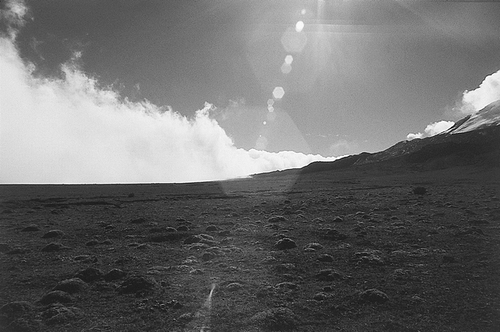
FIGURE 3. Map of Ecuador showing study sites; white stars indicate ice-capped volcanoes.
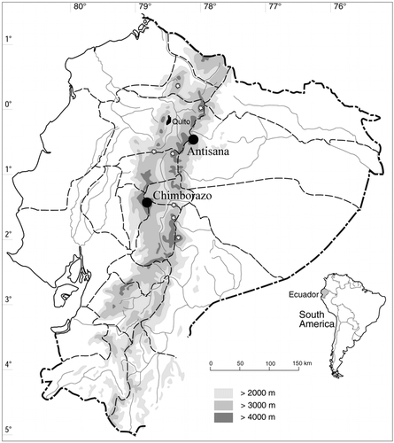
FIGURE 4. Contour maps of the studied areas, A. Chimborazo, B. Antisana. Wind directions are indicated by solid arrows (partly based on CitationClapperton, 1990 and CitationBlack, 1982); black squares indicate the closest climatic stations referred to in the text.
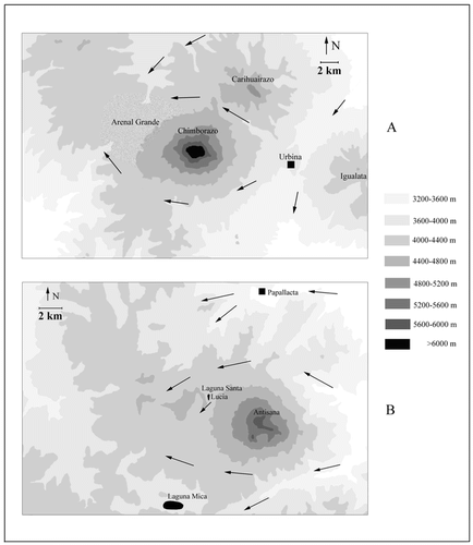
FIGURE 5. Shrubby vegetation with dominant Loricaria antisanensis on the eastern, humid side of Volcán Antisana (ca. 4200 m).
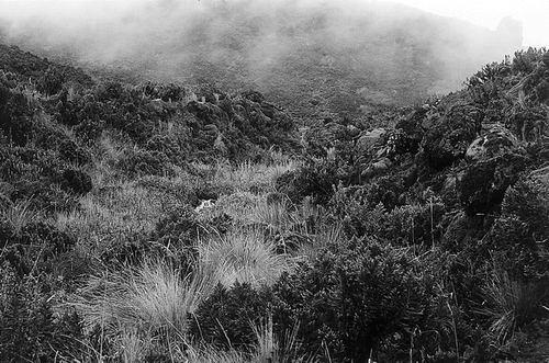
FIGURE 6. Resulting TWINSPAN dendrogram of the 65 vegetation samples (one sample remained unclustered) with corresponding eigenvalues for each division level.
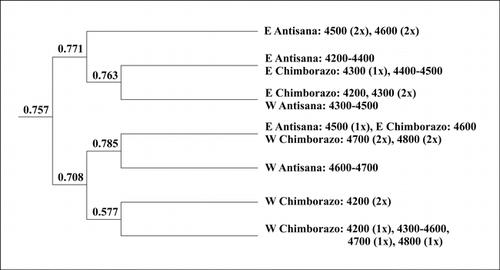
FIGURE 7. DCA ordination diagram of the vegetation samples, ▪ = E Chimborazo, • = E Antisana, □ = W Chimborazo, ○ = W Antisana, * = high-altitude samples; λ1 = 0.796, λ2 = 0.559, total inertia 9.831.
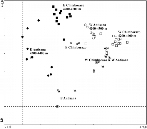
FIGURE 8. Floristic relationships between mountain pairs expressed as Chi-square distance between the observed and expected numbers of species held in common; positive signs indicate more and negative signs less species in common than expected, respectively.
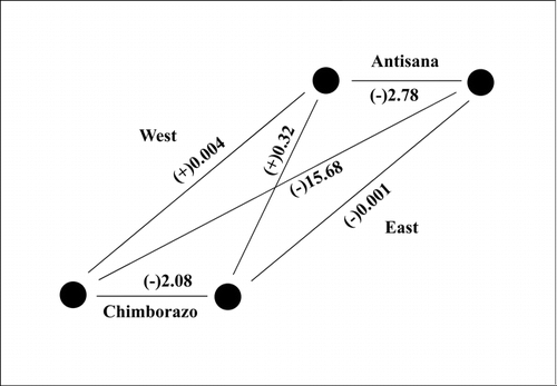
FIGURE 9. Degradation of the grass páramo in the surroundings of the Arenal Grande (ca. 4200 m).
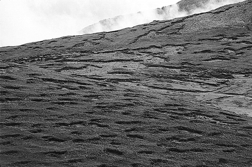
TABLE 1 Number of species for each examined mountain (bold diagonal), values of the Gleason's index of quantitative floristic similarity (above diagonal), and the observed (roman)/expected (italic) numbers of species held in common for the mountain pairs (below diagonal)a