Figures & data
FIGURE 1. (a) Air photograph of the Tana dune and location map. Here the parabolic morphology of the dune is evident (USGS 1:80,000; 1981). (b) Map of the dune and sample sites. Screened lines indicate sampling transects.
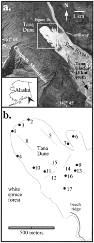
FIGURE 2. Morphology of the complex Tana dune. (a) The overall morphology of the dune advancing into spruce forest. Northwest is to the right. (b) Looking northeast at a ridge of superimposed transverse forms migrating along the larger parabolic feature. (c) The overrun ghost forest is evident in the southern blowout region of the dune field. (d) Close-up of the leading edge of sand migrating into recently buried trees.
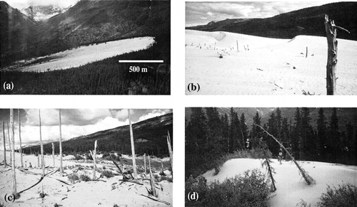
FIGURE 3. Composite stratigraphy of the dune complex. The lower sands are exposed in the southeastern locations and the overall sediment thickness reaches a maximum at the northwest apex of the dune.
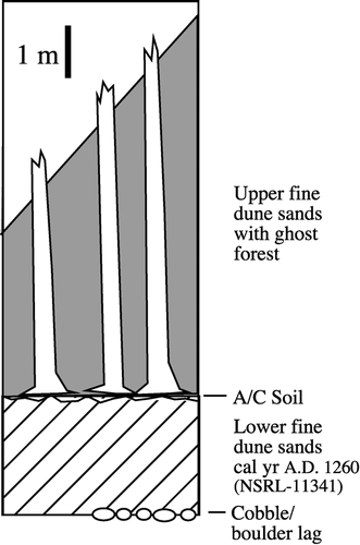
FIGURE 4. (a) The cross-dated positions of 80 trees. Series are arranged from south (bottom) to north (top). See for site locations. Inner ring dates are maxima as the stems of trees were sampled meters above the original ground surface. Outer-ring kill dates are minimal as an undetermined number of rings have been abraded or rotted. The black bars are intervals of growth for trees from the ghost forest; the gray bars are living trees. (b) The composite ring-width series based on samples from the Tana dunes. The broken line is a temperature reconstruction based on tree rings (CitationJacoby et al., 1999). Note the similarity between the temperature reconstruction and the growth patterns of the Tana dune trees.
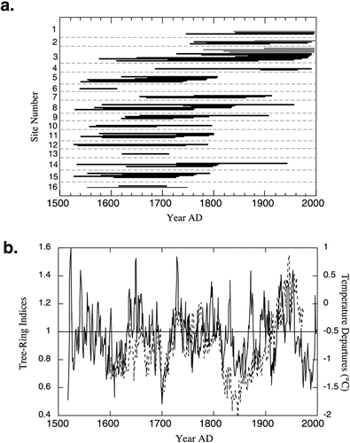
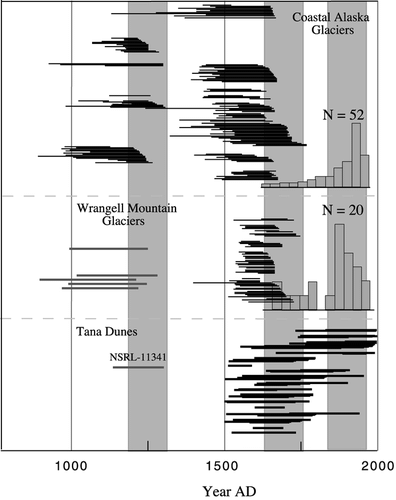
FIGURE 5. Comparison of glacial history from coastal Alaska and the Wrangell Mountains (CitationWiles et al., 1999, Citation2002) with dune activity. The glacier record is considered a proxy for summer temperature. The three-part LIA is evident from this record showing ice advances centered on A.D. 1250, 1650, and 1850 (shaded). The gray bars represent the ranges of radiocarbon-dated ice expansions. Black bars for all three regions are tree-ring-dated forests overrun by ice. Each bar represents an individual tree. The histograms are based on moraine dates. The two sigma range for radiocarbon age of NSRL-11341 from the lower sand at Tana Dunes is also shown.