Figures & data
FIGURE 1. A map showing the location of balsam poplar groves in relation to braiding and aufeis development on major rivers on the North Slope of Alaska (numbered sites are described in )
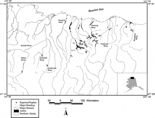
FIGURE 2. A map showing the location of balsam poplar groves in relation to faulting and geothermal springs on the North Slope of Alaska
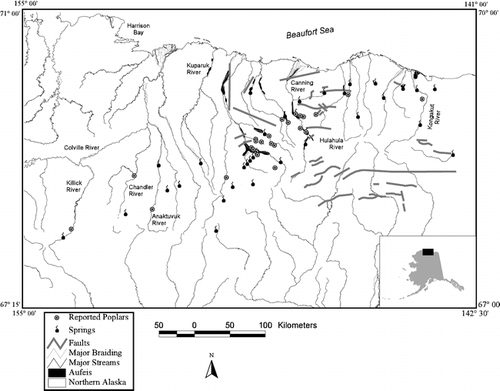
FIGURE 3. A preliminary model showing conditions favoring balsam poplar on the North Slope of Alaska
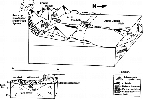
TABLE 1 A comparison of vegetation and soil variables along a north-south transect with distance from the rivera
TABLE 2 Chemical composition of Populus balsamifera in arctic Alaska by tissue and crown/stem position
TABLE 3 Soil properties of representative pedons at the “Cottonwood Creek” balsam poplar site, North Slope of Alaska
TABLE 4 Chemical composition of natural waters along the North Slope of Alaska
TABLE 5 Physiographic features of sites containing balsam poplar