Figures & data
FIGURE 1. Map of the Seward Peninsula showing the location of several 1977 fires (crosshatched areas), treeline, and the Imuruk Lake study site
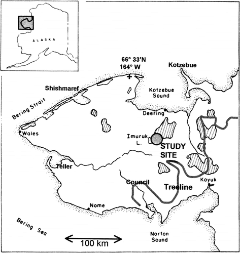
FIGURE 2. Aerial oblique photo (August 2001) of Nimrod Hill, where a 2-km-long transect was sampled before a 1977 tundra fire and at 8 locations (shown with arrows) from 1 to 24 yr postfire
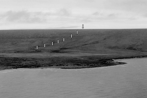
FIGURE 3. Profile of Nimrod Hill showing location of sites in relation to slope, vegetation type, and burn severity
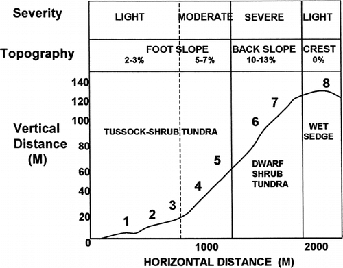
FIGURE 4. Bar graphs showing percent cover of vascular plant functional groups for (a) tussock-shrub tundra sites 1, 2, and 3 and for (b) tussock-shrub tundra sites 4 and 5
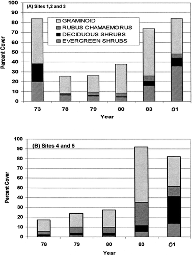
FIGURE 5. Bar graph showing percent cover of vascular plant functional groups at sites 6 and 7 prefire and at various intervals following the 1977 tundra fire
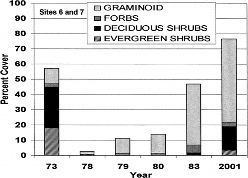
FIGURE 6. Photos taken from site 6 on the back slope of Nimrod Hill to the west toward Imuruk Lake (a) July 1973, 4 yr before a 1977 tundra fire, and (b) August 2001, 24 yr after fire. Note change in abundance of willow shrubs in the foreground
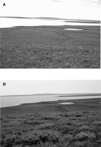
FIGURE 7. Bar graph showing the percent vascular cover of plant functional groups at site 8 on the flat crest of Nimrod Hill, where a sedge-Sphagnum wet meadow was present before the fire
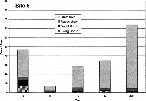
FIGURE 8. Bar graph showing the number of Salix pulchra shrubs that became established at different time intervals following the 1977 tundra fire at sites 2, 5, 6, and 7 on Nimrod Hill. Age was determined by counting the number of annual rings at the base of the largest stem on 44 randomly sampled willow shrubs
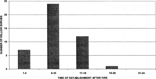
FIGURE 9. Seasonal thaw curve for undisturbed tussock-shrub tundra (solid line) in the Imuruk Lake area and averaged thaw depths (n = 10) at 5 tussock-shrub tundra sites burned in 1977 and measured at various times postfire from 1 to 24 yr
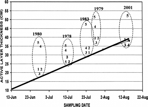
Table 1 Seward Peninsula fire sites considered here or in other studies
Table 2 Frequency (F) and Cover (C) percentages for species sampled in 10 contiguous 1 × 1–m quadrats at each of the 5 ft slope tussock-shrub tundra sites 1 (1978), 3 (1980), and 24 (2001) yr after a 1977 tundra fire on Nimrod Hill in the central Seaward Peninsula. Prefire values in 1973 were generalized for the foot slope
Table 3 Frequency (F) and cover (C) percentages for species in dwarf-shrub tundra on the back slope of Nimrod Hill (sites 6 and 7) sampled at each site in 10 contiguous 1 × 1–m quadrats, prior to (1973) and at intervals of 1 (1978), 2 (1979), 3 (1980), 6 (1983), and 24 (2001) yr after the 1977 tundra fire
Table 4 Frequency (F) and cover (C) percentages for species in sedge wet meadow tundra at site 8 on the crest of Nimrod Hill before the fire (1973) and 1 (1978), 2 (1979), 3 (1980), and 24 yr (2001) postfire