Figures & data
FIGURE 1. Study sites in eastern Lesotho and topographic setting of mire 1
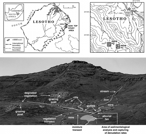
FIGURE 2. Gully denudation and aggradation for peat and mineral sediment surfaces (January 2000 to July 2001)
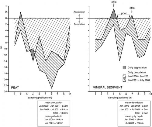
FIGURE 3. Otomys burrows and pathways within the peat horizon of a north-facing gully sidewall (gully depth ∼120 cm)
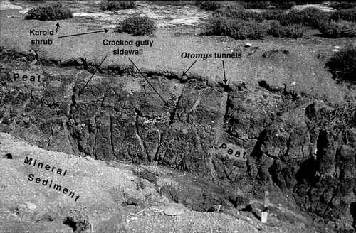
FIGURE 4. Cracked peat surfaces along gully sidewalls and adjacent areas. The cracks are infilled with sediment transported by wind and water (gully depth ∼3 m; width = 3–4 m)
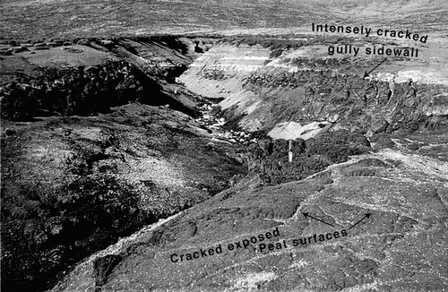
FIGURE 5. Particle size distribution for peat and mineral sediment and for a desiccation crack infill
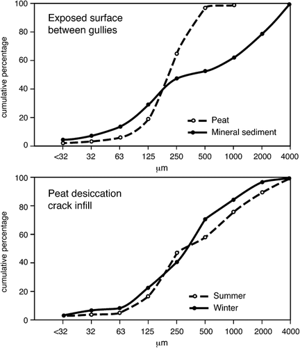
FIGURE 6. Ground thermal regime and associated horizontal particle movement for a north- and south-facing gully sidewall over 5 d in July 1999
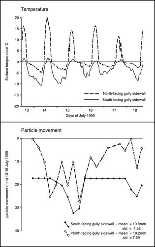
FIGURE 7. Soil moisture profiles across mire 1 during summer (Feb.) and winter (July) 2001
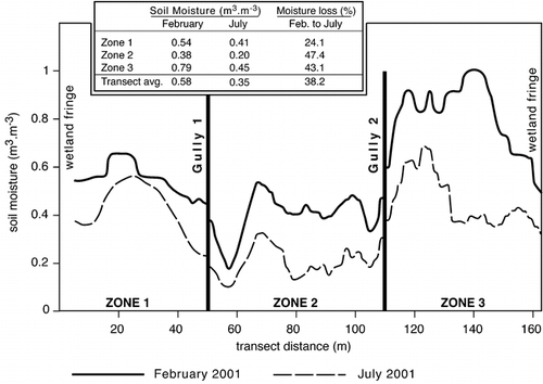
FIGURE 8. A biological transect across mire 1
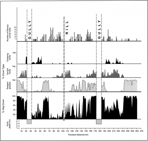
FIGURE 9. A vegetational transect across mire 2
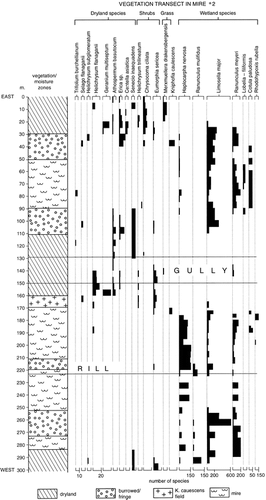
Table 1 Comparing shear strength values during February (summer) and July (winter) 1999 for various sedimentological settings (n = 30 per site). Percentage moisture and organics were measured in February