Figures & data
FIGURE 1. Geographical and geomorphologic location of the Foscagno Rock Glacier: (a) undifferentiated scree slopes and bedrock outcrops; (b) inactive rock glacier; (c) active rock glacier; (d) morainic deposits (Pleistocene age); (e) borehole location; (f) 14C ages (from CitationGuglielmin et al., 2001, modified)
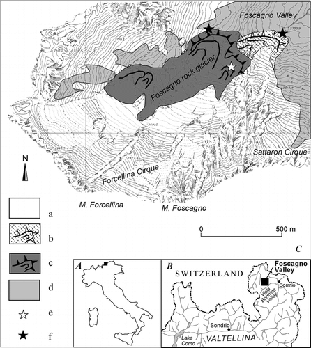
FIGURE 2. Aerial view of Foscagno Valley and rock glacier. The white star indicates the location of the borehole
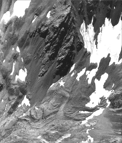
FIGURE 3. Stratigraphy of the borehole: (a) landslide deposit; (b) ablation till (Holocene); (c) massive ice body; (d) alternation of ice layers and ice-cemented debris flows sediments; (e) unfrozen ablation till (?). The bottom of the borehole is of phyllitic bedrock
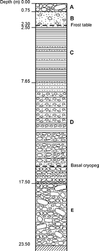
FIGURE 4. (a) ice fragments of the upper part (2.5–4 m); (b) ice core between 4.1 and 5.6 m—note the subhorizontal foliations and debris bands; (c) ice core between 5.6 and 7.1 m; (d) permafrost core with some thin ice layers between 8.9 and 10 m. The top is always to the left
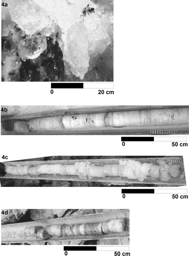
FIGURE 5. Crystal size measured with the linear intercept method on X and Z axes (DMx and DMz) and anisotropy ratio (Lx/Lz) patterns with depth in the ice body and relationships with the main debris bands
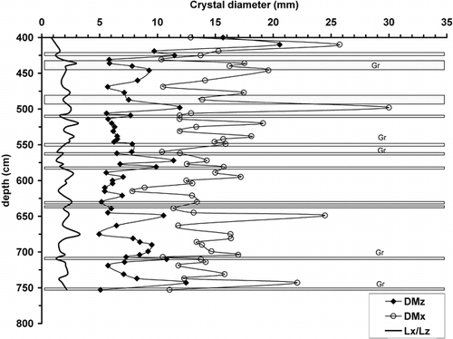
FIGURE 6. Pictures of thin sections of ice and corresponding Schmidt diagrams at different depths. (a) ice type a (cf. the text) at 4 m depth; (b) ice type b at 5.1 m depth; (c) ice type c at 5.7 m depth
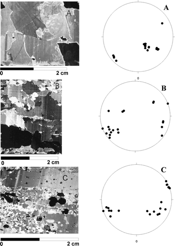
FIGURE 7. Depth profile of selected ions: (a) sulfate; (b) nitrate; (c) ammonium (expressed as &mu= L−1) with superimposed debris layers
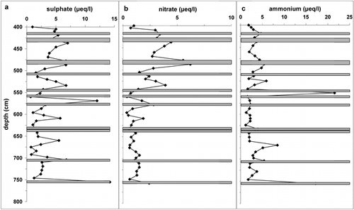
FIGURE 8. Depth profile of the concentrations of Na+ and Cl− (expressed as &mu= L−1)
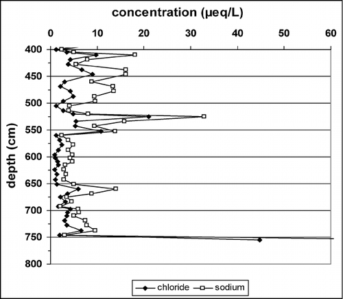
Table 1 Arithmetic mean of ion concentrations (expressed in meqL −1) of the different ice core layers; in parentheses one standard deviation is reported; N is number of samples
Table 2 Comparison of nitrate and sulfate data measured in different types of Italian and Swiss glaciers and rock glaciers