Figures & data
FIGURE 1 The main geomorphic features of the Izas catchment (located at 42°44′N, 0°25′W), including (1) the main divide, (2) contour levels, (3) the fluvial network, (4) terracettes, (5) solifluction lobes, (6) the main sediment source, and (7) the location of the measurement site.
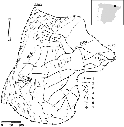
FIGURE 2 The dense gully network on Carboniferous slates close to the divide (pointed by the white arrows) is the main sediment source area in the catchment.
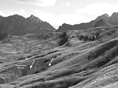
TABLE 1 Annual precipitation, runoff, runoff coefficient (RC), and sediment yield in the Izas catchment for the water years 2003/2004 and 2005/2006.
FIGURE 3 (a) Daily precipitation, (b) average daily temperature, (c) snowpack depth, (d) discharge and solute concentration, and (e) daily suspended sediment yield for the water year 2003/2004.
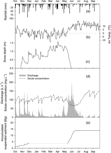
FIGURE 4 (a) Daily precipitation, (b) average daily temperature, (c) snowpack depth, (d) discharge and solute concentration, and (e) daily suspended sediment yield for the water year 2005/2006.
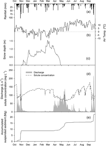
TABLE 2 Precipitation, runoff, and sediment yield during the snowmelt period (May–June) for the water years 2003/2004 and 2005/2006. Percentages in italics indicate the fraction of the annual output represented by the snowmelt period value.
FIGURE 5 Hourly discharge and suspended sediment concentrations (SSC) during the 2004 (a) and 2006 (b) snowmelt period.
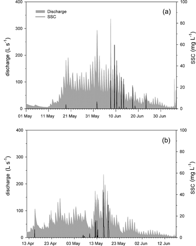
FIGURE 6 Relationships between hourly suspended sediment concentration (SSC) and discharge during an event involving rain on snow (a), and during a snowmelt-only event (b).
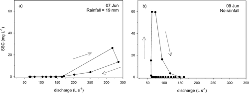
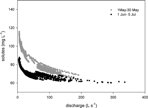
FIGURE 7 Relationships between hourly solute concentration and discharge during the 2004 snowmelt period.