Figures & data
FIGURE 1 Location of Karakoram surge-type glaciers identified in this study. Inset map shows general location of study area. White box shows region covered by . Numbers refer to glaciers shown in other figures and listed in .
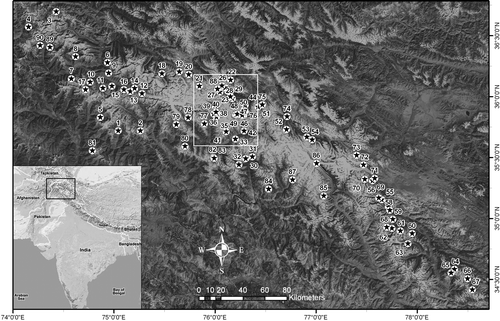
FIGURE 2 Main cluster of Karakoram surge-type glaciers (base image: ASTER, 26 July 2006). Numbers refer to glaciers listed in .
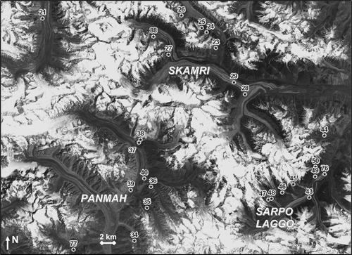
TABLE 1 List of Karakoram surge-type glaciers identified in this study. First column refers to locations shown in . Latitude/longitude values are based on WGS84 datum. ‘Surge date’ indicates that a glacier surged at some point during the years listed, although the surge did not necessarily last for that entire period. Columns ‘1976–1990?’ and ‘1990–2004?’ indicate glaciers that definitely surged during these periods (i.e., Index 1).
TABLE 2 List of satellite imagery used in this study.
FIGURE 3 Temporal sequence of glacier surges in Skamri Basin, 1973–2001. Numbers refer to descriptions in ; satellite image details provided in . Arrows in (b) and (c) indicate significant changes since the previous image.
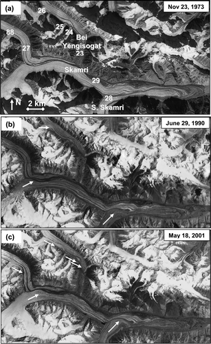
FIGURE 4 Temporal sequence of surges of tributaries of the Sarpo Laggo Glacier. Numbers refer to ; satellite image details provided in . Arrows indicate the occurrence of surges. Note that Glacier 45 has surged twice.
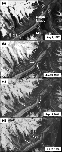
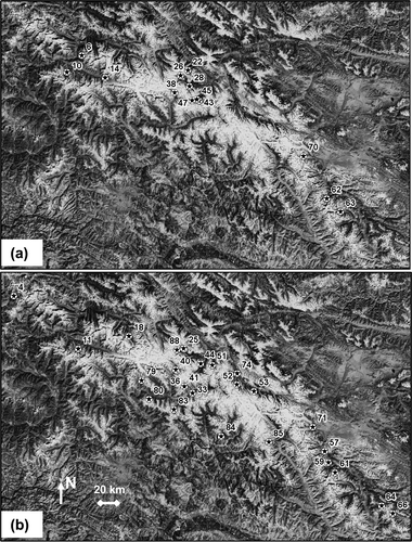
FIGURE 5 (a) Distribution of glacier surges observed during 1976–1990. (b) Distribution of glacier surges observed during 1990–2004. Numbers refer to glaciers listed in .