
Figures & data
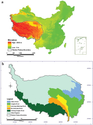
FIGURE 1. Distribution of the source regions of large Asian rivers on the Qinghai-Tibetan Plateau in China. (a) Location of the Qinghai-Tibetan Plateau in China; (b) location of the source regions of large Asian rivers on the Qinghai-Tibetan Plateau.
(continued). Distribution of the source regions of large Asian rivers on the Qinghai-Tibetan Plateau in China. (c) areal proportion of large Asian river basins in the Qinghai-Tibetan Plateau.
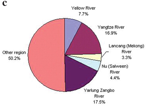
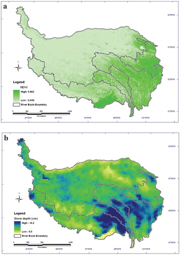
FIGURE 2. Spatial distributions of the average (a) annual maximum Normalized Difference Vegetation Index (NDVI) from 1981 to 2006; (b) snow cover duration (the cumulative number of days with snow depth >0 cm) from 1980 to 2004.
(continued). Spatial distributions of the average (c) annual mean snow depth (cm) from 1980 to 2004; and (d) annual maximum snow depth (cm) from 1980 to 2004.
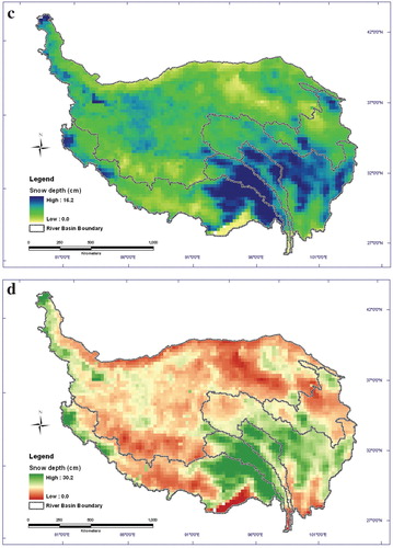
TABLE 1 Statistical characteristics (mean and standard deviation) of snow cover duration and snow depth in the source regions of large Asian rivers on the Tibetan Plateau from 1980 to 2004.
TABLE 2 Trend coefficients of snow cover duration and snow depth in the source regions of large Asian rivers on the Tibetan Plateau from 1980 to 2004.
FIGURE 3. Changes in (a) snow cover duration and (b) snow depth in the source regions of large Asian rivers on the Qinghai-Tibetan Plateau from 1980 to 2004.
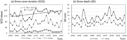
TABLE 3 Statistical characteristics (mean and standard deviation) of monthly and annual maximum Normalized Difference Vegetation Index (NDVI) in the source regions of large Asian rivers on the Tibetan Plateau from 1981 to 2006.
FIGURE 4. (a) Monthly distribution and (b) annual changes of maximum NDVI in the source regions of large Asian rivers on the Qinghai-Tibetan Plateau from 1981 to 2006.
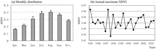
TABLE 4 Trend coefficients of monthly and annual maximum NDVI in the source regions of large Asian rivers on the Tibetan Plateau from 1981 to 2004.
TABLE 5 Correlation coefficients between snow cover and NDVI in the source regions of large Asian rivers on the Tibetan Plateau from 1981 to 2004.