
Figures & data
FIGURE 1. Protected areas in the Biafran forests and highlands (BFH). Topography information from the Shuttle-Radar Topography Mission (SRTM; available from U.S. Geological Survey). Protected area boundaries from IUCN and UNEP (Citation2010).
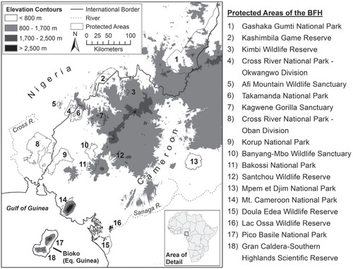
TABLE 1 Protected areas of the Biafran forests and highlands.
TABLE 2 Generalized forest type strata of the Biafran forests and highlands (BFH) with corresponding altitudinal range, coverage extent, and proportion occurring within protected area boundaries, and characteristic species.
FIGURE 2. Distribution of montane endemic rodents (Soricidae) in the BFH. Distribution data from IUCN (Citation2013). Protected area boundaries from IUCN and UNEP (Citation2010).
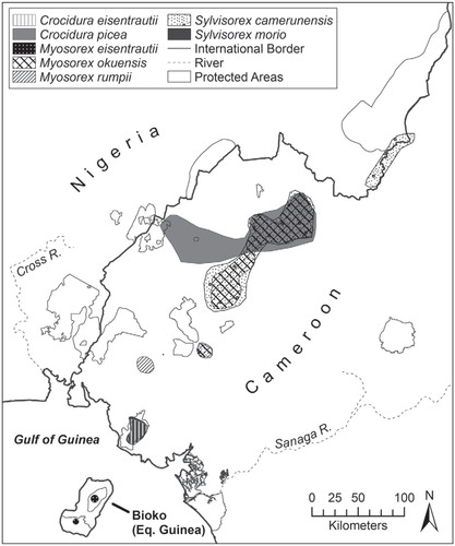
TABLE 3 Endemic montane rodents of the Biafran forests and highlands, their altitudinal range, and IUCN Red List category.