Figures & data
Fig. 1 Overview of the catchment. Two previous glacier-front positions as well as the position reached by the 2003–05 surge are drawn. The position of the RDC365 camera used for the time-lapse movie is shown. Map basis: Advanced Spaceborne Thermal Emission (ASTER) image taken on 24 July 2003.
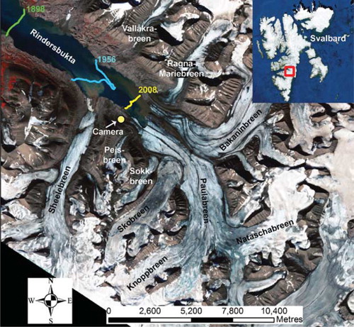
Fig. 2 Placing the time-lapse camera on 28 April 2005. Photographer: Anne-Marie LeBlanc.
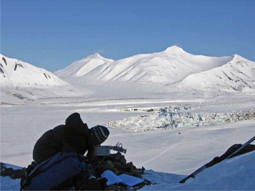
Fig. 3 Development of the surge illustrated by the progressive displacement of medial moraines and end moraine loops as well as the glacier-front positions. The illustration is based on the following images: NP1990 1:50.000 (black), Advanced Spaceborne Thermal Emission (ASTER) 24 July 2003 (blue), ASTER 23 July 2005 (green) and ASTER 4 August 2008 (red).
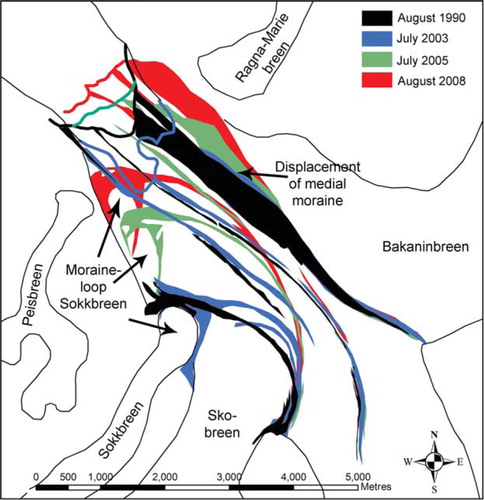
Fig. 4 Two Advanced Spaceborne Thermal Emission (ASTER) images showing Skobreen and most of Paulabreen showing the change in the crevasse pattern: (a) the early surge phase, 24 July 2003; (b) the full surge stage, 23 July 2005.
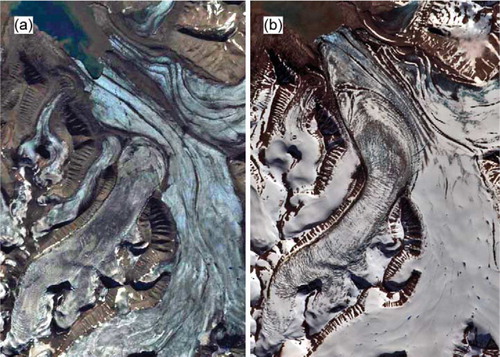
Fig. 5 Two oblique photographs on 8 August 2003, during the early surge stage: (a) most of Skobreen; (b) a major part of the catchment. Both photographs clearly show a surge bulge at the lower end of Skobreen. Photographer: Tavi Murray.
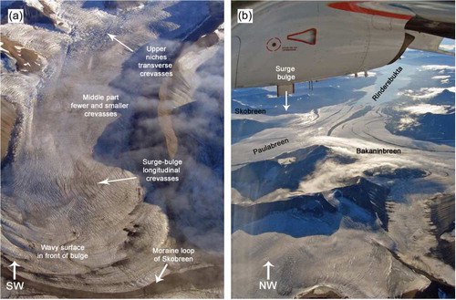
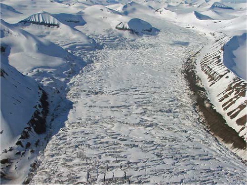
Fig. 6 The surging glacier advances into the fjord Rindersbukta, deforming the sea ice, in this photograph taken on 2 April 2005. Notice the chaotic brecciated glacier ice. Photographer: Anne-Marie LeBlanc.
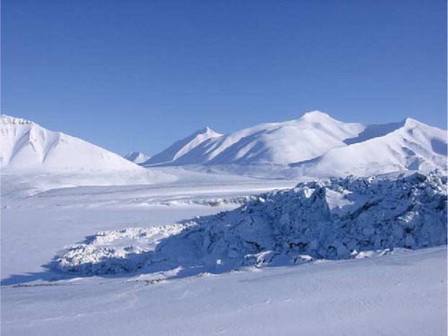
Fig. 7 The front of Paulabreen–Bakaninbreen on 14 April 2005. In the spring of 2005, the surge had only reached the south-western half of the front.
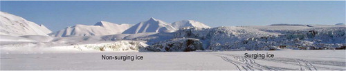
Fig. 8 Skobreen–Paulabreen during and following the surge. (a) The lower part of Paulabreen, viewed towards the south on 26 September 2005. Skobreen occupies the cirque in the upper middle part of the photograph, and the boundary between surging and non-surging ice on Paulabreen is visible on the upper left. (b) The surge front at the south-west margin of Paulabreen, 26 September 2005. Note the chaotically crevassed ice near the glacier front, behind which the ice is relatively uncrevassed. In the foreground of the photograph is a crevassed forebulge formed of old, buried glacier ice. (c) View over Paulabreen into Skobreen, 26 September 2005. (d) Remnant ice stranded above Skobreen after surge termination, 18 June 2007. The ice cliff is ca. 50 m high.
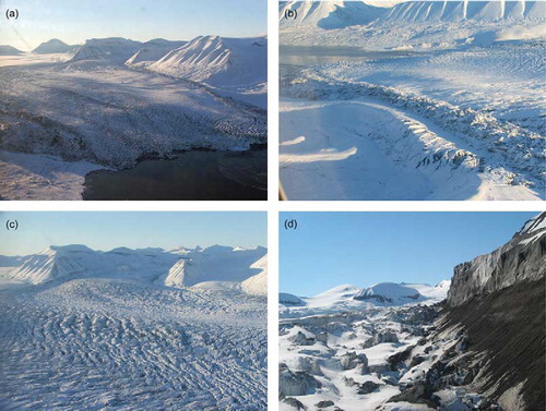
Fig. 9 Photograph taken on 18 June 2007 towards the south-west showing most of Skobreen after the surge. The majority of the glacier is covered with transverse crevasses, including the niches to the left in the picture. Note the substantial down-draw on either side of the main trunk. Towards the bottom in the picture longitudinal crevasses can be seen.