Figures & data
Fig. 1 Overview of the study area on the Fildes Peninsula.
Table 1 Overview of monitoring methods employed during the study. For further details see Peter et al. (Citation2008).
Fig. 2 The distribution of seabird breeding sites in the Fildes Region during the 2008/09 season.
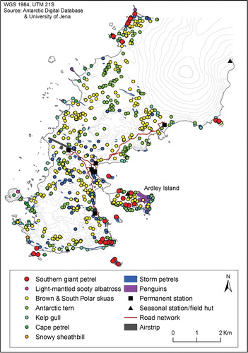
Fig. 3 The location of pupping sites for elephant seals (Mirounga leonina; E), Weddell seals (Leptonychotes weddelli; W), fur seals (Arctocephalus gazella; F) and leopard seals (Hydrurga leptonyx; L). Data from 2003/04 to 2009/10 are included.
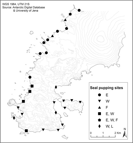
Table 2 Breeding pair numbers in the Fildes Region during the 2008/09 and 2009/10 seasons.
Fig. 4 Number of days with flight activity in the Fildes Region by aircraft type, between 10 December and 26 February each season. Shading indicates the proportion of station-based aircrafts.
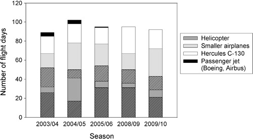
Fig. 5 Observed incidences of flights within the overflight exclusion zone, i.e., below the altitude (610 m) or within the horizontal distance (460 m) set out for Ardley Island in Resolution 2 (SAT Citation2004).
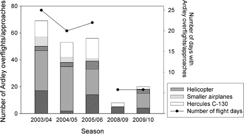
Fig. 6 Number of ship arrivals in Maxwell Bay by type of ship (left axis) and number of ship days (right axis, not summable). The asterisk represents one additional unknown freight ship, not included in the other categories.
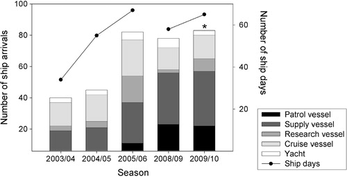
Fig. 7 Examples of environmental impacts in the Fildes Region: (a) vegetation damage caused by land traffic; (b) open waste deposit; (c) diesel plume in Maxwell Bay (visible as the sheen on the ocean in the centre of the image); and (d) beach ridge, damaged by quarrying.
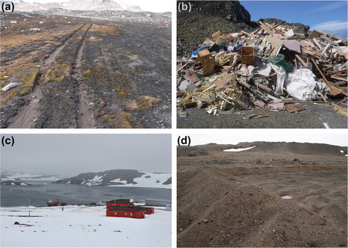
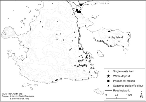
Fig. 8 Waste distribution in the southern part of the Fildes Region; only items recorded after 2006 are presented.