Figures & data
Fig. 1 (a) Geological overview map of north-western Svalbard showing the distribution of Old Red (Devonian) strata (e.g., Friend Citation1961). (b) Schematic east–west cross-section through the five fold-and-thrust zones of the Svalbardian fold–thrust belt between the Billefjorden Fault Zone in the east and the coast of north-west Spitsbergen in the west (Piepjohn Citation2000).
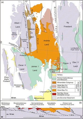
Fig. 2 Stratigraphic scheme of the Devonian Old Red Sandstone in north-western Spitsbergen, after Holtedahl (Citation1914), Vogt (Citation1941), Føyn & Heintz (Citation1943), Friend (Citation1961), Friend & Moody-Stuart (Citation1972), Murašov & Mokin (Citation1979), Piepjohn, Brinkmann et al. (Citation1997), McCann (Citation2000) and Piepjohn et al. (Citation2000).
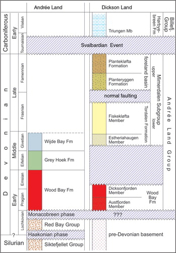
Fig. 3 Geological map of the south-easternmost part of the Andrée Land Basin in central Dickson Land west of Billefjorden, showing the distribution of the Mimerdalen Subgroup and its formations. From Dallmann, Ohta et al. (Citation2004) and Dallmann, Piepjohn et al. (Citation2004) and Dallmann (Citation2009), partly based on Brinkmann (Citation1997), Dißmann (Citation1997), Grewing (Citation1997), Piepjohn, Brinkmann et al. (Citation1997) and Michaelsen (Citation1998). For position see red frame in .
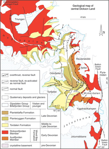
Fig. 4 Previous and present stratigraphic schemes of the Mimerdalen Subgroup and thickness of the stratigraphic units.
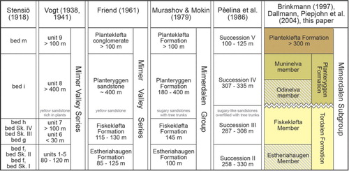
Fig. 5 Schematic stratigraphy and lithology (not to scale) of the Mimerdalen Subgroup, modified from Pčelina et al. (Citation1986) and Piepjohn, Brinkmann et al. (Citation1997).
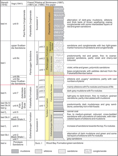
Fig. 6 Profiles of the six boreholes of the Russian mining company Trust Arktikugol in Munindalen, Odindalen and Tordalen (redrawn from Pčelina et al. Citation1986).
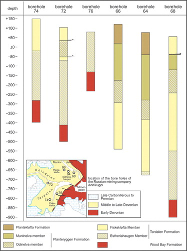
Fig. 7 Age of the Mimerdalen Subgroup, compiled from previous work.
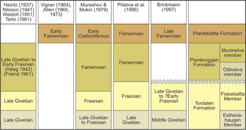
Fig. 8 Remnants of placoderms in grey sandstones in unit 5 of the Fiskekløfta Member (Tordalen Formation) within a tectonic slice at the northern cliff of Muninelva (Munin River). (Photo by B. Michaelsen.)
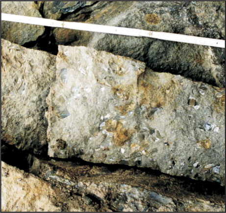
Fig. 9 Geological map of the Hugindalen area. The lowermost unit of the Mimerdalen Subgroup (Estheriahaugen Member) is not exposed. The Fiskekløfta Member unconformably overlies the Early Devonian Wood Bay Formation. The Odinelva member unconformably overlies the faulted Fiskekløfta Member and Wood Bay Formation. The Munindalen Member and the Plantekløfta Formation are not exposed.
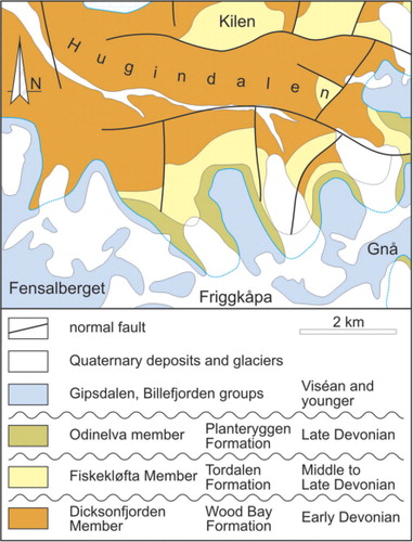
Fig. 10 Outcrop situation along the western slope of Reuterskiöldfjellet. The top of the Plantekløfta Formation is not exposed but is cut off by the west-directed lower Munindalen Thrust carrying the Early Devonian Austfjorden Sandstone Member (Wood Bay Formation) over the Plantekløfta Formation (Piepjohn, Brinkmann et al. Citation1997). The samples for palynological investigations were taken from siltstones of the uppermost Plantekløfta Formation directly below the lower Munindalen Thrust (Brinkmann Citation1997).
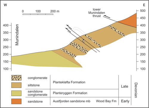
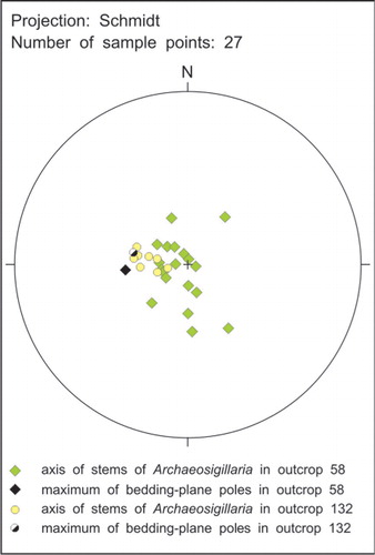
Fig. 11 Stereographic projection of the axis of the trunks of lycopsids in outcrops 58 and 132 along Muninelva (Munin River).