Figures & data
Figure 1. Map of Wapusk National Park Showing Location of Study Sites and the nearby town of Churchill.
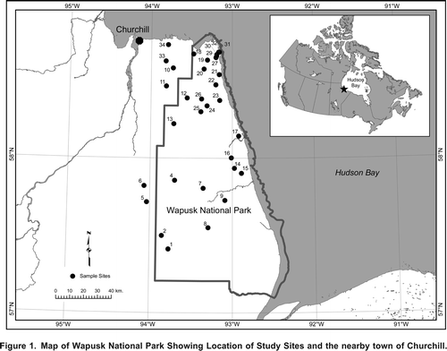
Table 1. Depth, temperature and water chemistry data for the 32 ponds.
Table 2. Terrestrial Vegetation composition surrounding ponds, after Brook's (2002) Landsat based vegetation map.
Figure 2. The molar ratio of Na+1 and Cl1 found in the study ponds showing all ponds (A) and only the more dilute ponds (B). The line depicts the ratio that would be expected for seawater.
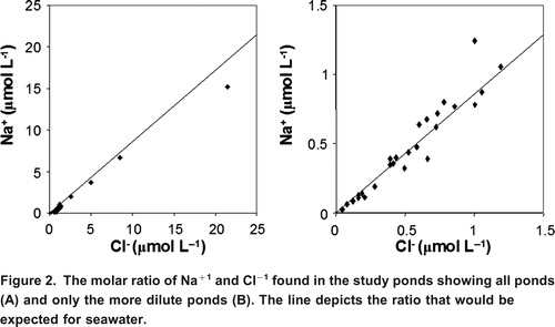
Table 3. Ratio of dominant ions to Cl.
Figure 3. Principal Components Analysis (PCA) showing the dominant variation in aquatic parameters amongst the ponds. The single greatest difference observed between the ponds is related to changes in salinity and the concentration of the dominant ions and is shown by the length and alignment of these vectors along Axis 1. The second greatest direction of variation in the PCA is related to changes in DOC (Axis 2).
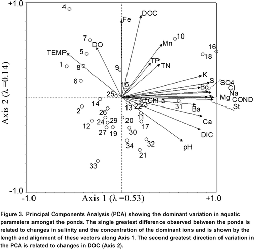
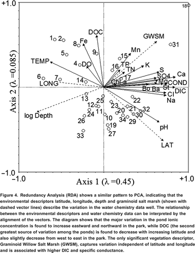
Figure 4. Redundancy Analysis (RDA) shows a similar pattern to PCA, indicating that the environmental descriptors latitude, longitude, depth and graminoid salt marsh (shown with dashed vector lines) describe the variation in the water chemistry data well. The relationship between the environmental descriptors and water chemistry data can be interpreted by the alignment of the vectors. The diagram shows that the major variation in the pond ionic concentration is found to increase eastward and northward in the park, while DOC (the second greatest source of variation among the ponds) is found to decrease with increasing latitude and also slightly decrease from west to east in the park. The only significant vegetation descriptor, Graminoid Willow Salt Marsh (GWSM), captures variation independent of latitude and longitude and is associated with higher DIC and specific conductance.