Figures & data
Figure 1. Generalized GIS-based framework of risk assessment model outlining model steps of data preparation, risk classification, weighting assignment, and risk map preparation.
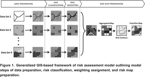
Table 1. Modeled risk parameters and associated risk values on a scale of 1 to 5 (low to high) based on their characteristics
Table 2. Developed parameter weightings from Ontario-wide survey of on-site system experts across Ontario based on median importance and certainty values.
Figure 2. The location of Huron-Kinloss Township study area on the east shore of Lake Huron in Southern Ontario [inset].
![Figure 2. The location of Huron-Kinloss Township study area on the east shore of Lake Huron in Southern Ontario [inset].](/cms/asset/f53c3c71-b5ce-4b2a-ae0f-a3d242f2384c/tcwr_a_10636594_o_f0002.gif)
Figure 3. Individual risk parameter ratings of each of the risk parameters within the model developed for Huron-Kinloss Township.
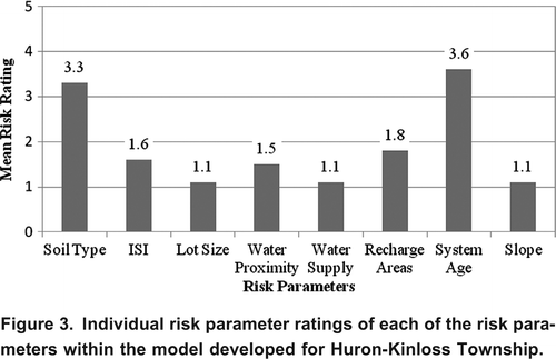
Figure 4. Developed recharge area risk ratings in Huron-Kinloss Township provided by Maitland Valley and Ausable-Bayfield Conservation Authorities for Huron-Kinloss Township (10 m resolution) based on significant recharge areas.
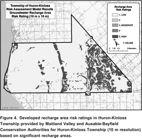
Figure 5. Final (before validation) relative risk areas based on the developed risk contours for Huron-Kinloss Township risk model.
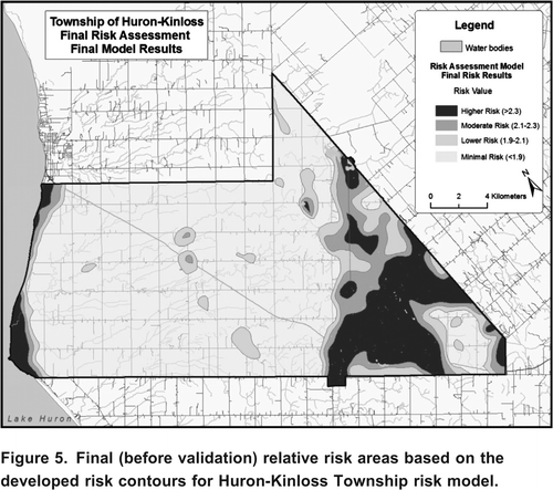
Figure 6. Proportion of area within Huron-Kinloss Township that fall under different risk categories under the final modeled results.
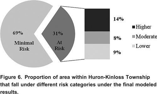
Figure 7. Contributions of risk parameters to mean risk score for the validated risk model for Huron-Kinloss Township.
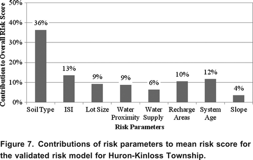
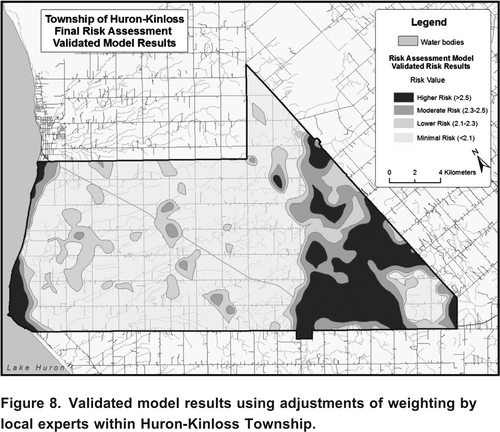
Figure 8. Validated model results using adjustments of weighting by local experts within Huron-Kinloss Township.