
Abstract
Lessons for designing fit-for-purpose land administration and land management activities, where the stated purposes are poverty alleviation, food security, and good governance, are provided. Contemporary developments from urban and rural Ethiopia provide the empirical basis: data is synthesised from fieldwork and other research activities undertaken between 2011 and 2013. With its large population and important geopolitical location, Ethiopia will continue to act as a yardstick for measuring the success of the global development agenda, particularly in Eastern Africa. Observations from training sessions conducted with cadastral and urban planning experts in Addis Ababa reveal challenges and opportunities regarding capacity development for urban land administration, urban land markets, and state land management. From the city of Bahir Dar, an alternative perspective of urban land administration is provided: the presented results shed light on the varying quality of cadastral development, but also the positive and negative impacts of cadastral implementation. Meanwhile, results from Dilla Town reveal the opportunity to link cadastral development to other infrastructure development activities (e.g. road construction and upgrade). The case also reveals the ongoing tension between ensuring adequate compensation payments relating to land acquisition, whilst also delivering a broader community benefit. Outputs from exploratory design work on the potential for land consolidation in the Amhara region are also articulated. The status of cadastral development in rural areas is revealed, along with future challenges for using cadastral data in land consolidation activities. Overall, the synthesised studies expose how fit-for-purpose ideologies are increasingly informing Ethiopian cadastral design, and under what conditions these designs can support poverty alleviation, food security, and good governance.
Introduction
The draft UN Post-2015 Development Agenda implied an emphasis on improving the relationship between people, urban land, and rural land. No less than six (6) of the twelve (12) drafted universal goals suggest the need for better land governance, land rights, and land information management (CitationUN 2013). The global thrust to end poverty, ensure gender equality, deliver food security, provide sustainable nature resource management, support good governance, and support a globally enabled environment will supposedly rely upon fit-for-purpose improvements to land institutions (CitationFIG 2014): it is through land focused projects, initiatives, and interventions that the goals coalesce and will be ultimately achieved, or not.
The new agenda comes at an important time for the global land administration sector: the sector is in transition (CitationMcLaren et al. 2013). Along with an increased focus on institutional capacity building, the sector is broadening its conventions on quality beyond mere spatial accuracy and legal precision. An acceptance of a continuum of approaches is now observed in literature and practice (c.f. CitationUN-Habitat 2008; CitationUN-Habitat 2012; CitationZevenbergen et al. 2013). Less spatially accurate methods for adjudication, surveying, demarcation, and recording are evident in numerous works and projects (CitationLemmen 2012; CitationVan Asperen 2012; Hackman-Antwi Citation2013). The emphasis is on designing fit-for-purpose solutions; ones that, according to CitationFIG (2014), promote flexible, inclusive, participatory, affordable, reliable, attainable, and upgradeable land administration systems. This newly concretised term ought to expedite closing the global land administration divide (c.f. CitationBennett et al. 2013). Contemporary examples utilising the approach include: Rwanda’s Land Tenure Regularisation (LTR) program; Namibia’s customary lands registration programs; and the rural land certifications programs of Ethiopia (CitationFIG 2014).
Ethiopia illustrates the overlap of the draft Post-2015 development goals and fit-for-purpose land administration in a practical setting: the relevance of both is clear in this context. Over the previous decade, and from a humble base, the country consistently progressed across numerous development indicators, usually at above regional and global rates (e.g. CitationUNDP 2013). On the ground, particularly in the capital Addis Ababa, the momentum of change is palpable. Nevertheless, many of the aforementioned development goals remain pertinent across the country. Ethiopia, with its large population and important geopolitical location, will continue to act as a yardstick for measuring the success of the global development agenda, particularly in Eastern Africa.
With regards to land issues in Ethiopia, numerous development initiatives are evident over the previous two decades (c.f. CitationShibeshi 2013; CitationHolden et al. 2011; Deininger et al. Citation2007). These aimed to secure urban and rural tenures in order to improve agricultural productivity, expedite urban development, and support infrastructure investment. While neither entailing changes to the underlying philosophy of universal state land ownership, or the institutional separation of urban and rural land management, they do entail supportive measures for the land sector (CitationAmbaye 2013; CitationVan Dijk 2013). These included: improving legal recognition and allocation of tenure rights; investigating options for land tenure transfers and changes; and improving the general administration of land tenure and land value. Of preeminence is the rural land certification project in Amhara Region – focused on delivering certificates to over 20 million plot holders (CitationPalm 2010), and several efforts to modernise the cadastre in urban areas, particularly in Addis Ababa (CitationBerisso and Zein 2013).
This paper provides a contemporary update on fit-for-purpose land administration perspectives in urban and rural Ethiopia. Following an overview of key terminology and methodology, results from four independent studies are presented. These relate to the cities of Addis Ababa, Bahir Dar, Dilla Town, and the rural parts of the Amhara region. Each study uses different works and analysis techniques to identify and examine context specific challenges and opportunities relating to fit-for-purpose land administration and the Post-2015 development agenda. These are then synthesised into generalised lessons. The paper concludes with a summary and consideration of future research activities.
Definitions
The following definitions are adopted for the study. ‘Land administration’ or land administration system is defined as the activities that relate to organising land tenure, land value, land use, and land development (c.f. CitationWilliamson et al. 2010). This is a broad definition encompassing policy, legal, tenure, administrative, technical, and capacity development elements. This definition closely aligns with the more recent definition provided in ISO 19152 (CitationISO 19152 2012), the international standard for the land administration dinaub, and otherwise known as the Land Administration Domain Model (LADM). ‘Cadastres’ and ‘land registries’ also require definition. These are sometimes considered technical subcomponents of, or even the agencies undertaking, land administration, however, here the broader institutional usage is adopted: cadastres and land registries encompass all the above and are considered synonymous to land administration and each other.
‘Fit-for-purpose’ is often considered synonymous with quality and is conventionally understood as the ‘the characteristics of the service that bear on its ability to satisfy stated or implied needs’ (CitationASQ 2013). Therefore in the field of land administration, one might suggest that ‘fit-for-purpose land administration systems’ are those where the tenure, policy, legal, administrative, technical, and capacity development aspects are aligned with the stated needs of the system. The stated (or implied) need usually varies between contexts; however, a legal or fiscal basis is usually historically evident. However, in land administration, ‘fit-for-purpose’ appears to have taken on a more specific contemporary meaning: ‘fit-for-purpose’ now relates to the design of land administration systems in developing countries. In these contexts, via national and international land policies, the aim is to support poverty alleviation, food security, and good governance, particularly for underrepresented groups (for example, customary groupings, woman, or the youth). Consequently, the philosophies embedded in the ‘continuum of land rights’ (CitationUN-Habitat 2008), the ‘responsible governance of tenure’ (CitationFAO 2012; Deininger et al. 2011), and the global development agenda can be understood to underpin contemporary use of the ‘fit-for-purpose’ concept. Therefore, ‘fit-for-purpose’ in the context of modern land administration, describes those systems that are flexible, inclusive, participatory, affordable, reliable, attainable, and upgradeable (CitationFIG 2014). The CitationFIG (2014) description also identifies specific technologies as being fit-for-purpose: general boundaries, aerial imagery, relative accuracy, and incremental improvement techniques, receive explicit attention. The CitationFIG (2014) definition is adopted in this work.
‘Land governance’ is considered a broader term and is defined as all the processes, regardless of who undertakes them, and how they are undertaken, that relate to decisions and activities on land, and the evaluation of these (c.f. CitationBevir 2013).
‘Land consolidation’ is also defined broadly, in alignment with CitationPašakarnis and Maliene (2010) to describe ‘the planned readjustment of the pattern of the ownership of land parcels with the aim of forming larger and more rational land holdings. Other goals may be attached to the process of consolidation such as improvements to the infrastructure and the implementation of developmental and environmental policies’.
‘Urban’ is defined in the general sense, and refers to those places with higher population and built infrastructure density than surrounding areas. ‘Rural’ is ‘simply’ defined as those areas not considered urban. Peri-urban can be considered the frontier or zone between urban and rural areas.
‘Post-2015’ refers to the draft global development agenda, slated to replace the Millennium Development Goals (MDGs) and known as the Sustainable Development Goals, and more specifically the report from the High Level Panel of experts relating to the Post-2015 Development Agenda (CitationUN 2013). At the time of writing the agenda remains in development, however, the overarching philosophy and more prominent objectives are likely to align closely to those in CitationUN (2013).
Methodology
Overall, a qualitative approach is used: a simplified research synthesis of four studies informs the final development of lessons. Data are synthesised from four recent field visits, research activities, and in some cases associated publications. Primarily, this involved extracting and aggregating the similarities and differences between the four studies, and developing an aggregated set of findings. The analytical lens is the draft Post-2015 development objectives, and specifically indicators on: ending poverty through provision of secured rights (draft indicator 1c); protecting the right of everyone to have access to nutritious food (draft indicator 5a), increasing the agricultural productivity by smallholders (5c) and ensuring effective governance and institutions through guaranteed access to government information (draft indicator 10d) (). The potential role land administration might play in supporting the objectives and background works are also indicated in . The objectives of focus were selected as they represent issues where land administration systems are considered likely to have the most impact, either positive or negative, on their achievement.
Table 1 Relationship between global development objectives, indicators, role of cadastre and selected case studies
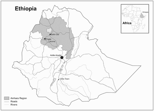
The locations of the four studies are provided in . The first study is observational in nature and based on primary data collected in August and September 2013. Results are derived from aggregating and generalising findings from training sessions. Experts from various levels of government and academia in Addis Ababa participated: expertise related to cadastral management, valuation, and urban planning. Challenges and opportunities with regards to urban land administration, urban land markets, and state land management were compiled. Second, an alternative perspective of urban land administration is provided, this time from CitationAlemie (2014, Citation2015). The focus is on Bahir Dar, the capital of the Amhara National Regional State, in the country’s North West. Supported by social and spatial data collection activities, the results shed light on the quality of cadastral development, but also positive and negative impacts of cadastres. Third, Woldeselasie’s (2013) case study analyses the relationship between infrastructure provision, compensation, and cadastral development in Dilla Town. The opportunity to link cadastral development with the ‘purpose’ of infrastructure provision is revealed. Fourth, outputs from Yimer’s (2014) exploratory design work on the potential for land consolidation in the Amhara region are articulated. From all case studies, the status of fit-for-purpose land administration is revealed, and the challenges and opportunities for poverty alleviation, food security, and good governance are synthesised.
1 Four case locations in Ethiopia (note: no scale)
Addis Ababa: good things come in threes?
While Ethiopia remains predominately an agrarian society, its relatively young major cities and urban areas are rapidly expanding with respect to population, geographic footprint, and infrastructure. Addis Ababa, the capital, provides the prime example. Since its establishment in the late 1880s, it grew at moderate pace under various political regimes, before experiencing rapid expansion in the previous two decades. Population now sits comfortably above 3·0M inhabitants. CitationZein and Berisso (2012) are able to dramatically illustrate the developments from a spatial perspective. It is of interest to consider these developments through the lenses of fit-for-purpose land administration and the draft Post-2015 development agenda. Of specific interest are the intended purposes of ending poverty through increased securitisation of property rights, and the ensuring of effective governance and institutions through guaranteed access to government information.
Efforts to establish land administration systems are evident throughout Addis Ababa’s short history (c.f. CitationTadesse 2006; CitationAmbaye 2013). In the early 1900s the first land tenure law was enacted, enabling private land ownership and transfer. Land registration and cadastral development soon followed, largely inspired by French interests. At the national level and under another political regime, the 1950s saw the introduction of compensation for compulsory acquisition and organisational reform; however, urban cadastres remained the domain of municipalities (Shibeshi Citation2010). In the 1970s, another political regime nationalised all land: a system of non-tradable land use rights was introduced in urban areas. Cadastral and land registration activities received little attention during this period. Beginning in the 1990s, further political changes at the national level had implications for land administration: a land leasing system was promoted for urban areas as per the Urban Land Leasehold Act 1993 (89/1993). While expropriation of the use rights was enabled, compensation for the acquired use would be payable. Transactions proliferated during this period: through negotiation between by parties; through fixed prices determined by municipalities; and through a bidding system. To support the Act, a land information system would be necessary to enable transfer, sale, mortgage and rent of the land leases. These would be the responsibility of regions and municipalities; however, the federal level could prescribe overarching controls and guidelines. Thus far, three identifiable attempts have been made to introduce these land information systems. The first two delivered mixed results: the projects focused on specific cities and aimed to deliver multi-purpose cadastres, although taxation was an apparent focus. The third attempt uses Addis Ababa as a pilot and focuses on delivering a juridical or legal cadastre. Whilst the technical components were completed in 2013, the promulgation of accompanying laws was delayed until 2014 (i.e. the Urban Landholding Registration Act). Perhaps a little incongruously to all three attempts, the first urban land management policy was only introduced in 2011.
With this background in mind, the Netherlands organisation for international cooperation in higher education (NUFFIC) in collaboration with the Institute for Housing and Urban Development Studies (IHS), the Ethiopian Civil Service University (ECSU), and the ITC Faculty of the University of Twente instigated a tailor-made training program for approximately twenty participants form different levels and arms of government and academia in August and September of 2013. The course ran for more than five weeks and included components in Ethiopia and the Netherlands. The broad curriculum focused on a range of issues relating to housing production, urban management, land use planning, land markets, and land information systems. Here, generalised observations made on issues specifically relating to fit-for-purpose land administration and the relevant Post-2015 development agenda indicators: the continuum of land rights, land markets, fit-for-purpose cadastres, and state land management, are extracted. The generalised views are not, and can neither be ascribed to specific participants nor participating agencies.
The continuum of land rights, as espoused by CitationUN-Habitat (2008) and subsequently many others, aims to support ending poverty by increasing the number of people with recognised property rights. While all land is vested in the state within Ethiopia, the continuum is realised to a minor extent through the two-stage (sometimes described as three-stage) certification process of usufruct rights in rural areas, and the land lease system of urban areas. More contentious has been the status and future status of informal occupations in urban areas. By definition, these have previously not been recognised legally or administratively: cases of dwellers being evicted and/or relocated to less attractive peri-urban areas are not uncommon. However, formalisation laws are now gaining traction. Formalisation activities would certainly enhance results for a poverty reduction indicator based on secure rights. However, ‘securing rights’ to land without supporting the associated livelihoods can work to undermine the intervention: the right can be transferred by the holder for quick financial gain – before they move onto another informal living arrangement. Likewise, using the land right certificate to gain access to credit will be meaningless unless the associated livelihood (i.e. job) enables repayment of the loan. In this regard, effort is needed to ensure information asymmetry is levelled by ensuring equitable provision of information and household educational services relating to land value and financial loans (c.f. CitationDale 2000). Moreover, potential side-effects of the focus on rights certification are: 1) the diversion of funding away from other development tasks; and 2) reduced flexibility in implementing city-wide infrastructure plans.
The continuum of land rights relates closely to the potential for land markets. A controlled land market operates in Addis Ababa, however, a significant portion of activity occurs informally: there exists the opportunity for governments to capture more value from these transactions. While constraints on marketable land tenures are a core issue, there appears the possibility to get more agreement and clarity on the role of informal transactions, financial institutions, interaction between the public notary and the cadastre, and compensation amounts. Any formalisation of illegal rights must be accompanied by economic benefits for both government and citizens.
Key in all this is the development of Addis Ababa’s cadastre, its fitness-for-purpose, and ensuring effective governance and institutions through guaranteed access to government information. The potential for an improved land administration system amongst the Ethiopian practitioners was observed: more efficient uses of land and improved tenure security would be key longer-term outcomes. However, the introduction of the system was not necessarily seen as beneficial for those in informal settlements: specifically, the costs of implementing the cadastre are seen as being better spent elsewhere in the short term (e.g. other essential infrastructure provision). This is perhaps a valid argument given the mixed results of earlier projects. Consequently, in the more recent effort, use was made of more ‘fit-for-purpose’ approaches: aerial photography capture by Hansa Luftbild was used for an initial update of the cadastral map. In line with CitationFIG (2014), the approach was affordable, attainable, and upgradeable, however, concerns regarding the capacity of existing institutions to maintain the designed system persist. That is, whether the operational system will be flexible, inclusive, participatory, and reliable remains to be seen.
Using Zimmerman (2013) as a framework, a range of specific improvements were identified by participants for the Addis Ababa cadastre:
getting firmer clarity with regards to the national vision for the land information system – specifically, the legal versus fiscal versus multipurpose roles and responsibilities of the cadastre
getting clarity on the short and longer term financing of the system, and more transparent government fiscal procedures relating to urban land in general
creating higher levels of citizen and government awareness and support, including the development of a coherent stakeholder model and communications plan
receiving more top-down support for the agencies involved – and more clarity with regards to interactions between land related organisations and the role of the private sector;
getting clarity of the timing of roll-out and operationalisation of the system – including when and how updating procedures would work
the need for more human expertise and training programs – specifically in relation to new software packages
the need for more clarity on prescribed standards for cadastral equipment and procedures
the requirement to have access to more reliable imagery and ground control points
the potential of utilising the lessons from the two efforts at cadastral establishment
monitoring and evaluation: instituting a urban property assessment board, setting clear performance benchmarks, and establishing professional bodies.
In the case of Addis Ababa, improvements with regards to Post-2015 draft indicators 1b and 10d might rest heavily on the above points being comprehensively addressed. Additionally, acting upon the points would enhance the argument that the Addis Ababa land administration system is indeed fit-for-purpose.
Bahir Dar: fast, quick, but fit-for-purpose?
Bahir Dar lies at the southern tip of Lake Tana, and is the capital of Amhara National Regional State, a state in the northwest of Ethiopia. Since 2010, research regarding the city’s urban land governance arrangements and accompanying land administration system was conducted (Alemie 2014; 2015). Bahir Dar’s geography and population of ∼250 000 are administratively divided into nine Kebeles. Whilst much smaller than Addis Ababa, the city is experiencing similar challenges relating to governance and growth: comparable forces are at play with regards to land tenure, transactions and development. The city is subject to similar urban policies, legal frameworks, and tenure arrangements: all land is considered leaseholdFootnote*. A doubling of the population over the previous two decades saw an increase in informality, particularly on the peri-urban fringes. Consideration of these developments is now undertaken through the lenses of fit-for-purpose land administration and development agenda objectives focused on ending poverty through increased securitisation of property rights, and ensuring effective governance and institutions through guaranteed access to government information.
The work of CitationAlemie et al. (2014) provides a number of insights on securitisation of rights for poverty alleviation. Using a mix of spatial and social research methodologies, the dynamism of informal settlements (insecure property rights) is captured. The focus is on the Wuramit Kebele in the north western part of the city. The settlements lie away from the major roads, consist of around 2000 houses, and are well hidden by surrounding plantations. The settlements lack access to piped water, energy, and other utilities: these are usually acquired at high cost in an ad-hoc fashion from nearby formal settlements. The research approach revealed the settlements grew significantly over an eight (8) year period: ignited by political uncertainty from the 2005 election disputes and the global economic crisis (perhaps more so), the underlying issues of unaffordable rental housing, cheap informal land occupation, inappropriate housing policy, limited local government capacity, and weak cadastral and planning systems, conspired to drive informality. The inadequacy of the existing cadastre and land use maps is illustrated starkly by overlaying them atop high resolution satellite imagery: significant mismatches between the vector datasets and on-ground situation were revealed. Whilst formalisation through use of fit-for-purpose land administration procedures might assist in fast tracking land rights securitisation, no formalisation law is issued for these ‘illegal’ land holdings, unlike other cities including Hawassa and Dire Dawa that instituted such laws earlier. At any rate, unintended side-effects of any such formalisation activities need careful consideration (e.g. promotion of illegal occupation).
With regards to information provision to support good governance, Alemie et al.’s (2015) analysis of the cadastral developments in Bahir Dar sheds further light. The work illustrates that the city does not maintain a complete cadastral system: demanding access to information is one thing, ensuring it exists in the first place is entirely another. Alemie makes clear that the regional government lacks the financial, administrative and technical capacity to build and maintain the desired system. Consequently, cadastral development progresses in an ad-hoc fashion: it has depended on the availability of donor funding (e.g. 2009 project) or government funding. This has a number of implications. First, the apparent motivation or ‘purpose’ of the system is observed to change over time, obviously undermining the chance of the system being ‘fit-for-purpose’ in the more general sense. ‘Multipurpose’ for a long time was the stated objective; however, all cities in the country are now mandated to deliver a legal cadastre. Previously, the integrated land information management office had not been established; although for the legal cadastre it is now instituted. Second, a sustainable long term approach is replaced by a project based mentality (c.f. CitationMagis and Zevenbergen 2014). Focus tends towards short term deliverables including selection of technical tools and surveying options (e.g. use of total stations). Key design tasks that would ensure a ‘fit-for-purpose’ design are passed over or expedited to ensure funding is utilised within set deadlines. The lack of a user needs assessment before one specific project is as an example. Important longer term aspects of a fit-for-purpose system also receive less attention: instituting sustainable updating procedures, building-in an archival database, and ensuring buy-in from an increasingly sceptical citizen population are overlooked. These specific aspects, if implemented, would support achievement of FIG’s (2014) fit-for-purpose characteristics including upgradeability, inclusivity and participation.
CitationAlemie (2014) shows these surface challenges stem from broader governance issues related to the cadastre. At the regional level moves to establish formalisation regulations were lengthy or delayed. At the national level, attempts to pass the Urban Landholding Registration Act were blocked by the parliament, supposedly as it was felt that the law gave too much mandate to the federal government. Meanwhile, the parliament argued it possessed overriding powers on the matter: an issue typical among federations. The debate took two years to resolve and was enacted in early 2014. Overall, there is opportunity to improve clarity with respect to roles and responsibilities with regards to the cadastre in the national laws. Meanwhile, from federal government there could be more emphasis placed on the importance of cadastral development through comparative performance measurement of the states. There lies the opportunity to improve cadastral co-management between regional and federal level: regions will need support in adopting the standards and procedures prepared by the federal government in relation to the Immovable Property Registration Act. The federal level will need to be aware of the formalisation regulations currently being prepared at the regional level. Whilst arguments can be made for the prescribed use of conventional surveying tools, other perhaps more fit-for-purpose technologies to support cadastral development could be investigated, for example, the use of imagery as discussed in CitationFIG (2014). Such discussions and decisions appear to be impeded by high-staff turnover at both management and operational level: few staff remains beyond four years. This collection of issues reveals the range of challenges with regards land information: not only its public accessibility, but, its fundamental creation.
Overall, the Bahir Dar case provides some interesting insights for fit-for-purpose land administration and the development agenda. Whilst fast tracking legalisation of informal settlements might assist in delivering on more secure property rights, the unintended side effects of such wholesale upgrades need to be taken into account. Moreover, a secured right on paper or in a record system is one thing, however, the fundamental goal remains the delivery of affordable and accessible water, sanitation, and services – not a certificate, title, or document per se (UN Habitat 2008; CitationFAO 2012). With regards to ensuring provision of public information – the shift in emphasis from a ‘multi-purpose’ to ‘legal’ cadastre in Bahir Dar can be seen a ‘fit-for-purpose’ measure (CitationHenssen 2010), if only to make it more attainable (CitationFIG, 2014). However, this stated purpose should remain clear, unwavering, and sustained – only then can any design be ‘fit-for-purpose’ with regards to implementation of legislation, institutional capacity, and technical characteristics. Moreover, only beyond that can delivery of cadastral information in the public domain be countenanced.
Dilla Town: finding and funding fit-for-purpose
Dilla Town with a population of 100 000 sits half way between Addis Ababa and the Kenyan border, in the southern part of Ethiopia. Its strategic location, along the main highway connecting the two countries, means it is a focus area for capital investment. The impetus has been on upgrading and providing new roads, paved community areas, and upgrades to the market place. The investment provides the opportunity to support the broader development agenda items of poverty alleviation and good governance. A range of investment models are being utilised – several of which require land acquisition. Without records of who holds and uses which lands, motivating participation, assisting with resettlement, and allocating compensation are made all the more difficult.
CitationWoldeselasie (2013) undertook research to assess how capital investment projects are dealing with land acquisition, through the analytical lenses of land rights, land information and broader governance aspects. It was hypothesised that, most likely, the programs would not be adhering to good practices (e.g. the Land Governance Assessment Framework (LGAF) as disclosed in Deininger et al. (2011)): activities such as project planning, participation, acquisition procedures, compensation, resettlement and impact would not be adhering to criteria. Woldeselasie developed a case-specific assessment framework incorporating elements from World Bank reports, Asia Development Bank reports, and the Land Governance Assessment Framework (CitationDeininger et al., 2012). The need to develop a new framework, in the face of other existing tools, remains open to question. Semi-structured interviews were conducted with government, civil society, and community stakeholders – including those directly impacted by the projects.
Woldeselasie accessed a range of local land records including some parcel information relating to land, and various AutoCAD files. Later he also acquired data relating to the position and nature of the capital investment programs. A separate assessment of the nature and use of cadastral land records was not undertaken due to time limitations. However, it was found that the projects did make provision for adjudication, surveying, and demarcation of affected peoples and parcels prior to undertaking the project; in a sense, a makeshift ‘capital investment cadastre’ was the result.
Overall, the results revealed a seemingly positive story. Woldeselasie’s hypothesis was proved largely incorrect: the notion that the projects were not following good practices is overstated. In aspects relating to project planning and public participation procedures – strong evidence to support adherence was obtained. In relation to land acquisition procedures, resettlement activities, and project impact – evidence also supported the notion that good practices were being followed. More contentious, however, were the results received in relation to compensation. In alignment with good practice, compensation was made available in advance, even to those without certificates. However, the payments were not done at replacement cost, although, there is no universal rule that this must be the case (CitationFIG 2010). Additionally, valuation procedures were not readily transparent, and it is unclear whether a scientific basis was used to determine the values. The latter findings appear to align with those espoused by, and expanded upon by CitationAmbaye (2013).
The results bring into focus the positive and negative roles capital investment projects play in supporting the development objectives of poverty alleviation and good governance. Compensation is the central issue with regards to poverty alleviation. The relevant procedures and amounts paid may support poverty alleviation; however, they can further marginalise segments of the community. Indeed, compensation amounts and processes are the key issue in land acquisition, appearing to usurp issues of participation, clear planning, and resettlement in importance. Therefore, it could be investigated whether more of the capital investment should be allocated to building the compensation fund, rather than the other ‘nice-to-have’ activities. Either way, it seems a land administration system – or information about land location, holding and value – remains important to the governance process. The case shows that if such information was stored, updated and available to the public, a clearer assessment of whether compensation amounts were reasonable could have been undertaken. Additionally, the effort put into surveying and demarcation during the planning phase of the project would have been reduced or not required. Finally, capital investment projects demonstrate another fit-for-purpose land administration opportunity: by aligning land information capture activities with infrastructure building activities an affordable and flexible approach for efficiently constructing missing parts of a cadastre is provided (c.f. CitationBennett et al. 2012; CitationFIG 2014). Infrastructure building activities require land information, and in the context of these large infrastructure projects, land surveying, recording and adjudication tasks often represent minor costs. However, a potentially negative outcome of the approach is that the usual project emphasis on infrastructure delivery may neglect the need to ensure other fit-for-purpose land administration characteristics: sustained cadastral updates and upgrades; and system reliability might not be assured.
Amhara region: from cadastre to consolidation?
Despite increased attention on urbanisation, a much higher percentage of the Ethiopians remain living outside urban areas. Indeed, like urban areas, rural populations continue to grow. In these areas subsistence farming and localised agricultural production persist as predominant livelihood patterns. Ethiopia’ rural areas are administered separately to urban areas: different polices, laws, and institutional frameworks apply. Rural cadastral development is no exception to this rule. In this regard, it is worth considering the fit-for-purpose aspects of these developments and the implications for the Post-2015 development agenda: objectives relating to food security provision and the focus on increasing the agricultural productivity of smallholders are of specific interest.
Since 1998 large resources were afforded to providing certification of land holdings in rural areas. This resulted in millions of certificates being delivered in under a decade via local land administration committees (CitationPalm 2010; CitationVan Dijk 2013). In alignment with the fit-for-purpose mantra, a flexible, affordable, upgradeable, inclusive, and participatory approach is utilised: preliminary paper certifications are later upgraded into a book of holdings including photos and certificates. Later still a secondary map book is intended: the spatial component of the registration program can be secondary (CitationShibeshi 2013). Also secondary, has been consideration of data updating mechanisms. The land lease system from urban areas does not apply in rural zones; a type of usufruct right applies: the certificates cannot be traded, nor used to acquire mortgages.
Sitting alongside the rural land registration program are agendas for improving agricultural productivity and the existing rural economy. Different mechanisms are available: technology investment, enforced production of specific crops, amongst others. Less attention has been afforded the potential for utilising land consolidation: an approach widely considered and continuously applied across much of western Europe over recent decades and centuries (CitationGrossman and Brussaard 1989; CitationBergh 2004; CitationVitikainen 2004; CitationThomas 2006; CitationDimitriou 2014). As defined under ‘Definitions’, land consolidation is essentially the process of reorganising land tenure rights and parcels in rural areas. It may merely consist of transferring existing land parcels between owners; however, more dramatic applications involve parcel consolidation and redesign. In Ethiopia, while consolidation is permitted, it only occurs on a piecemeal or voluntary basis. CitationYimer (2014) sought to investigate the viability of land consolidation, specifically land re-allotment, in the context of the rural parts of the Amhara region.
The Amhara region, like others, is administratively broken into zones, Woredas (districts), and Kebeles (towns; lowest administrative unit, equivalent to neighborhoods). Yimer focused specifically on Fagta Lakoma Woreda and the Kebele of Tafoch Dambule. The area studied can be considered part of a mountain village: it does not lie in the lowland areas of the Amhara region. Seventy households were considered. The landscape exhibits high parcel fragmentation: plot sizes average around one hectare. A landholder usually possesses around four land plots: each typically being within a few kilometres of each other and around twenty minutes walking distance from the family home. Each plot is usually within one kilometre from the main road; however, some can be up to fifteen kilometres away. Farming activities consist of subsistence farming, crop production, and livestock production.
When consulted on the concept and potential of land consolidation, a majority agreed that existing individual production capacity was constrained by limited access to land, water and productive soils. Meanwhile, only one third of respondents considered land fragmentation an inhibiting factor. Indeed, like is found in other smallholder contexts, fragmentation of holdings is considered to assist risk management practices. Microclimates are evident in the area: small and diverse parcel holdings enable soil diversity to be increased, whilst exposure to total failure by localised natural disasters is decreased. The importance of distributing risks appears to outweigh any perceived benefits of consolidated holdings: less than half the farmers suggested they would consider any re-allotment. Travel time between parcels was hardly considered a constraining issue. Additionally, all participants noted they were not prepared to relocate homes: close proximity to family and limited financial capacity to rebuild were key arguments. Despite this, more than half the community agreed that re-allotment would most likely improve production. Further research could explore the demographic make-up of the respondents (e.g. parents with larger holdings vs. children with smaller plots): this could potentially impact on these findings.
Meanwhile, Yimer finds that representatives from Woreda and regional government believe land shortage is a major challenge for the production levels of small holders. Population growth results in excess labour and drives further fragmentation: segments of the parent holdings are given to children. Whilst land consolidation does not create more land per se, it can deliver increased yield. In the region, land consolidation is a voluntary activity: no plans exist to impose or promote consolidation. Instead, improved productivity is promoted through use of chemical fertilizers or resettlement programs to lowland areas. In terms of the transition cost and social upheaval the regional government may have a good argument. The federal ministry (Ministry of Agriculture and Rural Development) sees more potential in more widespread large land consolidation programs supported by educational programs. Land banks, a key ingredient in successful land consolidation programs (e.g. the Netherlands), are already in place – however, these are used only to support large scale land investment and small scale transfer from deceased persons to others. At any rate, land consolidation and land re-allotment constitutionally lie beyond the mandate of the federal government and any implementation would require a change in existing land policy and laws.
From a technical perspective, CitationYimer (2014) illustrates that the technical components of European land consolidation approaches can be adapted and applied in the Amhara context. It should be noted that the applications was only possible because of the availability of pre-existing cadastral data – itself collected in a fit-for-purpose manner: low cost and rudimentary surveying techniques, including rope surveys, were used to collect spatial and attribute data (Deininger et al. 2007). Given the low cost of labour and relatively low land values, these approaches appear entirely appropriate. Through Yimer’s work the cadastral data are already demonstrated to be able to be applied in a multi-purpose fashion. Meanwhile, regarding the consolidation processes, the specific requirement to not transform the shape of parcels nor move households can be built into a GIS based solution. The subsequent re-allocation plan reduces travel times, increase plots sizes (through merged plots), and concentrates plot holdings. The design would likely improve productivity and as such can be seen as a contributor to desired smallholder productivity (indicator 5c) increases and food security more generally (indicator 5a). However, this assertion needs further empirical proofing, particularly outside the European context. Specifically, the social and economic costs of implementing the plan need careful consideration. In addition, the impact on the local environment, particularly bio-diversity, requires a separate study. For now, perceptions at smallholder and regional government level are likely to limit increased use of land consolidation.
Key lessons
The cases provide insights into fit-for-purpose land administration and its relationship to the future development agenda (i.e. draft Post-2015 development agenda), and specifically those objectives relating to poverty alleviation, good governance, and food security.
The draft Post-2015 development objectives may help to focus the work plans of international development agencies, however:
potential skewing of stakeholder behaviours and unintended side-effects of, and upon, local actors should be considered
achieving indicators is one thing, sustaining them beyond a prescribed ‘development agenda’ period is another altogether – this applies to ‘fit-for-purpose’ land administration design also.
That is, could a dogmatic focus on a fit-for-purpose characteristic, such as ‘flexible’, potentially undermine other desirable responsible governance characteristics, such as ‘rule-of-law’?
Fit-for-purpose land administration is on display, at least partially, in various contexts throughout Ethiopia. The studies in Addis Ababa, Bahir Dar, Dilla Town, and Fagta Lakoma variously revealed selections of fit-for-purpose land administration characteristics in action: flexibility, inclusiveness, participation, affordability, reliability, attainability, upgradeability in relation to land administration design were revealed in one context or another – however, arguably no context had all aspects covered. With regards to lessons, the fit-for-purpose philosophy can support the Post-2015 agenda, however:
in any community the ‘purpose’ should be transparently defined, sustained as a goal, and eventually carry high levels of community support (i.e. participatory and inclusive)
the ‘purpose’ may vary within a country or even region (e.g. rural versus urban) and this will impact upon implementation (i.e. flexible)
the ‘fit-for-purpose’ design can be implemented in stages and tied to other infrastructure developments (i.e. affordable and attainable)
the implementation should look beyond ‘post-2015’ and its end date to ensure sustainable updating procedures and self-funding mechanisms are included (i.e. reliable and upgradeable).
Securing more land rights through fit-for-purpose land administration activities can help to end poverty, but:
‘tenure security’ has multiple dimensions and a mix of fit-for-context indicators can/should be used and investigated (e.g. Functioning Cadastre? Certificates? Marketability of interest? Community benefit? Individual perception? c.f. CitationSimbizi et al. 2014)
land administration needs a mandate, enough institutional capacity, and, at some point early-on, community support.
Technical solutions (e.g. land consolidation backed by fit-for-purpose land administration) can help to ensure food security and good nutrition, but:
communities may not be willing to sacrifice existing living patterns, social arrangements, and risk management strategies
alternative measures (e.g. fertilisers, irrigation) may be less disruptive and cost effective in the short term – although, more environmentally detrimental.
Land administration that is fit-for-purpose in nature can support good governance and effective institutions through provision of public information; however:
systems must first be complete and maintained in order to do so; and therefore
land administration itself requires good governance and effective institutions.
Conclusions
Global development agendas influence land administration project design and funding. The newest instantiation, the Post-2015 development agenda, is likely to be no different. At first glance, the one-size-fits-all set of objectives appear at odds with the notion of ‘fit-for-purpose’ land administration. How each concept influences the other will no doubt be refined over time. In this regard, this paper sought to provide insights, and practical lessons, from ongoing land administration development activities in rural and urban Ethiopia: a yardstick for development in East Africa and more globally.
Overall, characteristics of fit-for-purpose were evident in each of the case locations studied; however, none of the cases exhibited all seven characteristics as espoused in CitationFIG (2014). At a more specific level, observations from Addis Ababa and empirical work from Bahir Dar and Dilla Town revealed existing land administration systems contribute to impeded urban land markets and state land management. Implementation has been challenged by unsettled legal frameworks, capacity and resourcing issues within regional governments, and a lack of cohesion between federal and regional levels. However, a new round of attempts appears more ‘fit-for-purpose’ in nature (e.g. focus on juridical cadastre) and better aligned with development agenda: time will tell. Meanwhile, the Amhara region case revealed the staged rural certification procedure has delivered certificates and a parcel map (in the region studied), although the significance of the artefacts for determining the perceived tenure security of individuals was not assessed (c.f. CitationSimbizi et al. 2014). While the map supported undertaking land consolidation in a technical sense (e.g. the development of a draft re-allotment plan), the participants were less interested in taking part in reality for family and risk management reasons – although, many conceded individual production levels would increase.
Finally, it is concluded that as follows.
Caution against a ‘blinker or ‘blinder’ mentality should be used when designing and applying development indicators.
Any ‘fit-for-purpose’ land administration design needs a clearly stated purpose, can be staged, may be region or even community specific, and should also have an eye on future developments.
Secure land rights through land administration can help to ‘end poverty’, but, how to measure ‘security’ needs consideration as does ensuring community and top-level government support.
Technical solutions aimed at ensuring food security and good nutrition may not carry local community support.
Demanding publication of government information is one thing, actually having it available and maintained is perhaps a more pressing issue.
Further research should track the establishment and implementation of Post-2015 development agenda, exploring and monitoring the role of fit-for-purpose land administration design.
Acknowledgements
The authors would like to acknowledge the financial support of NUFFIC (Netherlands), SIDA (Sweden), and the ITC Faculty (University of Twente, Netherlands) during the development of this work. The authors also wish to acknowledge the support of colleagues and students at the University of Twente including Chrit Lemmen, Jaap Zevenbergen, Fikerte Yimer, Asfaw Woldeselasie, Liza Groenendijk and also colleagues from IHS Rotterdam including Saskia Ruijsink. Finally, the authors wish to acknowledge that an abstracted version of the work was presented at the 2014 World Bank Conference on Land and Poverty, Washington D.C., March 24-27.
Notes
* Although, all holdings that existed prior to the leasehold system remain in other forms of tenure.
References
- Alemie, B., Bennett, R. M. and Zevenbergen, J. 2014. The socio-spatial synergy in land governance: a case study of informal settlements in Bahir Dar, Ethiopia. In: Proceedings of Annual World Bank Conference on Land and Poverty 2013, 8–11 April 2013, Washington DC, USA.
- Alemie, B. K., Bennett, R. M. and Zevenbergen, J. 2015. Evolving urban cadastres in Ethiopia: the impacts on urban land governance. Land Use Policy, 42, pp. 695–705. doi: 10.1016/j.landusepol.2014.10.001
- Ambaye, D. W. 2013. Land rights and expropriation in Ethiopa. PhD. KTH, Sweden.
- ASQ. 2013. Quality Glossary. American Society for Quality. Available at: <http://asq.org/glossary/q.html> [Accessed July 2013].
- Berisso, Z. A. and Zein, T. 2013. Implementation practice: real property registration systems in developing countries: confluence of technological, institutional and organizational requirements in the Addis Ababa Project. In: Proceedings of Annual World Bank Conference on Land and Poverty 2013, 8–11 April 2013, Washington DC, USA.
- Bevir, M. 2013. Governance: a very short introduction. Oxford, UK: Oxford University Press.
- Bennett, R. M., Rajabifard, A., Williamson, I. P. and Wallace, J. 2012. On the need for national land administration infrastructures. Land Use Policy, 29(1), pp. 208–19. doi: 10.1016/j.landusepol.2011.06.008
- Bennett, R. M., van Gils, HAMJ, Zevenbergen, J. A., Lemmen, C. H. J. and Wallace, J. 2013. Continuing to bridge the cadastral divide. In: Proceedings of Annual World Bank Conference on Land and Poverty 2013, 8–11 April 2013, Washington DC, USA. 22 p.
- Bergh, V. D. S. 2004. The history of land consolidation in Netherlands. PhD. Wageningen University, Wageningen, The Netherlands.
- Dale, P. 2000. The importance of land administration in the development of land markets – a global perspective, Land markets and land consolidation in central Europe. TU Delft: UDMS, pp. 31–42.
- Deiniger, K., Ali, D. A., Holden, S. and Zevenbergen, J. 2007. Rural land certification in Ethiopia: process, initial impact, and implications for other African countries. Washington: World Bank.
- Deininger, K., Selod, H. and Burns, A. 2012. The land governance assessment framework: identifying and monitoring good practice in the land sector. Washington D.C.: World Bank.
- Dimitriou, D. 2014. The development of an integrated planning and decision support system (IPDSS) for land consolidation. New York: Springer, 340p.
- FAO. 2012. Voluntary guidelines on the responsible governance of tenure of land, fisheries, and forests in the context of national food security. Rome: CFS.
- FIG. 2010. Hanoi Declaration: land acquisition in emerging countries. FIG Publication 51, Copenhagen, Denmark.
- FIG. 2014. Fit-for-purpose land administration. FIG Publication 60, Copenhagen, Denmark.
- Grossman, M. and Brussaard, W. 1989. Reallocation of agricultural land under the Land Development Law in the Netherlands. Wageningen: Landbouwuniversiteit.
- Hackman-Antwi, R., Bennett, R. M., de Vries, W. T., Lemmen, C. H. J. and Meijer, C. 2013. The point cadastre requirement revisited. Survey Review, 45(331), pp. 239–47. doi: 10.1179/1752270612Y.0000000015
- Henssen, J. 2010. Land registration and cadastre systems: principles and related issues, Lecture Notes: Masters program in Land management and land tenure. TU Munich, Germany.
- Holden, S. T., Deininger, K. and Ghebru, H. 2011. Tenure insecurity, gender, low-cost land certification and land rental market participation in Ethiopia. The Journal of Development Studies, 47(1), pp. 31–47. doi: 10.1080/00220381003706460
- ISO 19152. 2012. Geographic information – land administration domain model (LADM). 1 ed. Geneva: International Standards Organization.
- Lemmen, C. 2012. A domain model for land administration. PhD. TU Delft, Netherlands.
- Magis, M. and Zevenbergen, J. 2014. Towards sustainable land administration systems: designing for long-term value creation. In: FIG Congress 2014, Kuala Lumpur, Malaysia, 16–21 June 2014.
- McLaren, R., Bennett, R. M. and Lemmen, C. H. J. 2013. World Bank conference on land and poverty 2013. GIM International, 27(7), pp.38–39.
- Palm, L. 2010. Quick and cheap mass land registration and computerization in Ethiopia. In: FIG Congress 2010. Sydney, Australia,11–16 April.
- Pašakarnis, G. and Maliene, V. 2010. Towards sustainable rural development in Central and Eastern Europe: applying land consolidation. Land Use Policy, 27(2), pp. 545–49. doi: 10.1016/j.landusepol.2009.07.008
- Shibeshi, G. B. 2010. Ethiopian Cadastral Template 2010 – based on the PCGIAP-Cadastral Template 2003.
- Shibeshi, G. B. 2013. Participatory and pro-poor land administration system of the Amhara National Regional State of Ethiopia: evaluation and lessons learnt of the current status. In: Proc. Annual World Bank Conference on Land and Poverty 2013Washington DC, USA, 8–11 April 2013, 22 p.
- Simbizi, M. C. D., Bennett, R. M. and Zevenbergen, J. A. 2014. Land tenure security: revisiting and refining the concept for Sub – Saharan Africa’s rural poor. Land Use Policy, 36, pp. 231–238. doi: 10.1016/j.landusepol.2013.08.006
- Thomas, J. 2006. What’s on regarding land consolidation in Europe? In: XXIII International FIG Congress, Munich, Germany, 8–13 October 2006.
- Tadesse, D. 2006. Reflection on the situation of urban cadastre in Ethiopia. The municipal development partnership – Eastern and Southern Africa. Addis Ababa, Ethiopia.
- UN. 2013. A new global partnership: eradicate poverty and transform economies through sustainable development – the report of the high-level panel of eminent persons on the Post-2015 development agenda. United Nations Publications, New York, United States.
- UNDP. 2013. Human development report 2013 – the rise of the South: human progress in a diverse world. United Nations Development Program, New York, USA.
- UN-Habitat. 2008. Secure land rights for all. UN-Habitat, Nairobi, Kenya.
- UN-Habitat. 2012. Designing a Land Records System for the Poor - Secure land and property rights for all. Report 2/2012, United Nations Human Settlements Programme, Nairobi, Kenya.
- Van Asperen, P. 2012. Land tools to improve access and tenure security for the poor: cases from anglophone peri-urban Africa. In: Proceedings of Annual World Bank Conference on Land and Poverty 2012, Washington DC, United States of America, 23–26 April 2012.
- Van Dijk, M. P. 2013. How to incorporate informal peri-urban land markets: Changing land rights in China and Ethiopia. In: Proceedings of Annual World Bank Conference on Land and Poverty 2013, Washington DC, United States of America, 8–11 April 2013.
- Vitikainen, A. 2004. An overview of land consolidation in Europe. Nordic Journal of Surveying and Real Estate Research, 1(1), pp. 25–43.
- Williamson, I. P., Enemark, S., Wallace, J. and Rajabifard, A. 2010. Land Administration for Sustainable Development. New York: ESRI Press.
- Woldeselasie, A. 2013. Land acquisition for capital project implementation in Ethiopia: an assessment for the case of Dilla Town. MSc thesis. ITC, University of Twente, The Netherlands.
- Yimer, F. 2014. Fit-for-purpose land consolidation: an innovative tool for re-allotment in Rural Ethiopia. MSc thesis. University of Twente, Netherlands.
- Zein, T. and Berisso, Z. A. 2012. Addis Ababa: the road map to progress through securing property rights with real property registration system. In: Proceedings of the Annual World Bank Conference on Land and Poverty, Washington D.C., USA, 23–26 April 2012, The World Bank.
- Zevenbergen, J., Augustinus, C., Antonio, D. and Bennett, R. 2013. Pro-poor land administration: Principles for recording the land rights of the underrepresented. Land Use Policy, 31, pp. 595–604. doi: 10.1016/j.landusepol.2012.09.005
- Zimmermann, W. 2013. State land management, lecture in land policy and land management. ITC Faculty, University of Twente, Netherlands.