Ingrid Kretschmer (1939–2011)
On 22 January 2011, exactly one month before her 72nd birthday, Ingrid Kretschmer passed away in her native city of Linz (on the Danube), the capital of the province of Upper Austria. Ingrid Kretschmer was born on 22 February 1939, the first child of an engineer in Linz. Six years later, she lost her mother, who died giving birth to Ingrid's brother. Ingrid now had to take over a considerable share of looking after her two younger siblings. This taught her at a tender age to shoulder serious responsibility, and she thereby developed a remarkable degree of personal independence.
Having completed her secondary education, Ingrid moved to Vienna in 1957, to study geography and European ethnology (Volkskunde) at the University of Vienna. Already as a university student she had started to work for the Österreichischer Volkskunde-Atlas [Ethnological Atlas of Austria], published by the Austrian Academy of Sciences; from 1966 to 1981 she acted as this publication's cartographic director. Related to this was her doctoral dissertation, Die thematische Karte als wissenschaftliche Aussageform der Volkskunde [The Thematic Map as a Form of Scientific Expression in European Ethnology], submitted in 1964 (published in 1965).
When Erik Arnberger became the first Professor of Cartography in the University of Vienna's Department of Geography, he asked Ingrid Kretschmer to join him as his assistant. The following summer semester, a new chapter in her life began: from 1966 until 2009, that is, for more than 40 years, she lectured and conducted seminars on the most varied topics in cartography. In addition, after Ernst Bernleithner's death in 1978, she also assumed responsibility for delivering the lectures on the history of cartography.
In 1974, Ingrid Kretschmer presented her advanced thesis (Habilitation), which qualified her for a professorship in ‘geography with special emphasis on cartography’. In 1988, she was appointed Professor of Cartography.
Ingrid's substantial research activities fall into two periods. First, until the late 1970s, she focused almost exclusively on current cartography, concentrating initially on questions related to thematic mapping, map projections, cadastral maps and atlas cartography. She then moved on to theoretical cartography. The publication of Wesen und Aufgaben der Kartographie, Topographische Karten [Essence and Tasks of Cartography—Topographical Maps] in 1975, jointly with Erik Arnberger, belongs to this period. Then from the late 1970s, when she took charge of the history of cartography lectures regularly offered in Vienna University's Department of Geography, she devoted her research exclusively to this field, in which she had earlier published a number of minor contributions.
In 1981, Ingrid Kretschmer envisaged a major project to be undertaken in co-operation with Franz Wawrik (head of the Austrian National Library's map collection and an expert on the history of cartography in the Middle Ages and the Renaissance) and Johannes Dörflinger, assistant professor in the Department of History, Vienna University. This was the compilation of the Lexikon zur Geschichte der Kartographie [Dictionary on the History of Cartography], which covered the subject from earliest times to the end of First World War and for which some 150 experts from 27 countries had to be recruited as collaborators. Thanks to Ingrid's outstanding organizational talent, her tenacity and her untiring attitude to work, she was able to complete the project within five years. The two-volume work, published in 1986, won great praise and acclaim in Central Europe but was barely acknowledged outside the German-speaking area. Ingrid had to accept this disappointment and often voiced her regret that today few scholars in Anglophone and Francophone countries are able to read works published in German.
Ingrid's second major project was the compilation of an annotated catalogue of atlases published in Austria, or in the Austrian part of Austria-Hungary. Following the example of C. Koeman's Atlantes Neerlandici, it was envisaged to encompass—as far as possible—all Austrian atlases. In 1995, the resulting three-volume work Atlantes Austriaci: Österreichische Atlanten 1561–1994 [Atlantes Austriaci: Austrian Atlases 1561–1994] was presented at the 16th International Conference on History of Cartography held in Vienna. Volumes one and two (1561–1918) were written by Johannes Dörflinger, Helga Hühnel and Ludvík Mucha, while Ingrid herself did the third volume.
From 1981 onwards, Ingrid Kretschmer published a large number of articles on the history of cartography, some of which appeared in Imago Mundi (1988, 1991). She focused, inter alia, on the contribution of Austrian explorers to the cartographic coverage of East Africa and South America in the nineteenth and twentieth centuries (1988, 1990, 1992–1994, 2003), as well as on the development of relief representation (1988, 2000), on Austrian contributions to the development of thematic cartography (1989, 1991), on thematic atlases in the nineteenth and twentieth centuries (1995), on Mercator's projection (1993, 1994), on the history of high-mountain cartography in the eastern Alps (1996, 2000, 2002, 2004), on lithographic map printing (2002), and on the history of Austrian school atlases (2007–2009).
Before her retirement in autumn 2004, Ingrid Kretschmer was determined to produce a textbook on the history of Austrian cartography. Thus in summer 2004, Österreichische Kartographie: Von den Anfängen im 15. Jahrhundert bis zum 21. Jahrhundert [Austrian Cartography: From Its 15th-Century Beginnings to the 21st Century], written jointly with F. Wawrik and J. Dörflinger, was published.
Since Ingrid Kretschmer was fluent in English, her contributions to international scientific projects and journals were much in demand. She shouldered a major part of the organizational burden in several cartography and history of cartography events, such as the third Kartographiehistorisches Colloquium in Vienna (1986) and the 16th International Conference on the History of Cartography in Vienna (1995). From 1993 until her death, Ingrid Kretschmer was a member of Imago Mundi's board of directors.
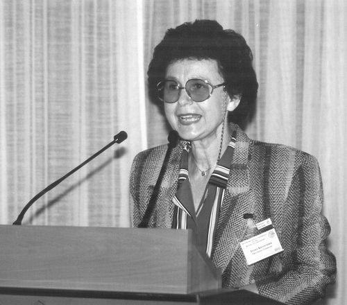
Ingrid Kretchmer at the 16th International Conference on the History of Cartography, Vienna, 1995, of which she was one of the main organizers.
For more than three decades, Ingrid Kretschmer played an important role in the Austrian Geographical Society (Österreichische Geographische Gesellschaft, originally Geographische Gesellschaft in Wien), one of the oldest geographical societies worldwide. Between 1975 and 1994, for a total of ten years, she was this society's secretary general; from 1997 until 2004 she was its president, the first woman to hold this position. The culmination of her many years of dedicated activity was the celebration of the Austrian Geographical Society's 150th anniversary in 2006, which she organized in her capacity as the Society's acting vice president and for which she published a voluminous festschrift: Österreich in der Welt, die Welt in Österreich. Chronik der Österreichischen Geographischen Gesellschaft—150 Jahre (1856–2006) [Austria in the World, the World in Austria. Chronicle of the Austrian Geographical Society—150 Years (1856–2006)].
Cartography decidedly was the major source of fulfilment in Ingrid Kretschmer's life: on the one hand, as an excellent teacher training her students, and, on the other hand, conducting research. Self-confident and with a sharply critical mind, she judged collaborators and colleagues in her field by her own highly exacting scholarly standards.
Johannes Dörflinger
University of Vienna
Select Bibliography of Writings in the History of Cartography
A full bibliography representing the range of Ingrid Kretchmer's interests and from which this selection has been taken, was kindly supplied by the Department of Geography and Regional Research, University of Vienna.
Die thematische Karte als wissenschaftliche Aussageform der Volkskunde (Bad Godesberg: Bundesanstalt für Landeskunde und Raumordnung, 1965).
‘Hundert Jahre metrisches Maßsystem in Österreich’, Mitteilungen der Österreichischen Geographischen Gesellschaft 115 (1973): 113–29.
‘Die Entwicklung der österreichischen Katastralmappen und ihre Bedeutung für die Geographie’, Mitteilungen der Österreichischen Geographischen Gesellschaft 116 (1974): 206–18.
(ed. with Erik Arnberger), Wesen und Aufgaben der Kartographie, Topographische Karten, 2 vols. (Wien: Franz Deuticke, 1975).
‘Der Einfluß Carl Ritters auf die Atlaskartographie des 19. Jahrhunderts’, in Carl Ritter—Geltung und Deutung, ed. Karl Lenz (Berlin: Dietrich Reimer, 1981), 165–89.
‘Leonhard Eulers Beitrag zur Kartographie’, in Kartographiehistorisches Colloquium, Lüneburg ‘84. Vorträge, ed. Wolfgang Scharfe and Eckhard Jäger (Berlin: Dietrich Reimer, 1985), 29–38.
(ed. with Johannes Dörflinger and Franz Wawrik), Lexikon zur Geschichte der Kartographie, 2 vols. (Wien: Franz Deuticke, 1986).
‘Kartographiegeschichte als wissenschaftliche Teildisziplin’, in Kartographiehistorisches Colloquium, Wien ‘86. Vorträge und Berichte, ed. Wolfgang Scharfe, Ingrid Kretschmer and Franz Wawrik (Berlin: Dietrich Reimer, 1987), 1–10.
‘The first and second Austrian school of layered relief maps in the nineteenth and early twentieth centuries’, Imago Mundi 40 (1988): 9–14.
‘Die kartographischen Ergebnisse der Teleki-Höhnel-Entdeckungsreise 1887–1888’, Mitteilungen der Österreichischen Geographischen Gesellschaft 130 (1988): 39–67.
‘Österreichs Beitrag zur kartographischen Erschließung Ostafrikas bis zum Ersten Weltkrieg’, in Abenteuer Ostafrika. Der Anteil Österreich-Ungarns an der Erforschung Ostafrikas (Eisenstadt: Amt der Burgenländischen Landesregierung, 1988), 129–60.
‘Thematische Kartographie in Österreich 1815–1918: Allgemeines’; ‘Gebrauchskarten für den Verkehr’; ‘Thematische Karten im engeren Sinn: Bevölkerungs-, Wirtschafts-, Handelskarten u. a’, in Austria Picta: Österreich auf alten Karten und Ansichten, ed. Franz Wawrik and Elisabeth Zeilinger (Graz: Akademische Druck- und Verlagsanstalt, 1989), 156–59, 169–72, 173–78.
‘Österreichische kartographische Leistungen in Ostafrika’, in 4. Kartographiehistorisches Colloquium Karlsruhe 1988. Vorträge und Berichte, ed. Wolfgang Scharfe, Heinz Musall and Joachim Neumann (Berlin: Dietrich Reimer, 1990), 11–20.
‘Die Rolle Österreichs bei der kartographischen Erschließung Mitteleuropas’, Mitteilungen der Österreichischen Geographischen Gesellschaft 132 (1990): 172–91.
‘Frühe österreichische Beiträge zur Methodenlehre der thematischen Kartographie’, in 5. Kartographiehistorisches Colloquium Oldenburg 1990. Vorträge und Berichte, ed. Wolfgang Scharfe and Hans Harms (Berlin: Dietrich Reimer, 1991), 101–10.
‘The mapping of Austria in the twentieth century’, Imago Mundi 43 (1991): 9–20.
‘Kartographische Erschließung und geographische Erforschung Amerikas durch Österreicher im 20. Jahrhundert’, in Die Neue Welt. Österreich und die Erforschung Amerikas, ed. Franz Wawrik et al. (Wien: Edition Brandstätter, 1992), 155–61, 202–8.
‘Österreich und die Erforschung Amerikas’, in Beziehungen zwischen Orient und Okzident, ed. Manfred Büttner and Wilhelm Leitner (Bochum: Brockmeyer, 1992), 1: 419–30.
‘Mercators Bedeutung in der Projektionslehre (Mercatorprojektion)’, in Mercator und Wandlungen der Wissenschaften im 16. und 17. Jahrhundert, ed. Manfred Büttner and René Dirven (Bochum: Brockmeyer, 1993), 151–74.
‘Österreichische kartographische Pionierleistungen in den tropischen Anden’, in Österreich und die Neue Welt, ed. Elisabeth Zeilinger (Wien: Österreichische Nationalbibliothek, 1993), 170–84.
‘Die Eigenschaften der “Mercatorprojektion” und ihre heutige Anwendung’, in Mercator—ein Wegbereiter neuzeitlichen Denkens, ed. Irmgard Hantsche (Bochum: Brockmeyer, 1994), 141–69.
‘Die erste geologische Karte von Südamerika’, in 6. Kartographiehistorisches Colloquium Berlin 1992. Vorträge und Berichte, ed. Wolfgang Scharfe(Berlin: Dietrich Reimer, 1994), 37–44.
(with Christa Binder), ‘La projection Mercatorienne’, in Gérard Mercator, cosmographe: Le temps et l‘éspace, ed. Marcel Watelet (Antwerp: Fonds Mercator Paribas, 1994), 193–207.
(ed. with Johannes Dörflinger), Atlantes Austriaci: Österreichische Atlanten 1561–1994, 3 vols. (Wien, Köln, Weimar: Böhlau, 1995).
Atlantes Austriaci: Österreichische Atlanten 1919–1994 (Wien, Köln, Weimar: Böhlau, 1995).
‘Zur Entwicklung thematischer Atlanten im 19. und 20. Jahrhundert’, in Vierhundert Jahre Mercator, Vierhundert Jahre Atlas, ed. Hans Wolff (Weißenhorn: Anton H. Konrad, 1995), 231–63.
‘Kartenprojektionen in Gerhard Mercators Atlas’, in Gerhard Mercator und die geistigen Strömungen des 16. und 17. Jahrhunderts, ed. Hans-Heinrich Blotevogel and Rienk Vermij (Bochum: Brockmeyer, 1995), 68–85.
‘Arbeits-, Forschungs- und Projektbereich “Kartographiegeschichte”’, in Kartographie in Österreich ‘96, ed. Ingrid Kretschmer and Karel Kriz (Wien: Institut für Geographie und Regionalforschung der Universität Wien, 1996), 153–64.
‘Kartographische Arbeiten Friedrich Simonys’, Geographischer Jahresbericht aus Österreich 53 (1996): 43–61.
‘The development of Austrian cartography. Cartographic representation of Austrian territories’, in La cartografia dels països de parla Alemanya—Alemanya, Àustria i Suïssa (Barcelona: Institut Cartogràfic de Catalunya, 1997), 119–75.
‘Naturnahe Farben kontra Farbhypsometrie’, Cartographica Helvetica 21 (2000): 39–48.
‘Frühe Alpenpanoramen im Dienst der Wissenschaft. Zum 100. Todestag von Friedrich Simony (1815–1896), erster Ordinarius für Geographie an der Universität Wien’, in 8. Kartographiehistorisches Colloquium Bern, 3.–5. Oktober 1996. Vorträge und Berichte, ed. Wolfgang Scharfe (Murten: Verlag Cartographica Helvetica, 2000), 85–93.
‘Globenforschung in Österreich’, in Virtuelle Globen in der Geovisualisierung, ed. Andreas Riedl (Wien: Institut für Geographie und Regionalforschung der Universität Wien, 2000), 141–55.
‘Carl Sonklars “Atlas” der Ötztaler Gebirgsgruppe—ein früher Gletscheratlas der Ostalpen’, Cartographica Helvetica 25 (2002): 11–20.
‘200 Jahre Steindruck (1797/98–1998). Zur Kenntnis der frühen Wiener Zeit’, in 9. Kartographiehistorisches Colloquium Rostock, 30. September–2. Oktober 1998. Vorträge, Berichte, Posterbeiträge, ed. Wolfgang Scharfe (Bonn: Kirschbaum Verlag, 2002), 117–30.
‘Österreichische Expeditionskartographie in Südamerika’, Cartographica Helvetica 28 (2003): 13–23.
‘Friedrich Simony. Erforscher des Karls-Eisfeldes, Dachstein (Oberösterreich)’, in Das Karls-Eisfeld. Forschungsarbeiten am Hallstätter Gletscher, ed. Kurt Brunner (München: Deutscher Alpenverein, 2004), 31–73.
‘Der Ortler—frühe Lage- und Höhenangaben durch österreichische Aufnahmen’, Mitteilungen der Österreichischen Geographischen Gesellschaft 146 (2004): 323–44.
(with Johannes Dörflinger and Franz Wawrik), Österreichische Kartographie: Von den Anfängen im 15. Jahrhundert bis zum 21. Jahrhundert (Wien: Institut für Geographie und Regionalforschung der Universität Wien, 2004).
(ed. with Gerhard Fasching), Österreich in der Welt, die Welt in Österreich. Chronik der Österreichischen Geographischen Gesellschaft—150 Jahre (1856–2006) (Wien: Österreichische Geographische Gesellschaft, 2006).
(with Lukas Birsak), ‘Der Kozenn-Atlas: Ein österreichischer Schulatlas schreibt Kartographiegeschichte’, Mitteilungen der Österreichischen Geographischen Gesellschaft 149 (2007): 253–84.
(with Moshe Brawer), ‘Der Kozenn-Atlas im Nahen Osten: Die hebräischen und arabischen Ausgaben für den Staat Israel’, Mitteilungen der Österreichischen Geographischen Gesellschaft 150 (2008): 317–38.
‘Avstrijski šolski atlasi od 1791 do 1860 in prva izdaja Kocenovega Atlasa 1861’, in Blaž Kocen 1821–1871: življenje in delo očeta Kocenovih atlasov, ed. Jurij Kunaver (Ljubljana: Slovenska Matica, 2009), 52–62.