Founded in 1873, the Royal Dutch Geographical Society (in Dutch: Koninklijk Nederlands Aardrijkskundig Genootschap, KNAG), has important collections of maps, atlases, and other materials on loan to the University of Amsterdam Library since 1880 and now housed within the special collections in the Allard Pierson research institute and museum. Inspired by the KNAG's 150th jubilee, the Allard Pierson staff hosted an exhibition in 2023, 'Maps Unfolded,' that showcased the collections in dialogue with additional materials. In the exhibition rooms, ‘Reflections on Maps Unfolded’, a parallel presentation, highlighted twentieth-century artists who, inspired by maps, incorporated cartographic elements into their works. Additionally, with the support and sponsorship of the Amsterdam GPS-multinational company TomTom, the exhibition offered a room introducing visitors to contemporary mapmaking technologies and a visual presentation of the map of the future.
From the very start, curators aspired to present a general overview of cartographic material to the public. The focus was neither the KNAG's history nor maps and atlases from a particular period, region or maker. Rather, Allard Pierson wanted to attract a broad audience to make people aware of the inexhaustible and typical expressiveness of maps by presenting a wide range of atlases and cartographic material. To that end, as the accompanying photo essay shows, they selected objects to show maps of an impressive variety in colour, size, genre, and age, that touched on topics from colonial relationships to Dutch interaction with water and changing borders.
To address these goals, Allard Pierson chose a straightforward, two-part exhibition structure. In the first part, the idea was to ‘zoom out’ from the local to the global. Visitors to ‘Maps Unfolded,’ it goes without saying, were in Amsterdam. So the first exhibition room was dedicated to maps of the city, followed by three rooms with maps of increasingly small scale: first the Netherlands, then Europe, and finally the World. In the second part, the exhibit took a thematic approach. Two large rooms were dedicated to former colonies in Indonesia, Suriname and the Antilles. This last choice also showcased materials in the KNAG collection. Throughout the exhibit, single and multi-sheet coloured maps drew eyes to the walls from ground level to above visitors' heads, and vitrines and touchtables encouraged readers to look down. Magnifying glasses in some rooms helped people of all ages to 'zoom in' on the details of physical maps while wall-mounted monitors allowed visitors to learn from experts.
Fig. 1. Introduction: ‘Open kaart / Maps Unfolded’ opened with an overview and introduction and provided background on the KNAG collection at the Allard Pierson. It also showcased a large map-inspired work of analog art by Gert-Jan Kocken (1971) which projects maps of Amsterdam from the World War II era in layers, evoking a sinister piece of history. This first room made it clear that maps can seem neutral or factual, despite being anything but. All photographs: (c) Reinder Storm.
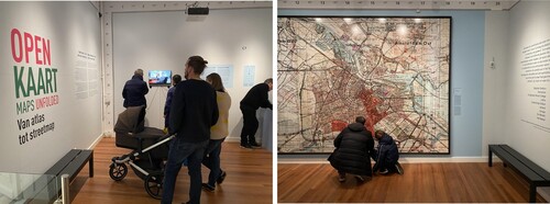
Fig. 2. Amsterdam: The first room invited visitors to think about both their own and the exhibition’s location, the city of Amsterdam. Several attractive maps demonstrated the growth of the city in phases. Visitors were drawn to maps of objects that were designed but never realised, particularly Jan Galman's 1857 plan projecting the Bridge over the IJ River and the newly acquired 1625 Balthasar Florisz Amsterdam wall map.
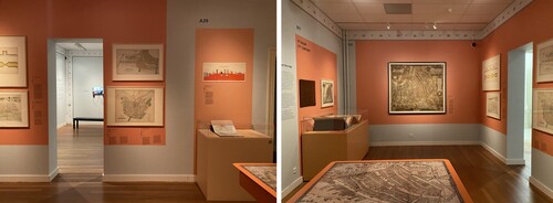
Fig. 3. The Netherlands: Maps in this room addressed the developments of cartographic contours of the country and documented the country's eternal struggle with water. Visitors were both surprised when encountering unfamiliar material and expressed recognition and amazement at the same time about the topicality and continuity of issues including the environment and climate change.
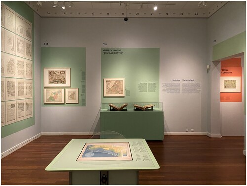
Fig. 4. Europe: The Europe rooms were dedicated to 'interaction with neighbours', which was expressed through two important themes: war and peace. A wall with satirical or cartoon maps was a crowd pleaser, judging by the time people took to view them. Less known cartography from the early days of the European Union was also appreciated.
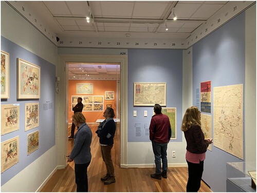
Fig. 5. The World: The oldest item in the exhibition was an atlas from 1490, which drew in the public with the Blaeu atlas cabinet, as well as Nicolaes Maes' 1657 painting, The Eavesdropper, featuring an imaginary wall map in the background, on loan from the Dordrechts Museum. The maps of continents also attracted a lot of attention: the 'empty' continent of Africa (a map from 1819) in particular appealed to the imagination. Visitors could browse through the online features of the most recent ‘Bosatlas’ (2021), the 56th paper and first hybrid edition of a popular school atlas first published in 1877, on a touch table.
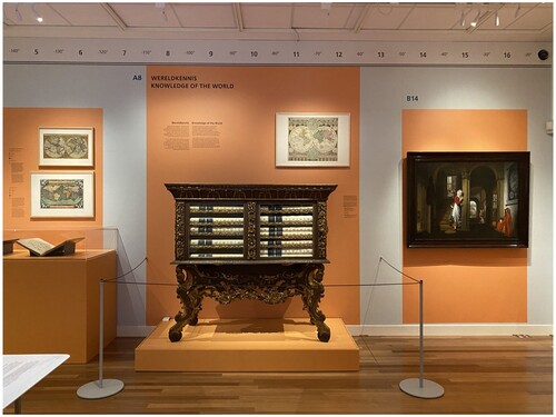
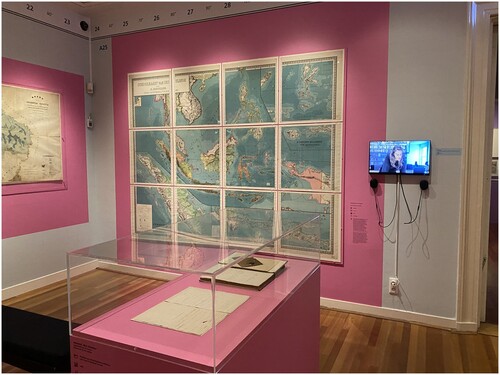
Fig. 6. Indonesia: The largest room in the exhibition was dedicated to the former Dutch colony in Southeast Asia, in part due to the strengths of the KNAG collection in this region. Visitors could move their gaze between the original manuscript of an important book by Eduard Douwes Dekker ('Multatuli') about the misbehavior of the Dutch in the colony, Max Havelaar (1860, English 1868) and a wall-mounted 12-leaf school wall map of ‘Insulinde,’ as Multatuli called the archipelago.
Figs. 7 and 8. The Dutch Antilles & Suriname: The last two rooms of ‘Maps unfolded’ concerned the (former) overseas West Indies territories, which discussed plantation culture and its excesses through detailed maps. Contradictorily, maps that represent a gruesome reality can be beautiful objects. For example, a poster advertising a 1770 auction of a plantation in Suriname, complete with buildings, land and enslaved people, that was held in Amsterdam, literally around the corner from the exhibition premises, was a silent witness that powerfully captured the dissonance and viewers' imagination.
In the last room the large 1737 multi-leaf map of Suriname by Alexander de Lavaux offered many starting points for reflection on the theme of the exhibition: current history based on historical documents, experience of culture and inspiration for a new perception of long-standing issues. Visitors could view the map with a work of art by the Surinamese artist Remy Jungerman inspired by it, bringing them into a contemporary and personal version of this story.
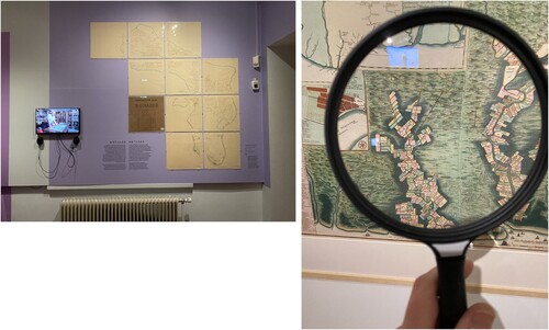
Fig. 9. The Geo Zone: This room highlights the cartographic collections at the Allard Pierson. For the exhibition, the Allard Pierson staff developed an interactive and modern cartographic presentation, in cooperation with Noordhoff, the publisher of the ‘Bosatlas.'
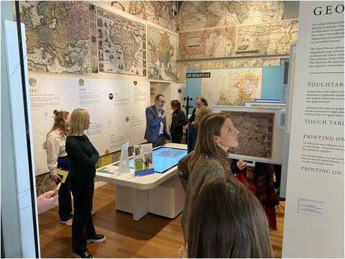
Fig. 10. Map of the future: Building on long-standing connections between the Amsterdam multinational TomTom and Allard Pierson, TomTom created a video in which experts discussed the latest developments in GPS/GIS and addressed new solutions for geographical and cartographical challenges, such as What3words, a geocoding system aspiring to provide 'the simplest way to talk about location.' This video alternated with a short film introducing Amsterdam's prolific cartographic history, with attention to the flourishing of mapmaking in the seventeenth century.
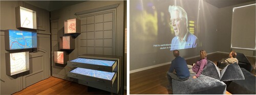
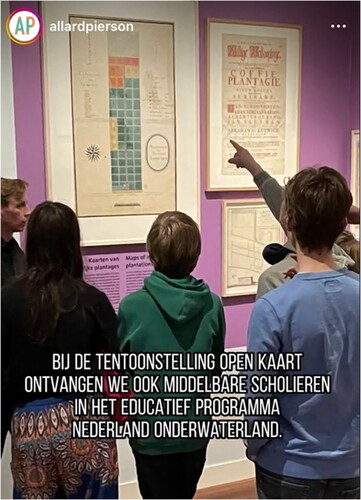
Fig. 11. Education: Curators developed lessons and tours for children and elementary school, high school, and university students.