Abstract
This paper uses primary and secondary data sources to discuss changes in the management of the Lake Chilwa floodplain, Malawi, a wetland that is an important source of livelihood for over a million people who subsist on agriculture, fishing and birds. These common pool resources are under pressure, largely due to the economic value of the wetland and weaknesses in management. Colonial development split up this complex ecosystem into departmental districts and sections, making it hard to manage. Although the area is a Ramsar site, changes in economic interests combined with larger-scale economic developments have negatively affected the status of these resources, putting pressure on them and causing conflicts. The paper addresses the questions of entitlement to the use of interrelated common pool resources and power relations among local leaders, local people and immigrants to the area.
1. INTRODUCTION
The Lake Chilwa floodplain is one the most important wetlands in Malawi, boasting a diversity of natural resources that are now under imminent threat of degradation because of increased pressure from excessive use by humans. This paper discusses the management of the area's common pool resources: land, water, fisheries and wildlife (birds). It shows how economic transformation, power relations and changes in knowledge have transformed the use of these four interrelated resources. The argument is that the crisis happening in the wetland originates from interrelated institutional weaknesses dating from colonial times, when the management of these common pool resources was split into departmental districts and sections, rather than being maintained as an interconnected ecosystem.
The problem of overuse of common pool resources does not seem to have been pressing in colonial and early post-colonial times. However, since the 1980s the area has become a target for immigrants from many other places in Malawi because of its rich resources and the ease of gaining access to them in the absence of proper regulation. The area has a very high population compared with the national Malawi average of 104 – just over 1 million, with a density of 162 persons per km2 (Malawi Vulnerability Assessment Committee, Citation2005; Bhima, Citation2006). The pressure comes not only from the local population growth but also from immigration, which is related to the high value of fish, land suitable for irrigation in the wetland, and bird meat (Peters, Citation2004). A number of authors write of high pressure on the resources discussed in this paper. For instance, of the 1.5 million partly migratory birds in the area, 1.2 million are harvested each year, and formal as well as informal irrigation has increased twofold in the past decade, reaching up to 136 000 ha (Government of Malawi, Citation2000; Peters, Citation2004). Fisheries too are under intense pressure, although it is argued that good catches do not really depend on fishing effort but on re-flooding. Nevertheless, catches seem to fluctuate between 20 000 and 40 000 tonnes, and the number of vessels increased by 20 per cent between 1990 and 2000 (Allison et al., Citation2002).
The Chilwa floodplain is in an area that is an interconnected mountain, river and lake ecosystem whose management has been segmented into departments and falls within three administrative districts. This has led to partial loss of the traditional management knowledge, and the area now harbours a legal pluralism, creating open access and informal privatisation constellations for irrigated land, water, fisheries and wildlife (birds).Footnote1 This floodplain is in the northern part of the basin, an open grassland seasonally flooded by rivers that feed into the lake. It is home to a variety of fish species (providing a habitat in which they can breed and hide) and a large bird population. The land is fertile and has abundant water for irrigation. This fertile land is estimated to be between 500 000 and 750 000 km2 (Peters, Citation2004; Kambewa, Citation2005). The potential of the Lake Chilwa area, especially of its floodplain wetland, can best be deduced from the fact that it was declared a Ramsar site in 1997 and a management plan was formulated in 2001 (see Maloya, Citation2001).
We characterise the resources in the floodplain wetland as being common pool resources, which are by definition difficult (but not impossible) to exclude users from and that are subtractable, meaning that the units used are no longer accessible for use by someone else within one season (Becker & Ostrom, Citation1995; McKean, Citation2000; Haller, Citation2007). Even if irrigated land is so far not a common pool resource, since exclusion is possible, as long as it depends on water from either floods or irrigation it becomes related to a common pool resource for its basic characteristic.
Common pool resources, which in the case of the Chilwa floodplain are connected with the lake and interconnected within one ecosystem, can be managed in separate regimes by specific institutions, an act that can be characterised as human intervention. Most of these resources were not managed as open access in the past but as communal property. Access was regulated by membership of a group and by rules and regulations with regard to specific use of the resource – techniques, timing and so on. During the colonial and post-colonial eras, state property and management of these resources was subject to state regulations. One of the major drawbacks of state management is that it erodes or changes local common property institutions and, if the state lacks financial means to enforce its rules and regulations, resources become de facto open access or they may be privatised for short-term gains for powerful users. Often this threatens the sustainable use of resources, as can be seen from the situation in other floodplain areas (Haller, Citation2009).
The problem of open access at the floodplain wetland under discussion began with the opening up of common pool resource areas through the colonial government, and later through the Malawi government, that lacked adequate institutions and coordinated management for the governance of a complex ecosystem. Up to the mid-1980s this was not as pressing a problem as it is today, since the pressure on the resources and the off-take were relatively low. However, with the increase in pressure this weakness has become problematic, since increased pressure requires coordinated management at different levels (Allison et al., Citation2002; Peters, Citation2004; Kambewa, Citation2005). Two aspects are of importance with regard to the decreasing sustainability of the resource base. First, the introduction of large-scale irrigation projects made the area commercially valuable, attracting more resource users from other parts of Malawi. Second, the growing value of the common pool resources in the area, coupled with resource degradation elsewhere in the country (fisheries, wildlife and land) and a fall in tobacco and coffee prices on the world market, also contributed to the push and pull factors: people were pushed out of formal employment because of the economic crisis and were pulled by the commercial opportunities the Chilwa area offered. As access to wildlife and fisheries was de facto unregulated and access to land was easily obtained, population build-up in the wetland was inevitable. This paper outlines these developments and argues that this problem of poor state management can be traced back to the colonial times, which brought not only economic and political but also institutional changes, meaning changes in the rules and regulations for using and managing the Lake Chilwa and Chilwa floodplain areas.
The paper also argues that the erosion of old management structures and the building up of a state management structure with centralised management schemes persisted even during the economic crisis facing Malawi since the early 1990s (as well as in other African countries) because this served powerful interests at all levels. Maintaining ineffective centralised structures until the 1990s helped maintain the economic interests of these actors and, on the lower level, the absence of the state helped the more powerful outsiders and local leaders to get the lion's share. However, from the 1990s the pressure started to build and outside conservation interests became manifest. Decentralised structures and co-management schemes became popular. The paper also analyses the various trends in Malawi since colonial times, arguing that the reason for the lack of effective change is the failure to see the Chilwa area as an interconnected ecosystem, the lack of vertically integrated institutional settings, and the failure to understand the local level politics that are important for successful decentralisation schemes, especially when involving local authorities. The pressure on this area is likely to continue, given its high economic value. It is estimated that the economic value of the wetland is US$21 056 392 per year. The biggest contributor to this figure is fishing, which contributes an estimated US$18 million, followed by agriculture at about US$1.5 million (Schuijt & Brander, Citation2004).
2. METHODS AND SOURCES
This paper is based on studies carried out around the Lake Chilwa area from 1966. The four major studies used in this analysis are the Lake Chilwa studies of change in a tropical ecosystem performed from 1966–1979, the State of the Environment studies performed for the Lake Chilwa Wetland and Catchment Management Project from 1996–1999, the Broadening Access and Strengthening Input Market Survey Project (2004), and the PhD research by Friday Njaya (Citation2009). The authors also consulted historical literature that offered ethnographic information such as the economic, social, political and religious structures of the inhabitants of the wetlands in question. As the literature could not answer all their questions, the authors carried out a small investigation involving a total of 10 in-depth interviews with well-established citizens in the wetland area who were knowledgeable about each of the four resources covered by the study, so as to fill the gaps in the data.
3. ENVIRONMENTAL SETTING AND POPULATION
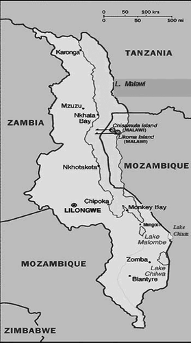
The Chilwa floodplain is in the southern part of Malawi and shares its eastern borders with Mozambique (see ). It is located to the north of the Phalombe plain between the Zomba Plateau and Mount Mulanje. The lake is at an altitude of 627 m above sea level. The wetland covers a fluctuating area of 1500−2400 km2. In ‘normal’ years, the water can cover about 1500 km2, about one-third of this being swamp and marshes. Plant biomass production of as much as 20−30 tonnes per hectare per year has been recorded from the predominant lake habitat of Typha and Phragmites reeds (Bhima, Citation2006).
Figure 1: Map of Malawi showing the location of Lake Chilwa
3.1 Irrigation water and land
These two common pool resources are largely interdependent. Wetland areas are mostly inundated for rice production, but gardens rely on irrigation from the main rivers and tributaries that also carry fertile alluvial soil to the more sandy unproductive soils downstream. Owing to floods, good land also becomes unstable unless farmers put a good deal of effort into maintaining irrigation channels. We focus especially on what are called ‘wetland gardens’, and the specific local management regimes they are subject to and how these regimes have changed (Peters, Citation2004).
3.2 Fisheries
There are 14 species of fish, of which the most important ones are mlamba (Clarias mossambicus), matemba (Barbus paludinosus) and makumba (Oreochromis shirana and Orechromis chilwae). The valuable Oreochromis and other species are found not only in the open water but in the wetland as well, especially during low flood levels. Fish breed in rivers, tributaries, wetland and open water (Government of Malawi, Citation2001).
3.3 Wildlife
Lake Chilwa wetland is an important breeding, resting and feeding habitat for large numbers of water birds of the West Asian−East African flyway. About 160 species have been recorded at the lake, including 41 migratory species. On the basis of counts in 2000, it was estimated that the wetland supports around 1.5 million resident and migratory water birds (Bhima, Citation2006). Duck species are especially important for commercial reasons (Schulten, Citation1970; Wilson, Citation1999; Bhima, Citation2006).
3.4 Ecosystem features
One of the major features of the area is the link between highlands, sandy and silty depressions and the lake itself, which has no outlet. This has the effect of flooding the low-lying northern and western areas, because the water that flows in here is pushed back. These floodplain areas are therefore a lot marshier than the southern and eastern areas. The adjacent lake provides 20 per cent of the fish caught in Malawi, harbours most of the water birds in Malawi and is the source of 50 per cent of Malawi's rice production in informal gardens and formal irrigation systems (Maloya, Citation2001; Peters, Citation2004; Kambewa, Citation2005; Bhima, Citation2006). The main ethnic groups are the indigenous Nyanja and the Yao who migrated into the area later, and there are other smaller ethnic groups, such as the Lomwes and the Senas. Most of these local groups use the wetland mainly for small-scale farming and fishing.
4. PRE-COLONIAL HISTORY AND ETHNOGRAPHY
Anthropological and historical studies (Mitchell, Citation1956; Pachai, Citation1973, Citation1979; Agnew, Citation1979; Phiri, Citation2004) show that Lake Chilwa and its plains were one of the main crossroads of Central Africa until the end of the nineteenth century. Pachai Citation(1979) reported that the history of the local Nyanja and the Yao had been influenced by immigration and the slave trade. The Nyanja, who were probably the original inhabitants of the area, are the predominant tribe around the lake and have permanent villages on Chilwa Island as well. The Yao originally came from today's Mozambique and are scattered over the whole region. They immigrated into the area as refugee settlers but had a firm foundation in coastal trade for hundreds of years. Ivory and slavery were the mainstay of their trade, and their chief customers were the Portuguese and the Arabs (Pachai, Citation1979). They established their position by taking advantage of internal struggles among the Nyanja and using superior weapons (guns) acquired through contact with Arabs. By the time the British missionaries arrived (led by David Livingstone), Yao power was already firmly established. Even though they had a matrilineal kinship system, most of the Yao leaders turned to and adopted Islam as a result of contact and trade relations with Arabs on the East coast of Mozambique. The Yao were thus embedded in a complicated trade system that complemented farming and fishing in the wetland (Agnew, Citation1972; Alpers, Citation1972).
The inhabitants of the Chilwa wetland were organised into chiefdoms, which were loose entities with a group of fairly independent headmen. One of the local headmen was often more powerful and was called the chief in European literature. He was important for arbitrating conflicts among his group of followers. Chiefdoms were distinct territorial units and all the villages within the area recognised the authority of the chief. The area under study contains the chiefdoms of Kawinga, Malemia and Mposa. While Kawinga is Islamic due to contact with Arabs, people in Malemia and Mposa are mostly Christian. Despite the influence of Islam and Christianity, however, ancestral cults and a matrilineal kinship structure that used to regulate access to resources through the female line in the past was still of major importance to the Yao and the Nyanja in the 1950s (Mitchell, Citation1956).
5. PRE-COLONIAL INSTITUTIONAL ARRANGEMENTS (BEFORE 1891)
The basic common pool resource management system was located at the level of villages and chiefdoms. In their political system, the Yao leaders tried to build some form of empire. To this effect, they engaged in slave trading and kept as many slaves as possible. They also increased the number of people under their control by giving men who had married into their village through the matrilineal system access to resources. They also increased their numbers by keeping their male children in their villages instead of allowing them to settle in villages where they had married as per custom. The end result was that the population in the wetland began to swell. Access to resources was also used as a tool by chiefs to attract people to join their chiefdom. Chiefdoms and villages had boundaries, and in order to get access to these resources one needed to be a member or be invited to use resources within the limits of the territory belonging to a chief or a headman. Access to land and water resources, for example, was given to outsiders by marriage as they were moving to the place of the wife (Mitchell, Citation1956). Further to this, people who had immigrated into the area and were not related to the chief paid a small amount locally called chothokoza (literally meaning ‘thanks’) to the leaders, usually a small portion of the yield, to thank them for allocating them floodplain gardens to cultivate (Peters, Citation2004; Kambewa, Citation2005).
Fishing was also linked to the control of territories of chiefdoms and villages. For members of the village, access was not regulated within a territory where people used traps and nets (Kayambazinthu & Chabwera, Citation1999). In terms of ownership, Kayambazinthu and Chabwera indicate that each community claims access to the beaches closest to them and membership of the community was important in order to get access. The floodplain wetlands, however, especially on the Kachulu side, had regulations that controlled fishing activities. There were certain seasons when fishing was prohibited until certain rituals to the ancestors were performed. Village members were allowed to fish using fish traps and hooks and line, but not to use poisonous herbs (Binauli & Chipeta, Citation1999). These local institutions were monitored and sanctioned by the leaders. In cases of violations, they had their traditional courts and also specific mystical powers to prevent misuse, by threatening attacks by ancestral spirits and witchcraft. Despite most Yao being Islamic, these religious systems often remained in place. Almost no indigenous conservation practices are known in relation to birds on the wetlands. Birds were seen as a mobile resource not to be managed (Wilson, Citation1999).
6. COLONIAL INSTITUTIONAL ARRANGEMENTS (1891–1964)
During the scramble for Africa the Portuguese were the first to show interest in the area, but instead it was the British who colonised the area as part of the Nyasaland Protectorate proclaimed in 1891. The colonial administration put an end to slavery and slave trading by progressively disarming the Yao, mainly using superior force. Yao leaders hence came under the control of the British colonial administration. In 1893 money was introduced as a medium of exchange and the economy of the area quickly changed from barter for slaves, ivory, and so on to exchange for economic goods, leading to the monetisation of the local economy (Mitchell, Citation1956). The British ordinance set up the power for the local headman and for the chiefs over all other subjects. The Native Authority Ordinance was passed in 1933. This gave powers to local chiefs to collect taxes in their areas on behalf of the colonial government (Mitchell, Citation1956). In addition, the chiefs were given powers to allocate land and control the use of resources by their people and immigrants. Access to land and other resources could also be obtained through inheritance and marriage (Peters, Citation2004; Kambewa, Citation2005).
The colonial administration had several interests in the area. Lake Chilwa was declared a game reserve in the late 1890s, and by 1911 the hunting of big game (elephant, rhinoceros and wildebeest) was allowed only by licence (Peters, Citation2004). The area also attracted the interest of settlers who wanted it for cultivation. They were given the best land for estate establishments around the town of Zomba. This meant that people from elsewhere in the country came to work in the estates. Agricultural use of the areas along the rivers and in the floodplain increased, as did livestock grazing, hunting and fishing (Peters, Citation2004). This was the beginning of the pressure on the area, as the floodplain and the lake area became of interest to the colonialist in order to meet the nutritional needs of a growing urban centre and the surrounding plantations (Mitchell, Citation1956). However, this pressure was nowhere near as heavy as that of recent years, especially from the 1980s onwards.
During colonial times the authority for managing common pool resources was assigned to various government departments (wildlife, agriculture, fisheries and water). Although the colonial administrations put in place regulations that forbade the use of wetlands and stream-banks, these were never operational since people continued to use the wetland as they had done before. Even for the colonial administration itself, the wetland became valuable for large-scale irrigation beginning in the 1950s (Peters, Citation2004).
7. POST-INDEPENDENCE INSTITUTIONAL ARRANGEMENTS (1964−TODAY)
7.1 Background information on changes in resource management
Even after Nyasaland became the independent state of Malawi in 1964, the basic colonial administrative structure that had been inherited remained. The area of Lake Chilwa still fell under the administration of three Districts (all with very poor infrastructure) and its management conservation was still sectorally based in various government departments. Despite its nearness to Zomba, the capital of Malawi after independence, for most of the 1960s and early 1970s the lake basin lay outside the main sectors of development and was not easily accessible. At that time there were only two roads providing access to the area, which enabled some tracks to approach the fishing beaches to the south of Phalombe River. A few public utilities were established in the plain. The area started opening up, however, with the introduction of rice irrigation schemes and the construction of a rail line to the Indian Ocean on the northwest side of the wetland. Passing between Lakes Chilwa and Chiuta, the railway was very close and influenced the lives of the people in all the areas (Pachai, Citation1979). These developments and the increase in the value of rice made the Chilwa wetland more and more attractive, especially for cultivation (in the form of large-scale irrigation projects).
The value of resources in the area, particularly land and water for agriculture, increased considerably between the 1970s and 1990s. To meet the increasing interest, irrigation schemes, particularly for rice production, were established in the 1970s. Up to that point, pressure for land in this area was less pertinent (Agnew, Citation1979). This was in sharp contrast to the land pressures that Malawians experienced in the surrounding area and in the Shire Highlands in particular, where white settlers aggressively acquired land for tea and tobacco production. In the early 1970s the Malawi government also saw the potential of the Lake Chilwa basin in terms of development, and four rice schemes were established as part of the national irrigation schemes programme. This affected central areas of the wetland where, in cooperation with Taiwan, modern rice schemes with high yielding varieties were introduced. According to Chilivumbo Citation(1970), when the rice schemes started the people who took up the challenge first were fishermen and a political movement belonging to the ruling party, the Malawi Congress Party Young Pioneers, whose members came from all over the country to work on the schemes. Later, when the movement was disbanded, most of these people did not move back to their home areas but settled in the area, adding to the pressure on land. It did not take long for the demand for irrigation plots to increase.
Like many other African countries, Malawi experienced a major economic crisis in the 1980s (Burritt, Citation2006; Chirwa, Citation2008). The country was importing more than it was exporting. This led to huge debt, and the country was forced to adapt the International Monetary Fund and World Bank funded Structural Adjustment Programme. Part of the crisis stemmed from declining prices for tobacco, tea and coffee, which had been the main sources of foreign income for the country. The resulting financial constraints had an impact on the level of government services. An increasing number of people who had lost jobs in the formal economy as a result of the economic downturn had to try to earn a living from common pool resources such as fishing, hunting and cultivation of wetlands (Department for International Development, Citation1998; United Nations Systems in Malawi, Citation2001; Peters, Citation2004; Chirwa, Citation2008). As the pressure on the floodplain wetlands increased, the management of land and water, birds and fisheries became an increasing problem.
By the second half of the 1990s, off-take of birds and fish and the use of dambo farmingFootnote2 had increased dramatically, raising concerns from the government and conservation non-governmental organisations (the International Union for the Conservation of Nature, the WorldFish Centre and others). They documented a phenomenal increase in the use of common pool resources, a factor that could lead to serious resource and management problems if regulations were not installed and successfully implemented. The Lake Chilwa Wetland and Catchment Management Project was thus established in order to highlight the need for a management plan that would involve local actors and also address the problem of the lack of coordination between the various resource use sectors and systems of management of the ecosystem as an integrated resource.
Since independence, common pool resource management has gone through a number of phases. During the one-party era (1964–1994) regulations were highly centralised. Prior to 1994, policy-making and regulation followed very much the traditional linear pattern of decision making; that is, top-down (Allison et al., Citation2002). Considerable policy space has opened up to various actors and interests – the media, political parties, civil society, parliament, donors – since the introduction of multi-part politics. Policy spaces have potentially extended to the grassroots through the decentralised system of governance. Until recently, policy processes have generally been chaotic, unsystematic and strongly driven by neopatrimonial or informal considerations (patronage driving policies instead of policies driving patronage). The weaknesses of the policy-making systems created substantial room for excessive donor influence in policy-making, and consequently the management of common pool resources (Chinsinga, Citation2007). If the chaos was evident in single sectors, how much more so with a complex ecosystem that is under the jurisdiction of so many departments and three different district assemblies?
The remaining sections of this paper illustrate the institutional problems to be solved, and address such issues as who has the right to get access to resources and who coordinates resource use and delegates its horizontal and vertical integration.
7.2 Institutional changes in land management and use
The establishment of the rice schemes had consequences for the institutional arrangements that applied to land in the area. First, land in the irrigation schemes was no longer under chiefs and they could not allot it. People around Lake Chilwa had lost de facto rights to over 2000 acres of fertile land. Second, because of the labour demands, the nuclear family's status was being enhanced at the expense of the mbumba, the sororate. Tension arose between men and their brothers-in-law as both groups demanded the services of the children. In addition, there emerged a new type of farmer who relied on fertiliser and a constant supply of irrigation water (Chilivumbo, Citation1970). Third, there developed a change in access to other wetland gardens. The increase in the value of irrigated land in the wetlands made the local leaders (traditional authorities and village headmen), who remained in the same line as the ones appointed during the colonial times, try to get rent from people to whom they had given land for gardening. Peters Citation(2004) and Kambewa Citation(2005) in their surveys note that most people claimed to be owners of the fields but still had to pay a kind of tribute to the chiefs. Kambewa furthers notes that the institution of ‘thanksgiving’ (chothokoza) had been transformed into a rent-seeking institution with the obligation to pay if one did not want to lose the land. As more and more immigrants were interested in getting land, the pressure on land increased and the problem became one of privatisation on the one hand and open access on the other (see also Kambewa, Citation2005). The increasing power that the chiefs acquired as administrators linked to the government made it possible for them to grant access to land for locals or outsiders (Kambewa, Citation2004). That land, however, is becoming scarce as a result of the increase in irrigation schemes. The rapid developments in the cultivation of rice and the scramble for land have had some other negative impacts, including the loss of wildlife due to destruction of habitats. Some resources, as reported by Kambewa Citation(2004), are disappearing: wild animals (28 per cent), fish (12 per cent) and birds (11 per cent). Again there is no coordinated formal institutional framework covering the district-level agrarian, fishery and water management policies.
The increased pressure on land also had other consequences. Water is a very valuable resource for people in the wetland, especially with the introduction of irrigated agriculture. Competing uses of this resource have led to a number of conflicts (Kambewa, Citation2004). Peters Citation(2004) describes how the overall use of water sources in the wetland has increased over the past few decades despite the uses not being new. Her research shows that the competition between users for water and watered lands has intensified over the past decade and that, in addition to the pressure of the localised uses, there was the use of water further upstream by Zomba town and its expanding peri-urban areas. Kambewa (Citation2004, Citation2005) also reports how the Chilwa Basin has been faced with an increasing demand for wetland gardens, resulting in conflicts and competition for water among various users. Since agricultural activities require huge and regular amounts of water, dams and canals have been constructed to divert water from the natural courses of rivers. During the wet season, the canals serve as conduits for the water to flood downstream villages. When the water level goes down in the dry season, though, large-scale farmers who need water to irrigate their crops divert its natural course and starve the villages downstream.
The main competitors over the use of river-flows for cultivation are stream-bank gardens, wetland gardens, irrigation schemes and private estates. Those situated along the rivers pump water from the river before the onset of the annual rains for dry-planting tobacco and for nurseries, and to water crops in a low rainfall year. Those that are away from the rivers draw water from the river for their nurseries, using tractors and water bowsers. This use of the river brings them into competition with stream-bank gardeners and irrigation schemes downstream.
7.3 Changes in the fisheries
Before 1964 and during the first three decades after independence, fishing in the wetland area had been done differently from fishing in the open lake. Fishing had a lower significance then, but its importance grew, particularly as the lake dried up in the late 1960s. Agnew and Chipeta Citation(1979) note that among a number of options that fishermen had in 1967 were to start commercial fishing in the swamps, streams and Lake Mpoto (a lagoon of the River Sombani) or in lagoons in the northern swamps, or to trap birds. But the situation for local fishermen and local cultivators who did floodplain fishing became even tenser from the 1980s as an economic crisis in Malawi began to develop. At the same time, fishermen in Lake Malawi had seriously overfished their areas and were now seeking access to the underfished area of the Lake Chilwa basin. This development meant that more and more people were attracted to the area for commercial fishing. However, there were no laws binding the fishery sector that could be used to coordinate and control the increased use of the wetland and no coordination between the districts was possible. This was a serious institutional problem because it affected the management of mobile fish stocks, which bred in the rivers that fed the lake. Restocking the lake when it began to dry up with commercially valuable fish had been possible in the past because of the more or less intact breeding grounds in the wetland and in the rivers (Njaya, Citation2009). With the influx of fishermen from other water bodies in the country and the extensive usage of the wetland, the breeding grounds were disturbed.
The Department of Fisheries of the Government of Malawi is among several departments that are operating in the Lake Chilwa catchment area. Prior to 1996, no enforcement was carried out as part of the departmental activities and the management of the lake was different from that in the other lakes and there were no closed seasons or gear restrictions. The non-availability of restrictive management regulations on Lake Chilwa resulted in pressure being exerted on the stocks since fishermen from the other lakes migrated to Lake Chilwa when the other lakes were closed. These migrant fishermen brought in new and more destructive fishing gears such as the nkacha (an open water seine net).
Ambali and Kabwazi Citation(1999) note that there were no formal local committees involved in the management of Lake Chilwa fisheries prior to 1995. Formal community involvement came about as a result of the drought of 1995. The Fisheries Department then established River Committees made up of village headmen to conserve the remaining fish populations that survived in the rivers. Although these committees had been set up and attempts had been made to protect sanctuaries in the rivers and in ponds, clear guiding principles as to the relationship between river and lake and upstream committees were missing (Njaya, Citation2009).
7.4 Changes in wildlife management
Efforts to manage the thousands of birds that are found in the wetlands are a recent development. There was of course the Wildlife Act of 1999, which provided for the conservation of wildlife throughout Malawi and the protection of rare, endangered and endemic species of wild plants and animals. Unfortunately, the Department of National Parks and Wildlife, which was supposed to reinforce this Act, has had little presence in the area. It concentrated most of its activities in national parks and wildlife reserves. However, in 1997 Lake Chilwa was listed as a Ramsar site to ensure that there would be wise and sustainable use of all natural resources, especially the birds (Bhima, Citation2006). This has made the Department take a keen interest and establish a presence in the area.
8. DISCUSSION AND CONCLUSIONS
Schuijt and Brander Citation(2004) argue that the Lake Chilwa floodplain has huge economic potential and is a source of livelihoods for many households within and outside the wetland. They also point out that the wetland faces a multitude of problems and threats, including a reduction in lake level because of abstraction within the catchment and degradation of the catchment area, over-trapping and shooting of resident and migratory birds, population increase, soil erosion and siltation, destruction of breeding grounds and sanctuaries for fish, and the use of agro-chemicals that have a negative effect on the environment. This paper has shown that one of the reasons for this state of affairs is the failure of management regimes over time.
It has shown how the sustainable use of common pool resources of the Chilwa wetland area has over the years come under real pressure. This has largely been due to the fragmentation of management efforts, which is a colonial heritage. Since colonial times the formal institutional setting has not been harmonised, and accordingly it has not been possible to coordinate resource use in this complex interlinked ecosystem. Instead of coordinated state action between the various departments (wildlife, agriculture, fisheries and water), management been chaotic. Furthermore, the area comes under the jurisdiction of three administrative districts. This institutional set-up did not change after independence and during one-party rule (1964–1994). The introduction of multi-party politics brought decentralised systems of management in government. The result of this for the area was that it came under three different district management plans, and yet the ecosystem is one and needs to be managed as an integrated resource.
Owing to a rise in the economic value of the area and the economic crisis of the 1980s, coupled with weak national and local institutional set-ups, the area has attracted many outsiders. The wetland became even more attractive than the highly populated areas in surrounding areas or overfished lakes in other parts of the country. The result was that immigrants as well the state became more and more active in fisheries and in irrigated agriculture, in due course competing with local users. There was also competition among local users within and between villages.
For the local people this has meant alienation of valuable assets such as land, whose distribution is now the responsibility of the elite and the state (Kalk, Citation1979). More and more foreigners profit from fish and wildlife as well as water and land. The land is becoming increasingly attractive to foreigners because of its potential, which has been further increased by the provision of irrigation infrastructure by the government and foreign partners (Taiwan). This attractiveness is at odds with the lack of adequate institutions governing and coordinating access to the common pool resources. The combination of economic and environmental crisis and low rainfall further increases competition for water resources, causing conflicts between commercial and subsistence fishermen. The latter move further into the floodplain, disturbing habitats and potentially destroying the stocks that breed by the banks of the sandy rivers. The upstream farmers are another example. They get all the water from the streams when water is scarce, and in the process starve the small-scale farmers who depend on the same water for cultivation. This inevitably creates tensions. The reverse is true when there is too much water. Farmers upstream release the water, which then floods the crops of farmers downstream, causing further tension.
These tensions are evidence of the lack of coordination between the formal institutions that govern the various sectors and the erosion or lack of local institutions regulating access to water, land and fisheries. The Ramsar convention and the formulation of the management plan are some of the attempts to solve the problems of coordination, but they seem unable to prevent the conflicts because they are not enforced and because stakeholders are not clear about their roles and sometimes their roles conflict with each other. The Danish International Development Agency used to fund most of the activities aimed at coordinating management initiatives in the wetland, but when they pulled out the funding for such activities was drastically reduced. The management plan then had to rely on each of the three district assemblies to pick up the pieces in the various district plans. This represented a major challenge because for close on 10 years now the district assemblies have operated without elected councillors, making it difficult to work with the communities in the wetland.
Resources in this ecosystem are heavily interlinked and interdependent. Fish spawn in the rivers and populate the lake and the swamps. Thus, the water being diverted from the rivers by the farmers starves not only the human population downstream but also the breeding places for the fish, which are often at the confluence of the rivers as well. Water is needed for many more uses now (domestic, and for irrigating rice and tobacco) than was previously the case, hence the conflict among users (Mulwafu, Citation2000, Citation2003). The expansion of the rice fields has attracted more birds to the area. Much as bird hunting was done before, it was on a small scale; but in recent years this has increased dramatically, not only because there are more birds but also because fish stocks, which were the main source of protein in the area, are dwindling because of the overfishing as a result of destructive gear that has been brought in by migrants (Njaya, Citation2009). People then hunt birds in large numbers to compensate for the lost income and protein from fish.
Management of natural resources in an environment like the Chilwa floodplain is thus not an easy task because of the interrelatedness of the ecosystem, so much so that management options for one type may impinge on the activities of people using a different type of commons. An example of this is the bird breeding sanctuaries that the Bird Hunters Association has established in the grassy wetland along Lake Chilwa. These are areas where local fishermen use baskets, nets and hooks. Unfortunately, the closed season for the birds does not necessarily coincide with the closed season for fishing, so the fishermen disturb the breeding birds. Attempts are being made to get the Beach Village Committees to work hand in hand with the Bird Hunters Committees. Situations like this make it clear that the most feasible way to manage the area is to have a comprehensive inter-sectoral management plan for the whole wetland basin as an integrated ecosystem, coupled with a participatory approach that empowers the various stakeholders on the local level and challenges elites and powerful resource users who capture benefits at the expense of other, more needy, users. This would help coordinate the use of the wetland commons in a sustainable way.
This special issue was produced with the support of the European Union's Sixth Framework programme through the Cross-Sectoral Commons Governance in Southern Africa Project No. 043982. This work does not reflect the Commission's views and in no way anticipates its future policy in this area.
Notes
1Pastures are here excluded because the cattle population has decreased in the past 30 years (Peters, Citation2004).
2A dambo is a shallow wetland with river-like branches found in high rainfall areas of central, southern and eastern Africa.
REFERENCES
- AGNEW , S . 1972 . “ Environment and history: the Malawian setting ” . In The early history of Malawi , Edited by: Pachai , B . London : Longman .
- AGNEW , S . 1979 . “ The people and the land ” . In Lake Chilwa: studies of change in a tropical ecosystem , Edited by: Kalk , M , McLachlan , A J and Howard-Williams , C . The Hague/Boston/London : Dr W Junk .
- AGNEW , S and CHIPETA , C . 1979 . “ Fishing and fish trading: socio-economic studies ” . In Lake Chilwa: studies of change in a tropical ecosystem , Edited by: Kalk , M , McLachlan , A J and Howard-Williams , C . The Hague/Boston/London : Dr W Junk .
- ALLISON , E H , MVULA , P M and ELLIS , F . 2002 . “ Conflicting agendas in the development and management of fisheries on Lake Malawi ” . In Africa's inland fisheries: the management challenge , Edited by: Geheb , K and Sarch , M . Kampala, Uganda : Fountain Publishers .
- ALPERS , E A . 1972 . “ The Yao in Malawi: the importance of local research ” . In The early history of Malawi , Edited by: Pachai , B . London : Longman .
- AMBALI , A JD and KABWAZI , H H . 1999 . The study of fish reproductive biology in Lake Chilwa and Mpoto lagoon with special reference to fishery conservation measures and in relation to changes in lake regime Lilongwe Report for the Lake Chilwa Wetland and Catchment Management in the Department of Environmental Affairs
- BECKER , D C and OSTROM , E . 1995 . Human ecology and resource sustainability: the importance of institutional diversity . Annual Review of Ecology and Sytematics , 26 : 113 – 33 .
- BHIMA , R . 2006 . “ Subsistence use of waterbirds at Lake Chilwa, Malawi ” . In Waterbirds around the world , Edited by: Boere , G C , Galbraith , C A and Stroud , D A . Edinburgh : The Stationery Office .
- BINAULI , L and CHIPETA , L . 1999 . Gender, livelihood security systems and environmental management in the Lake Chilwa wetland and catchment areas Lilongwe Report for the Lake Chilwa Wetland and Catchment Management in the Department of Environmental Affairs
- BURRITT , K . 2006 . Expanding access to financial services in Malawi , New York : United Nations Capital Development Fund, USAID & UNDP .
- CHILIVUMBO , A . 1970 . “ Impact of development ” . In Decline and recovery of a lake , Edited by: Kalk , M . Zomba, , Malawi : Government Printer . Research Report 1966–1970, University of Malawi, Lake Chilwa Coordinated Research Project.
- CHINSINGA , B . 2007 . The social protection policy in Malawi: processes, politics and challenges , The Future Agricultures Consortium. www.future-agricultures.org/ Accessed 22 May 2009
- CHIRWA , E W . 2008 . “ Poverty reduction strategies in Malawi: process, implementation and sustainability ” . In In Assessment of poverty reduction strategies in sub-Saharan Africa: the case of Malawi , Addis Ababa, Ethiopia : Organisation for Social Science Research in Eastern and Southern Africa .
- DEPARTMENT FOR INTERNATIONAL DEVELOPMENT . 1998 . Malawi country strategy paper , Lilongwe, Malawi : DFID .
- GOVERNMENT OF MALAWI . 2000 . National irrigation policy and development strategy , Lilongwe, Malawi : Ministry of Agriculture and Irrigation .
- GOVERNMENT OF MALAWI . 2001 . Lake Chilwa wetland management plan , Lilongwe, Malawi : Department of Environmental Affairs .
- HALLER , T . 2007 . Understanding institutions and their links to resource management from the perspective of new institutionalism , 2 , Bern, , Switzerland : NCCR North−South . (2002/1), National Centre of Competence in Research North−South Dialogue 2.
- HALLER , T . 2009 . “ Common pool resources, legal pluralism and governance from a new institutionalist perspective: lessons from the African Floodplain Wetlands Research Project (AFWeP) ” . In Negotiating local governance. Natural resource management at the interface of communities and the state , Edited by: Eguavoen , I and Laube , W . Münster/London/New York : Lit Verlag .
- KALK , M . 1979 . “ Focus on social problems ” . In Lake Chilwa: studies of change in a tropical ecosystem , Edited by: Kalk , M , McLachlan , A J and Howard-Williams , C . The Hague/Boston/London : Dr W Junk .
- KAMBEWA , B MD . 2004 . Patterns of access and use in wetlands: the Lake Chilwa basin , Madison, , USA : Department of Agriculture and Applied Economics, University of Wisconsin . Collaborative Research Support Programme
- KAMBEWA , B MD . 2005 . Access and control of wetlands in Malawi: an analysis of social and power relations , Bunda College of Agriculture, University of Malawi . PhD thesis
- KAYAMBAZINTHU , E and CHABWERA , E . 1999 . The women and men of Lake Chilwa wetland and catchment areas: a gender profile . Report for the Lake Chilwa Wetland and Catchment Management in the Department of Environmental Affairs, Lilongwe
- MALAWI VULNERABILITY ASSESSMENT COMMITTEE . 2005 . Malawi baseline livelihood profile , Lilongwe : Ministry of Economic Planning and Development .
- MALOYA , H . 2001 . “ Community-based natural resources management: the case of Lake Chilwa Wetland, Malawi ” . Gland, , Switzerland : Ramsar Convention Bureau . www.ramsar.org/features/features_malawi_chilwa.htm Accessed 30 June 2009
- MCKEAN , M . 2000 . “ Common property: what is it, what is it good for, and what makes it work? ” . In People and forests: communities, institutions, and governance , Edited by: Gibson , C , McKean , M and Ostrom , E . Cambridge, MA : MIT Press .
- MITCHELL , J C . 1956 . The Yao village: a study in the social structure of a Nyasaland tribe , Manchester : Manchester University Press .
- MULWAFU , W O . Conflicts over water use in Malawi: a socio-economic study of water resources management along the Likangala River in Zomba District . Paper presented at the 1st Water Research Fund for Southern Africa/WaterNet Symposium: Sustainable Use of Water Resources . November 1–2 , Maputo, Mozambique.
- MULWAFU , W O . The use of domestic water supplies for productive purposes in the Lake Chilwa catchment area in southern Malawi . Paper presented at the International Symposium on Water, Poverty and Productive Uses of Water at the Household Level . January 21–23 2003 , Muldersdrift, South Africa.
- MVULA , P M . 2002 . Fluctuating fisheries and rural livelihoods at Lake Malawi , Norwich, , UK : University of East Anglia . Report for the Lake Chilwa Wetland and Catchment Management in the Department of Environmental Affairs
- NJAYA , F J . 2009 . The Lake Chilwa fishing household strategies in response to water level changes: migration, conflicts and co-management . PhD thesis, Faculty of Economic and Management Sciences, University of the Western Cape
- PACHAI , B . 1973 . Malawi: the history of the nation , London : Longman .
- PACHAI , B . 1979 . “ The influence of history on Lake Chilwa and its people ” . In Lake Chilwa: studies of change in a tropical ecosystem , Edited by: Kalk , M , McLachlan , A J and Howard-Williams , C . The Hague/Boston/London : Dr W Junk .
- PETERS , P E . 2004 . Informal irrigation in Lake Chilwa basin: stream-bank and wetland gardens . Collaborative Research Support Programme, Kennedy School of Government, Harvard University, USA
- PHIRI , D D . 2004 . History of Malawi: from earliest times to the year 1915 , Blantyre, Malawi : Christian Literature Association .
- SCHUIJT , K and BRANDER , L . 2004 . The economic value of the wetlands , Gland, , Switzerland : World Wildlife Fund International .
- SCHULTEN , G GM . 1970 . “ Bird life ” . In Decline and recovery of a lake , Edited by: Kalk , M . Zomba, , Malawi : Government Printer . Research Report 1966–1970, University of Malawi, Lake Chilwa Coordinated Research Project
- UNITED NATIONS SYSTEMS IN MALAWI . 2001 . Common country assessment of Malawi: a country-based process for reviewing and analysing the national development and identifying key issues as a basis for advocacy and policy dialogue , Lilongwe, Malawi : United Nations .
- WILSON , J GM . 1999 . The waterfowl of Lake Chilwa and their utilization by local communities, and conservation measures as required by the Ramsar Convention . Report for the Lake Chilwa Wetland and Catchment Management in the Department of Environmental Affairs, Lilongwe