
PREFACE
There are various publications on the 90th birthday of Gottfried Konecny. His involvement in the International Society for Photogrammetry and Remote Sensing (ISPRS) is particularly described by others. Here, his forward-oriented impulses in research and development at the former Institute for Photogrammetry and Engineering Survey of the (Technical) University of Hannover, today Institute for Photogrammetry and Geoinformation, Leibniz University Hannover, and some of his activities supporting developing and other countries by given short-term courses are highlighted. Gottfried Konecny was always one of the first in pushing new technologies. With the analytical plotter AP/C-3, he introduced analytical photogrammetry in Germany. Based on his experience with this not really operational version, he induced the company Zeiss to develop the first really operational analytical plotter Planicomp, which resulted in the end of analog photogrammetric devices and their limitations. At the invitation of Gilbert Hobrough, a mainly hardware-based image correlator was developed for the AP/C-3 in Hannover which anticipated many of today’s applications. Gottfried Konecny initiated remote sensing in Germany. Based on his proposal with the Metric Camera Flight on Spacelab, the then highest resolution civil stereoscopic space images available were generated. Despite limited computer performance at his institute, a digital stereo plotter was developed, using hardware components from the cooperating Swedish company Context Vision, long before digital stereo workstations with increased and affordable computer capacity were possible. Also, in the area of GIS, he too, pushed development in collaboration with companies and administrations. Shortly before the end of his time as head of the institute, and more so after he became emeritus professor, he started a series of educational workshops, particularly in developing countries, but also other countries, to support the development of photogrammetry, remote sensing and GIS. He promoted the use of space imagery for mapping to improve the situation of poorly updated topographic maps.
Gottfried Konecny became professor and head of the Institute at the former Technical University Hannover in 1971. The author of the paper, Karsten Jacobsen, was employed by him in 1974, based on an agreement from 1971, initially as Scientific Assistant and after my PhD later as Academic Director. I, therefore, spent a long time together with Gottfried Konecny. But even after his and even my retirement, we had some joint projects, as neither of us stopped working after official retirement.
Short information about the CV
Gottfried Konecny was born in Troppau, Czechoslovakia/Sudetenland, in 1930. From 1950 up to 1954, he attended the Technical University of Munich, Germany, on the subject Surveying Engineering. He then received a USA government Fulbright Scholarship to study at Ohio State University, Columbus, Ohio, USA (Geodetic Science) from 1954 up to 1956, under W.A. Heiskanen and Frederic Doyle, where he received the Master of Science (MSC) in addition to the appropriate Diploma from the Technical University Munich. He then worked, from 1957 up to 1959, as Scientific Assistant under R. Finsterwalder, Institute of Photogrammetry, Technical University Munich, Germany, resulting in the PhD.
From 1959 to 1971, he worked at the Department of Civil Engineering, University of New Brunswick, Canada, where he initially worked on establishing a University Department for Surveying Engineering with the first English speaking undergraduate and graduate degree program in Canada. He was initially an Assistant Professor until he took the position as full Professor and Department Head for the subjects of Surveying, Geodesy, Photogrammetry and Cartography. Based on a grant from the National Science Foundation during this time, he attended the Summer School in Applied Mathematics at the Louisiana Polytechnic Institute, Ruston, La., USA, National Science Foundation (NSF) in 1960, where he participated in software development for line-scan cameras.
In 1971, he became professor and director of the Institute of Photogrammetry and Engineering Surveys, Technical University of Hannover, Germany (today named Institute of Photogrammetry and Geoinformation, Leibniz University Hannover) until he retired as emeritus professor in 1997. He remained as director of the institute until the appointment of his successor, Christian Heipke, in 1998 – this somewhat strange situation of his retirement was typical for him; he could always find a solution to solve problems arising from the outside. At that time, the university required a break of one year between a retirement and the commencement of a successor, which Konecny bridged by the official replacement of his position by himself for one year.
Setting trends in research and development
In accordance with the beginning of his career, Gottfried Konecny continued to be internationally oriented. This was not usual at that time, when flying was not as common as today. He acted as a door opener for contacts to companies and governmental organizations, as well as maintaining existing contacts. He continued his role as a member of the NSF (USA) for the Summer Institute for Glaciology, of Michigan State University at Juneau Icefield, Alaska, USA, with field surveys in 1965, 1969, 1970 which he continued from his position in Hannover in 1972, and had the author finish the survey of a glacier for him in 1975.
For a long time, Gottfried Konecny, in collaboration with companies and other leading scientists, initiated important developments in the field of photogrammetry, and later, remote sensing and GIS.
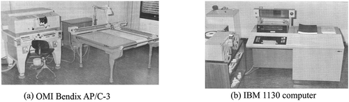
During the time when photogrammetry was based on analog devices, with the APC-3 from OMI/Bendix, the Hannover institute had the first analytical plotter in Germany which was not really operational due to limited computer power of the IBM 1130, for which even a hard disc device of 5 MB had a price of 50 000 DM (corresponding to more as 25,000 US$ today) (). Nevertheless, this basic instrument, including its development, gave impulses in the field of photogrammetry. Important functions were programmed for this analytical plotter, which could later be seen in commercial versions. With the experience of the APC-3, a push was made in the development of analytical plotters.
Figure 1. OMI Bendix AP/C-3 and IBM 1130 computer
With an invitation of the photogrammetric group of Zeiss in Oberkochen, Gottfried Konecny convinced Zeiss to start with the development of the analytical stereo plotter Planicomp, which was the first really operational version. With this development, Zeiss regained the leading position in photogrammetry which had been lost to the Swiss company Wild after the Second World War.
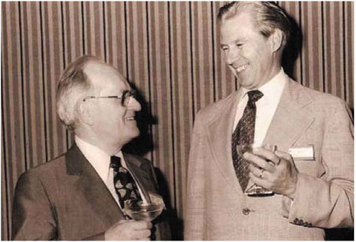
Gilbert Hobrough, from Vancouver, Canada, being the first developer in the field of image correlation in the early 1950’s (Sutton, Orteau, and Schreier Citation2009) spent more than a year, from 1978, at the Institute of Photogrammetry and Engineering Surveys, to develop a digital hardware correlator connected with the analytical plotter APC. Almost in parallel, Uki Helava, who was named the father of the analytical plotter with the first patent for a concept of the analytical plotter in 1957, spent one year at the institute designing his own analytical plotter (Konecny Citation2010), ().
Figure 2. Gilbert Hobrough and Uki Helava in Hannover
Before 1960, remote sensing information extraction was limited to manual interpretation of aerial photographs. Especially after the launch of Landsat 1 (at first named ERTS-1) in 1972, the civilian sector also changed to multispectral analysis, even though the ground sampling distance (GSD) was limited to 79 m. As one of the initiators for the special research project SFB 149 Survey- and Remote Sensing at Coasts und Seas at the University Hannover, with the sub-project R1 Sonar Survey, in which an interferometric sonar detector was developed, and sub-projects S1, S2 Remote Sensing, the ability in the area of remote sensing became strongly improved. This project was funded from 1973 up to 1985.
In the United States, computer-based object classifications began. Gottfried Konecny was always open to new technologies and tried to promote them. Remote sensing applications had not really used in Germany until 1973. In 1975, he undertook a tour in the USA together with the author. Included were visits to NASA JPL in Pasadena, USGS in Denver, University of Kansas, Interpretation Systems Incorporated also in Lawrence, Kansas, NASA Johnson Space Center, Houston, NOAA in Miami, USGS in Reston, ETL in Fort Belvoir, Virginia, IBM in Gaithersburg, Maryland and Woods Hole Oceanic Institution, Maryland. The main topic of all visits was the application of remote sensing. This technology was also new in the USA, and they were not allowed to talk about remote sensing on the Earth at ETL, so we talked about forest classification on the moon. With this new information on remote sensing, Gottfried Konecny promoted the application in Germany, including the implementation of a PhD thesis with ERTS-1 on land classification.
The progress of research and development in the field of remote sensing (Reeves et al. Citation1983) realized by the special research project was the basis for the acquisition of two additional permanent positions for the institute at a time when the staff positions at the University Hannover were being cut.
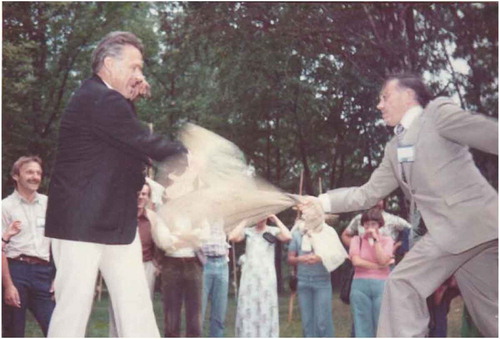
The relationship to Fritz Ackermann, University of Stuttgart, in Germany, should also be mentioned. While Gottfried Konecny initiated the research and development of new topics in a wide field, Fritz Ackermann tried to bring special topics into commercial products. For some years, the block adjustment of independent models had been propagated by the University of Stuttgart, which is now limited to special applications, while in Hannover the bundle block adjustment was preferred. From 1970 up to 1980, however, only a few organizations had a precise stereo comparator to generate image coordinates instead of model coordinates, which justified the method of independent models. This changed with the availability of analytical stereo plotters. Nevertheless, the combination of raising new topics in Hannover, together with the commercialization by the Stuttgart University, was optimal for the development of photogrammetry in Germany. The combination of both driving forces lead to the support from the Institute of Photogrammetry, Stuttgart University, with all employees, together with the Hannover employees, in organizing the International Society for Photogrammetry (ISP) Congress 1980 in Hamburg with Gottfried Konecny as Congress Director ().
Figure 3. Fritz Ackerman and Gottfried Konecny in a fun fight during the ISP congress in Helsinki in 1976 when they tried to push each other from a balancing bar with a straw bag
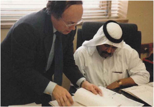
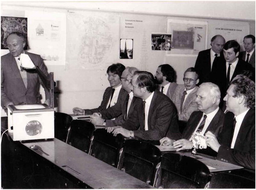
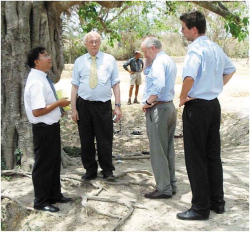
Although GIS began with a paper mapping analysis by J. Snow during the spread of the cholera epidemic in London 1854, the period 1960 to 1975 could still be described as GIS pioneering, followed by the period 1975 up to 1990 for GIS commercialization (GIS Geography). This new tool (Konecny Citation2010) was used in a GIS project in Kuwait for surveying, photogrammetry and utility survey. The project was based on data acquisition and a course held in Kuwait by G. Konecny, H.-P. Baehr, O. Schuster and K. Jacobsen in 1980 ().
Figure 4. Gottfried Konecny discussing GIS application for Utility Systems in Kuwait, 1981
The project, including a completely new ground control system and new mapping of the whole country, was realized by Asia Air Survey. Nevertheless, the practical use of the data collected was interrupted by the Iraq invasion of Kuwait when Gottfried Konecny left Kuwait on the last plane before closing the borders. Parallel to this GIS project, a project on the Land Information System in the city of Neustadt am Rübenberge was carried out, supported by the German Research Foundation, DFG, in order to improve the geometric and semantic information of utility systems.
The civilly available space images in 1980 had a very limited ground resolution. At that time, digital imaging was limited, so film-based systems like the US CORONA and the Soviet space imagery were state of the art, but strictly classified. Therefore, Gottfried Konecny suggested the use of a standard aerial metric camera, which was slightly modified for use in space. This was realized in 1982 with the use of the Zeiss RMK normal angle camera on board the Spacelab. “The Metric Camera instrument has been provided to the European Space Agency (ESA) for the flight in the First Spacelab Mission as a multiuser facility by the Federal Republic of Germany. It has been sponsored by the German Ministry for Research and Technology and developed by the main contractor MBB-ERNO and subcontractors Carl Zeiss and Kayser-Threde under a contract from German Aerospace Research Establishment (DFVLR) based on an experiment proposal by Prof. Konecny, lnstitut für Photogrammetrie und lngenieurvermessungen, Universität Hannover.” (Schroeder and Konecny Citation1982) ().
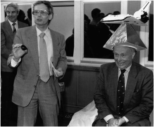
Figure 5. Honoring Gottfried Konecny in 1990 for his Metric Camera activities with a typical Hannover “Doctor Hat” and joking about small things which had not been optimal
With images from the metric camera, a standard deviation in X and Y of 7.7 m and for the height, 20.2 m with accurate ground control points (GCPs) was achieved in Germany. In areas outside the test field in Germany, accuracy was usually limited to GCPs digitized from maps. In 1983, the maps 1:50,000 were not better than 30 m to 50 m in X and Y. The activities with space images attracted a lot of attention; in 1985 we had a visit from the Lower Saxony Research Minister, Cassens (). Of course, this improved the institute’s situation in gaining funds for research projects.
Figure 6. Gottfried Konecny presenting results of the Metric Camera Mission to Lower Saxony Minister for Research, Cassens (right hand side) and the rector of the university in 1985
With the metric camera images, maps of 1:50,000 could be generated (Konecny et al. Citation1988). For several countries with metric camera images, better maps than the existing 1:50,000 maps could be generated. This was an advantage for the general public, especially for countries with classified maps. Nevertheless, with a ground resolution of 10 m to 20 m, not all elements important for topographic maps of 1:50,000 could be identified. Today, we want to have a ground resolution of at least 5 m for this map scale. In particular, the height accuracy could be improved by Large Format Camera images, due to a better height to base relation and an image motion compensation which was taken a year later from Spacelab.
The change from analog to digital images, such as by Landsat and SPOT from 1986 onwards, influenced Gottfried Konecny to start developing a digital stereo workstation at the Institute of Photogrammetry and Engineering Surveys in Hannover. The available computer performance was not satisfactory at that time, so a partly hardware supported solution in cooperation with the Swedish company Context Vision was realized. This demonstration version of a digital plotter was developed from 1986 up to 1988 (Lohmann et al. Citation1988). This digital plotter contained the basic functions of the later digital photogrammetric stereo systems using the improved computer power of the following years.
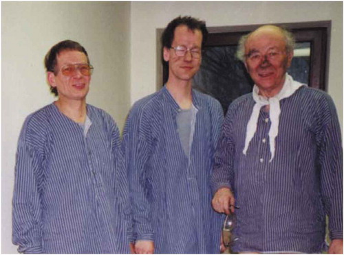
Gottfried Konecny’s interest is not limited to his profession. He also likes visits to museums and art galleries. He was also interested in mountains, even if he did not have the time to climb or hike. A few years ago, he initiated the mapping of the highest mountain peaks using space images. He was also interested in new and special things, such as visiting the last active coal mine in Germany in 1999, where we had contacts from a long-term project to determine the subsidence caused by mining activities based on aerial images ( and ).
Figure 7. The author, Gottfried Konecny and Christian Heipke before visiting a German coal mine 1999
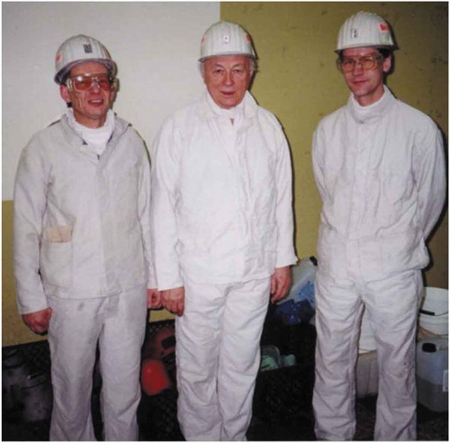
Figure 8. After visiting the coal mine
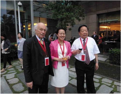
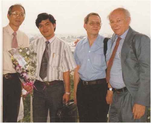
Gottfried Konecny was always one of the first to make contact with countries where it was possible. This is evident through a visit to China in 1979, to the Wuhan Technical University of Surveying and Mapping, shortly after the country’s reopening, and another visit together with a German delegation in 1980. He arranged, for the author, the installation and training of bundle block adjustment in 1985, in Wuhan. Gottfried Konecny continued his contact with China by several visits and, vice versa, we received several Chinese visitors and scholarship holders in Hannover. For him, the world is small and visits to various countries are common, which is what his son calls “travel craziness”. The author was invited by the Wuhan University for software support in 2009. During this time, there was also a celebration of the Wuhan University, and the author and Gottfried Konecny, not knowing of the other, were sitting close together in the festival hall ().
Figure 9. Celebration of the Wuhan University, 2009, Gottfried together with Jie Jiang and Li Deren
Based on a fellowship from the USSR Academy of Science in 1970 in Leningrad, Gottfried Konecny also had early contacts with the Soviet Union which led to access to Soviet space images from KFA1000, KATE200, MK4, KFA3000, KVR1000, TK350 (Jacobsen and Müller Citation1988). At the symposium of the ISPRS Commission II “Experiences with Space Photographs for Mapping” in 1987 in Leipzig, located in the former German Democratic Republic, we shocked the East Germans with presentations including mapping with the Soviet space images (Jacobsen Citation1987; Konecny et al. Citation1988). After the reunification of Germany in 1990, we received the information that the East Germans also worked with the same images, but for them it was top secret and they were not allowed to talk about it. Contact with Russia still continues with regular visits to GeoSibirsk in Novosibirsk, even up to 2019 ().
Figure 10. Gottfried Konecny in action, 2013 in Novosibirsk
He also regularly visits the annual conference Ostrava GIS in the Czech Republic, close to his hometown Troppau, where the author visited together with Gottfried Konecny in 2011, at GIS Ostrava weekend.
We worked as early as possible with the operational French line scanner images of the SPOT satellite, the German test images of the Modular Optoelectronic Multispectral Stereo-Scanner (MOMS-02) and the images taken by the Indian and the Korean Remote Sensing Satellites, as well as with the high-resolution US satellite images.
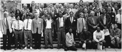
After mapping on the basis of analog images in Hannover, we used almost all available types of space images for geometric analysis, height model generation and mapping with self-developed software. These activities also formed the basis for the “Mapping from Space” workshops in Hannover (), in which more and more participants took part over time. This was continued by Konecny’s successor in Hannover, Christian Heipke, as the ISPRS workshop of the Working Groups I/1, I/3 and IV/4 – Sensors from Space, Hannover in 1999.
Figure 11. Participants of the Hannover workshop “Mapping from Space 1993”
Figure 12. Participants of the Hannover workshop “Mapping from Space 1995”
Figure 13. Participants of the Hannover workshop “Mapping from Space 1997”
Starting with the first available radar images in 1981, as Shuttle Imaging Radar SIR-A, the geometric aspects of radar images were analyzed in some projects, taking into account the special imaging conditions and the use of digital elevation models (DEM). This was partly handled within the special research project SFB 149 up to 1985, and from 1985 onwards, through individual research projects. These include the radarmap project for ERS-1, which started in 1989, before the satellite was launched in 1990. In cooperation with the German Aerospace Center DLR, a radar map for Germany with ERS-1 images was created.
We had several collaborations with companies, e.g. Zeiss, so our analytical stereo workstation Planicomp P1 was paid for by worldwide installations of IPI software. This was also similar with the company Kern, Aarau, from whom we bought the DSR15, which was also paid by worldwide IPI software installations.
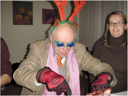
Gottfried Konecny was always good for fun as you can see in , eating chocolate during the Christmas party of the Hannover institute in 2010.
Figure 14. Christmas party in Hannover 2010
Support of developing and other countries and consultations
Beside his activities in ISPRS and EARSeL, Gottfried Konecny was chairman of the German Advisory Group on Development Aid in Surveying (BEV) for around 30 years. Based on this function, but not limited to developing countries, he gave several educational seminars and had several advisory meetings worldwide. These activities increased especially after his retirement. The educational seminars were funded by the German Aids for Technical Cooperation (GTZ), additional external funding, even from the Japanese Aids for Development, supported by Shunji Murai, and in a few cases, directly paid by the Hannover institute. In addition, some consultations have been held with foreign companies and organizations. For Gottfried Konecny, the expenses for the consultations had to be paid, but additional payments were not important for him, he was more interested in the topics themselves. Below, further common occasions between Gottfried Konecny and the author are listed. Of course, we both also gave additional courses individually.
In the frame of a GTZ project in 1991, we gave a 2-week course on analytical photogrammetry, including training with the Planicomp in the University Harare, Zimbabwe. Shortly afterward in the same year, we had a similar, very successful course at Anna University, Madras (now Cennai), followed by a second course in 1992, and the jointly organized “India Workshop on Advances in Photogrammetry and Cartography for Mapping” at the Anna University Madras in 1994.
The Summer Workshop on GIS/GPS at the Middle East Technical University (METU) in Ankara followed in 1995. In addition to the staff, a mixed group of Turkish and Greek Students attended. This was special due to long term conflicts between Turkey and Greece. In 1996, we gave a GTZ Summer Workshop on GIS/GPS at the National Center for Remote Sensing (NCRS), in Lebanon. On the initiative of Gottfried Konecny, and supported by the GTZ, the author gave a course on “Training in Digital Photogrammetry” at the National Remote Sensing Agency (NRSA) in Hyderabad in 1997, and again in 1998.
In 1998, we had a workshop in Ho-Chi-Minh-City, Vietnam, together with Shunji Murai under the name Caravan Workshop on Mapping from Space (). Further workshops followed under this name, but with topics fitted to the local requirements.
Figure 15. Shunji Murai, the local organizer, the author and Gottfried Konecny during a hospital visit for the additional presenter Hans Knop 1998 in Ho-Chi-Minh-City, Vietnam
In 1999, a “Workshop on Geographical Information Systems” followed at the National University of Science and Technology (NUST), in Rawalpindi, Pakistan. This time, in addition to Gottfried Konecny and the author, also the new appointed head of the Hannover Institute, Christian Heipke attended.
Also in 1999, at the Institute of Surveying and Mapping in Diyatalawa, Sri Lanka, we again had the “Caravan Workshop on Mapping from Space” a similar workshop ().
Figure 16. Caravan Workshop on Mapping from Space 1999 in Diyatalawa, Sri Lanka
In 2000, with a stopover in Bangkok, we had a two-week workshop on photogrammetric cadastral surveying in Phnom Penh, Cambodia, and again 2004, a two-week workshop on a similar topic there. The establishment of a cadastre in Cambodia was required due to the total displacement and reduction of the population by the Red Khmer some years before ().
Figure 17. Phnom Penh 2004 at the Killing Fields
In 2000, we held an educational course, financed by the GTZ, on “ortho photo technology” for cadastral application at the IGN, in Guatemala City, Guatemala. In 2001, training was held on the main topic of photogrammetric mapping at the General Office of Remote Sensing (GORS) in Damascus, Syria. In 2002, in Ahmedabad, India, we participated in a workshop in the Space Application Center (SAC) of the Indian Space Research Organization (ISRO) on mapping from space.
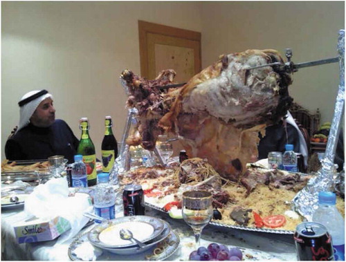
In 2003 we had a common cooperation, meeting at the Ministry of Rural Affairs (MOMRA) and also with the Turkish company Geotech in Riyadh, Saudi Arabia. All together, we had several visits in Riyadh before and also afterward at MOMRA and also at Geotech ( and ).
Figure 18. The author, Kamil Eren from Geotech, Gottfried Konecny, 2011 in Istanbul on the return trip from Riyadh
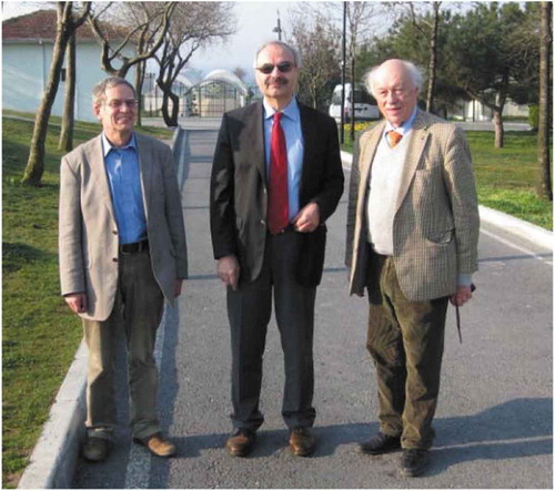
Figure 19. Small snack in Riyadh
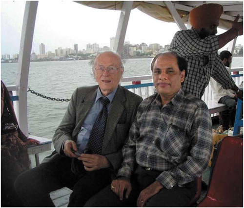
In 2005 after common presentation in Dubai (), we had an initial consulting meeting at the Rolta company in Mumbai, India (), resulting in a series of meetings which followed.
Figure 20. The author, Gottfried Konecny and Li Deren at Map Middle East in Dubai
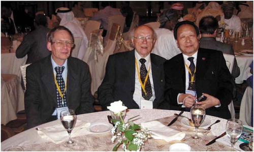
Figure 21. During visit at Rolta company in Mumbai 2005
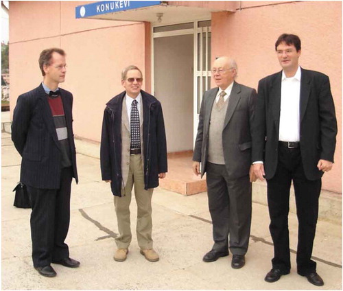
With four speakers from the Leibniz University Hannover, we held a Workshop on Mapping from Space in 2006 at the Zonguldak Bülent Ecevit University in Zonguldak, Turkey () with which we have been in cooperation for a long time.
Figure 22. Christian Heipke, the author, Gottfried Konecny and Uwe Sörgel during Workshop on Mapping from Space, Zonguldak 2006
These series of workshops, educational presentations and consultations were supported by several individual meetings, in which contributions were distributed. Gottfried Konecny wrote several book chapters and the book Geoinformation – Remote Sensing, Photogrammetry and Geographic Information Systems (Konecny Citation2014) and, prior to that, the German version, as well as a Korean version. He also wrote the brochure on “The International Society for Photogrammetry and Remote Sensing – 100 years of the Society” in 2010. The joint book by Dowman, I., Jacobsen, K., Konecny, G., Sandau, R., (Citation2012): High Resolution Optical Satellite Imagery was awarded the Karl Kraus Textbook Medal by ISPRS in 2016.
Conclusion
This paper gives only a selected overview about some of Gottfried Konecny’s activities in research, development and education, which are by no means very well known, but gives an idea of his never-ending activities and his strong influence in photogrammetry and remote sensing and the use of GIS.
Disclosure statement
No potential conflict of interest was reported by the authors.
References
- Dowman, I., K. Jacobsen, G. Konecny, and R. Sandau. 2012. High Resolution Optical Satellite Imagery. Whittles Publishing. ISBN 978-184995-046-6.
- GIS Geography. “The Remarkable History of GIS”. https://gisgeography.com/history-of-gis/
- 2008. History of Photogrammetry by the Center for Photogrammetric Training. https://ibis.geog.ubc.ca/courses/geob373/lectures/Han
- Jacobsen, K. 1987. Experiences with Space Photographs for Mapping. ISPRS Intercommission WG I/II Leipzig.
- Jacobsen, K., and W. Müller. 1988. “Geometric Potential of Space Images.” ISPRS Archives XXVII-part2-sup. https://www.isprs.org/proceedings/XXVII/congress/part2/191_XXVII-part2-sup.pdf.
- Konecny, G. 2005. Geoinformation (Korean language). CRC Press, 340. ISBN89-5688-4 93530.
- Konecny, G. 2010. “The International Society for Photogrammetry and Remote Sensing – 100 Years of the Society.” ISPRS Publication, BEV Wien 64. https://www.isprs.org/documents/centenary/ISPRS_History_Konecny.pdf.
- Konecny, G. 2014. Geoinformation - Remote Sensing, Photogrammetry and Geographic Information Systems. second ed. CRC Press. ISBN 978 142006 8566
- Konecny, G., K. Jacobsen, P. Lohmann, and W. Müller. 1988. “Comparison of High Resolution Satellite Imagery for Mapping.” ISPRS Archives XXVII-part4-sup. https://www.isprs.org/proceedings/XXVII/congress/part4/226_XXVII-part4-sup.pdf.
- Lohmann, P., G. Picht, K. Jacobsen, and L. Skog. 1988. “The Design and Implementation of a Digital Photogrammetric Stereo-Workstation.” ISPRS Archives XXVII-part 2.
- Reeves, R., J. Estes, S. Bertke, and C. Sailer. 1983. The Development and Principles of Remote Sensing, Manual of Remote Sensing. 2nd ed. Bethesda, MD: ASPRS. ISBN 0-937294-42-X.
- Schroeder, M., and G. Konecny. 1982. “Metric Camera Experiment in Spacelab Mission 1 –STS 9 – Remote Sensing from Space a Contribution of the Federal Republic of Germany.” BMFT/DFVLR. Hannover. https://aerial-survey-base.com/wp-content/uploads/2017/01/Metric-Camera-Experiment-in-NASA-Spacelab-Mission-1-STS-9-NASA_flach_LR.pdf.
- Sutton, M. A., -J.-J. Orteau, and H. W. Schreier. 2009. Image Correlation for Shape, Motion and Deformation Measurements. Springer. ISBN 978-0-387-78747-3.