
This special issue is dedicated to Prof. Gottfried Konecny (see ), the former president of the International Society for Photogrammetry and Remote Sensing (ISPRS) on the occasion of his 90th birthday, which he celebrated in good health and spirits in June 2020 (see ). A visionary leader and missionary of global topographic mapping, a world scientist and a world citizen who restlessly built and continues to build sustainable bridges between different generations and different peoples of the globe and a true pioneer of photogrammetry and remote sensing, Konecny has shaped our field of research and development over the last 75 years in ways second to none. He also has a very special connection to China, which prompted the Editor-in-Chief of Geo-spatial Information Science to suggest this journal as a very good place to publish this special issue. As the successor of Prof. Konecny at the Institute of Photogrammetry and GeoInformation of Leibniz University Hannover, it is with great honor, joy and thankfulness that Christian Heipke accepted the invitation to be guest editor of this special issue, together with Deren Li.
Figure 1. Gottfried Konecny, giving a presentation at the ISPRS Congress in Melbourne, Australia, in 2012
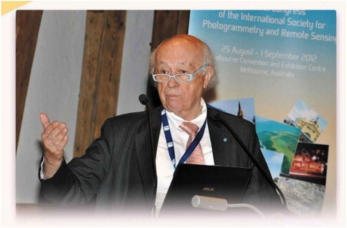
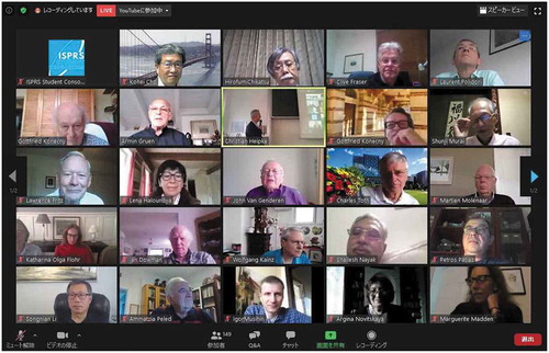
Figure 2. Almost 150 people participated in the webinar on 17 June 2020 on the occasion of Gottfried Konecny’s 90th birthday
Before presenting the contents of this issue, let us give a brief account of the life and professional achievements of Gottfried Konecny. While he is indeed one of the most well-known personalities in our fields, in particular the younger generation might not be fully familiar with his remarkable career. Gottfried Konecny was born in 1930 in Troppau, Czechoslovakia, to German parents. He started his involvement with mapping when he became a draftsman in 1945, 1 year before moving to Bavaria with his family, in 1946. Between 1950 and 1957, he studied Surveying Engineering at TU Munich and in between he completed a M.Sc. degree in Geodetic Sciences at The Ohio State University,
Columbus, OH, under the supervision of Prof. Frederick J. Doyle, after having been awarded a US Government Fulbright Scholarship. In 1959, he obtained a PhD degree from TU Munich with a thesis on aerotriangulation with convergent imagery, supervised by Prof. Richard Finsterwalder.
From 1959 to 1971, he was first Assistant Professor and since 1966 Full Professor and Head of Department at the University of New Brunswick in Fredericton, Canada, where he was instrumental in developing the first Geomatics Program in North America, which quickly became a role model across the English speaking world, and served as a blue print e.g. at the University of Cape Town in Africa and the University of New South Wales in Sydney, Australia. On the scientific level he greatly contributed to the early development of line scanners and, in particular, to analytical photogrammetry and analytical plotters. Project work led him across the world, we only mention here the National Geographic Society Expedition to Mt. Kennedy, where Konecny served as Chief Surveyor and the photogrammetric survey of the Idikki Dam in Kerala, India. In 1966/67, he was with NASA in Houston during a sabbatical, mapping about 20 lunar landing sites for the Apollo Programme.
In 1971, he returned to Germany to take up the Chair at the Institute of Photogrammetry and Engineering Surveys at the (now) Leibniz University Hannover. His major activities comprised the development of remote sensing in Europe. He was the Project Scientist of the first photogrammetric mapping project from space in the world, the Metric Camera, which flew on board the Space Shuttle Columbia from 28 November to 8 December 1983, obtaining a stereoscopic coverage of 10% of the Earth landmass. Another topic of major interest to Konecny was topographic mapping for sustainable development, in particular for less favored areas of the world, which directly led him to bring together photogrammetry, remote sensing and geospatial information systems. As always, he did not only suggest and analyze new ways of mapping, but also pushed for their introduction into work in practice. One such activity he was involved in was the KUDAMS Project to set up an Integrated Urban Geographic Information System in Kuwait, involving control surveys, photogrammetry, digital mapping and GIS, between 1980 and 1990.
From 1976 to 1992, he was a member of the ISPRS Council and was responsible for the ISP Congress in Hamburg in 1980. He was instrumental in including remote sensing into the name and the activities of the society, thus transforming ISP to ISPRS. From 1984 to 1988 he served as ISPRS president. Since 1992, he is an ISPRS Honorary Member and has continued to work for the goals of the society in various roles until today. Currently, he serves as Vice Chair of working group WG IV/2 entitled Global Status of Mapping and Geospatial Database Updating.
In 1998, he became Emeritus Professor of Leibniz University Hannover, but he obviously did not like the idea of retirement. He thus continued lecture series around the world, and he has taken on various consultancy engagements, e.g. in Dubai and in Saudi Arabia. The most recent projects were the work on the status of topographic mapping of the world, carried out in conjunction with UN-GGIM and ISPRS during 2012 and 2015, and the project to map all the peaks higher than 8000 m in the Himalayans in a cooperation between Beijing University of Civil Engineering and Architecture, the company Esri in Redlands, CA, the European Academy of Sciences and Arts, Salzburg, and his former institute in Hannover.
Needless to say that with such a successful career, Konecny received numerous awards and recognitions, only the most important ones can be mentioned here. In 1990, he received the German Federal Cross of Merit, he holds Honorary Doctorates of the University of Tucamán, Argentina, the University of New Brunswick in Fredericton, Canada, Anna University in Chennai, India, and the State University of Geodesy and Cartography in Moscow, Russia, and Honorary Professorships at Wuhan University, China, and the Siberian State University of Geosystems and Technologies in Novosibirsk, Russia. He is an Honorary Member of ISPRS as well as various national and international scientific organizations, and is the recipient of the Fairchild Award of the American Society for Photogrammetry and Remote Sensing.
This short account of his career would have convinced you, the reader, that Gottfried Konecny is indeed, a very special scientist of photogrammetry and remote sensing. The 17 contributions of this special issue further underline the role and influence Konecny has played in our field over the last 75 years and, indeed, continues to play until today.
The first four contributions are personal accounts, praising the achievements of Gottfried Konecny. Deren Li et al. emphasize his role for photogrammetry and remote sensing in China, Shunji Murai writes about his own experience in personal and professional meetings, while Karsten Jacobsen, a former PhD student and close coworker at IPI in Hannover for nearly 30 years, recalls encounters with Konecny, mostly during overseas trips. Finally, Lena Halounová gives a very personal account of Konecny’s curriculum vitae.
The next group comprises three position papers. Charles Toth reflects on changes from analog to digital photogrammetry and the birth and development of remote sensing – Konecny was an active contributor to all of them. Armin Grün gives an overview of the development of photogrammetry and puts Konecny’s career into context with his own. In a very topical article, Orhan Altan and Ian Dowman reason about human needs in the times of the corona pandemic and the role geotechnology plays to combat and overcome the related problems.
The following two articles are devoted to Sino-German research on automation in photogrammetry and geoinformatics. While Lin Chen et al. review feature matching methodologies in the era of big data and deep learning, Chenxi Wang et al. describe their work on trajectory analysis to infer traffic rules at road junctions from GNSS data.
The next four papers contain presentations of Chinese satellite programs, showcasing the significant progress which has been achieved in this area in the last two decades. Deren Li et al. review the developments of high-resolution optical satellites and their applications to surveying and mapping, and Yanfei Zhong et al. focus on spaceborne hyperspectral remote sensing capabilities. Two papers are explicitly devoted to satellite image applications. While Jixian Zhang et al. describe Chinese activities in mapping large parts of the Chinese territory based on high-resolution imagery, Jun Chen et al. present their work on global land cover mapping and the possibilities to validate automatically achieved classification results.
Konecny was not a scientist in the narrow sense of the word. As mentioned, he was also instrumental in building bridges between peoples and cultures. Consequently, this special issue contains two such examples. Wolfgang Kainz et al. present results from a cooperation between Austria and China, while Thomas Luhmann, a former PhD student of Konecny from Hannover, describes his experiences in cooperating with colleagues in Ukraine.
Finally, Konecny’s involvement in scientific societies led Jochen Schiewe, another former PhD student of Konecny, to discuss the role of cartography and the cartographic societies in the whole mapping process, while Laurent Polidori picks up Konecny’s interest in history and traces the origins of the terms photogrammetry and remote sensing by scanning historical text documents with search tools from the big data era.
Finally, we thank all authors for their valuable contributions, and the able and extremely friendly staff of the journal for all the help they provided to us. We hope the reader will enjoy looking through the contributions as much as we did when putting them together.
We would like to close this editorial by extending our best wishes for the future to Gottfried Konecny and wholeheartedly thank him for all the help, advice and mentorship we were able to enjoy during our cooperation. May he continue to be active in our field – it will be for the benefit of all.
Christian Heipke, Deren Li
References
- Altan, O., and I. Dowan. 2021. “The Changing World Under the Coronavirus Threat.” Geo-spatial Information Science 24 (1): 48 – 55. doi: 10.1080/10095020.2021.1886874.
- Chen, J., L. Chen, F. Chen, Y. Ban, S. Li, G. Han, X. Tong, C. Liu, V. Stamenova and S. Stamenov. 2021. “Collaborative Validation of GlobeLand30: Methodology and Practices.” Geo-spatial Information Science 24 (1): 132 – 142.
- Chen, L., F. Rottensteiner and C. Heipke. 2020. “Feature Detection and Description for Image Matching: From Hand-crafted Design to Deep Learning. Geo-spatial Information Science 24 (1): 56 – 72. doi: 10.1080/10095020.2020.1843376.
- Grün, A. 2021. “Everything Moves: The Rapid Changes in Photogrammetry and Remote Sensing.” Geo-spatial Information Science 24 (1): 31 – 47. doi: 10.1080/10095020.2020.1868275.
- Halounová, L. 2021. “Gottfried Konecny: The Influence in the Global Development of the Three Geosciences.” Geo-spatial Information Science 24 (1): 21 – 25. doi: 10.1080/10095020.2020.1860555.
- Jacobsen, K. 2020. “Gottfried Konecny: The Photogrammetric and Remote Sensing Trend Setter.” Geo-spatial Information Science 24 (1):12 – 20. doi: 10.1080/10095020.2020.1833688.
- Kainz, W., X. Tang and Y. Xue. 2021. « The Austrian Node of the Natural Resources Satellite Remote Sensing Cloud Service Platform: Examples of Sino-Austrian Cooperation.” Geo-spatial Information Science 24 (1): 143 – 149. doi: 10.1080/10095020.2020.1857213.
- Li, D., M. Wang and J. Jiang. 2020. “China’s High-resolution Optical Remote Sensing Satellites and Their Mapping Applications.” Geo-spatial Information Science 24 (1): 83 – 92. doi: 10.1080/10095020.2020.1838957.
- Li, D., Y. Zhu and L. Shi. 2021.“Gottfried Konecny: Our Best Friend in Photogrammetry and Remote Sensing of China.” Geo-spatial Information Science 24 (1): 5 – 7. doi: 10.1080/10095020.2020.1860554.
- Luhmann, T. 2020. “Development of German-Ukrainian Cooperations for Education and Research in Photogrammetry and Laserscanning.” Geo-spatial Information Science 24 (1): 150 – 157. doi: 10.1080/10095020.2020.1831891.
- Murai, S. 2021. “Gottfried Konecny: Involvement of Spatial Information Sciences in ISPRS Disciplines.” Geo-spatial Information Science 24 (1): 8 – 11. doi: 10.1080/10095020.2020.1860556.
- Polidori, L. 2020. “Words as Tracers in the History of Science and Technology: The Case of Photogrammetry and Remote Sensing.” Geo-spatial Information Science 24 (1): 165 - 175. doi: 10.1080/10095020.2020.1843375.
- Schiewe, J. 2021. “The Need for Disciplinarity, Interdisciplinarity and Scientific Societies – The Cartographic Perspective.” Geo-spatial Information Science 24 (1): 158 - 164. doi: 10.1080/10095020.2020.1863748.
- Toth, C. K. 2021. “Gottfried Konecny: The Ambassador of Photogrammetry and Remote Sensing for 75 years.” Geo-spatial Information Science 24 (1): 26 - 30. doi: 10.1080/10095020.2020.1860553.
- Wang, C., S. Zourlidou, J. Golze and M. Sester. 2020. “Trajectory Analysis at Intersections for Traffic Rule Identification.” Geo-spatial Information Science 24 (1): 73 – 82. doi: 10.1080/10095020.2020.1843374.
- Zhang, J., H. Gu, W. Hou and C. Cheng. 2021. “Technical Progress of China’s National Remote Sensing Mapping: From Mapping the Western China to National Dynamic Mapping.” Geo-spatial Information Science 24 (1): 119 – 131. doi: 10.1080/10095020.2021.1887713.
- Zhong, Y., X. Wang, S. Wang and L. Zhang. 2021. “Advances in Spaceborne Hyperspectral Remote Sensing in China.” Geo-spatial Information Science 24 (1): 93 – 118. doi: 10.1080/10095020.2020.1860653.