
Abstract
In this study, we present a map of the geochemical reactivity of rocks of the Czech Republic at a scale of 1:1,000,000 based on a geodatabase of regional geological maps at a scale of 1:50,000, as well as description of the method of how the map was developed. Research for this study was performed by compiling information between a database of regional geological maps and data from the lithogeochemical database to calculate and classify the rocks into eight groups according to carbonate content and coefficient of alkalinity. Rocks in these groups were further subdivided according to the susceptibility to weathering, forming a total of 28 categories. Knowledge of geochemical background is essential for making informed landscape management decisions, as this information determines the areas with higher levels of susceptibility to soil acidification and/or nutrient degradation. The map from this study will therefore provide essential information, albeit incomplete, to aid landscape management practitioners.
1. Introduction
The natural environment is strongly determined by climate, relief and bedrock, forming specific landscapes (CitationChuman & Romportl, 2010; CitationRomportl, Chuman, & Lipský, 2013). Lithology and geochemical composition of the bedrock influences the properties of soils (CitationSposito, 1989) as well as stream water chemistry, as has been demonstrated in a variety of environments (e.g. CitationChuman, Hruška, Oulehle, Gürtlerová, & Majer, 2013; CitationKrám & Hruška, 1994; CitationKrám & Hruška, 2010; CitationLindell, Åström, & Öberg, 2010; CitationWilliard, Dewalle, & Edwards, 2005). Climate and relief also influence vegetation cover and the rate, as well as the form, of weathering. Over the last several decades, estimating rates of weathering has become important in addressing environmental issues such as acidification and nutrient degradation of soils and water in many landscapes. Extremely high sulphur and nitrogen emissions has resulted in forest decline (CitationOulehle, Hofmeister, Cudlín, & Hruška, 2006) and lost or damaged fish stocks and reduced biodiversity in lakes and rivers (CitationSkjelkvåle, Mannio, Wilander, & Andersen, 2001). Soil-buffering capacity is one of the most important phenomena regulating these harmful effects, and is greatly dependant on the geochemical composition of the bedrock and its weathering rate.
The ability of soils to resist acidification and nutrient degradation processes depends on the amount of base cations (Ca, Mg, Na, K) released during weathering. The rate of weathering is conditioned by the geochemical rock composition and susceptibility to weathering in the given environment. During the weathering process, chemical, physical and biological forces act upon rocks and their component minerals. Nonetheless, chemical reactions dominate mineral alteration processes, with the main effect of chemical weathering being the dissolution of minerals by water (CitationChurchman, 2000). All minerals dissolve in water, but the pathways and rates of dissolution vary widely between different types of minerals (CitationSposito, 1989). Based on early weathering studies, CitationGoldich (1938) observed that the weathering sequence for common igneous rocks was the reverse of Bowen's reaction series that ranked minerals in the order of crystallization from magma. The higher the formation temperature of silicate mineral, the more susceptible it would be to breakdown due to weathering at the Earth's surface. For example, olivine and pyroxenes are expected to weather faster than feldspars, which in turn weather faster than quartz (CitationGoldich, 1938).
CitationKramer (1968) stated that hydrolysis, resulting in the physical disaggregation of rocks and the removal of mobile elements, is the most significant process of weathering in normal humid-climate environments, because of the input of various acids, including dissolved CO2 from the atmosphere as well as from plant and microbial sources, and also organic acids from such biological weathering agents as fungi, lichens and moss. Hydrolysis almost invariably occurs in acid conditions (CitationChurchman, 2000). In general, the main process during weathering is an exchange of Na, Ca, Mg, and K for H in the mineral structure with or without a loss of Si (CitationChurchman, 2000). Therefore, the small, mobile, highly polarizing ion H3O+ often plays an important role in weathering reactions. However, each of these elements has a different susceptibility to weathering depending on the bond strength (CitationKramer, 1968).
CitationReiche (1943) suggested that in general, susceptibility to weathering is dependent on the proportion of the alkali and alkaline earth metals in a rock, and based on this relationship proposed a weathering potential index (WPI). The coefficient reflects the parent rock bulk chemistry and mineralogy, and incorporates the bulk major element oxide chemistry (molecular proportions of each oxide based on weight) into a single value, using a complete silicate rock analysis. The higher the index value, the higher the susceptibility to weathering. The WPI was later modified by CitationVogel (1975), excluding H2O, FeO, TiO2 from the formula.
There are other so-called weathering indices, e.g. CIA – Chemical Index of Alteration (CitationNesbitt & Young, 1982), CIW – Chemical Index of Weathering (CitationHarnois, 1988), and WIP – Weathering Index of Parker (CitationParker, 1970), but they are used for characterizing weathering profiles and are plotted by depth, thus comparing the extent of chemical alteration at different depths, and do not use the complete silicate analysis. These weathering indices essentially measure the degree of depletion of mobile components relative to immobile components during weathering (CitationHarnois, 1988), and in homogenous parent rock they change systematically with depth (CitationPrice & Vebel, 2003). They also incorporate the bulk selected element oxide chemistry (the molecular proportions of each oxide based on weight) into a single value; thus the stoichiometric changes during weathering are reflected in the index value. Detailed reviews of these proposed indices have been carried out by CitationDuzgoren-Aydin, Aydin, and Malpas (2002), CitationPrice and Vebel (2003) and CitationHarnois (1988).
Out of the weathering indices, we selected the index using complete silicate rock analysis, like the weathering potential index of CitationReiche (1943), however we did not account for water content.
Knowledge of the geochemical background is essential information to guide landscape management, as it shows areas potentially at risk of water contamination, and the susceptibility of soil to acidification and/or nutrient degradation. The Czech Republic in particular is known to be severely affected by these factors. Therefore, this study is an effort to create a map of the geochemical reactivity of rocks for the Czech Republic that will provide essential information, albeit incomplete, to aid landscape management practitioners.
2. Geological structure of the Czech Republic
The Czech Republic has complex geology when compared to many other countries (see the Geological setting of the Czech Republic after CitationZoubek et al. (1998)), as the territory consists of two basic contrasting units: the Bohemian Massif of Proterozoic and older Paleozoic origin and the Western Carpathians (including the Carpathian Foredeep), part of the northern branch of the Alpine Orogeny. The Bohemian Massif is a part of the European Variscides (CitationMísař, 1997) similarly to Schwarzwald, Rhenis Massif or Voges, and is generally divided into platform and pre-platform. The pre-platform basement was built during several orogenic phases of the Variscan Orogeny. The platform stage succeeded rapid peneplanation of the Variscan mountains during the Carboniferous and at the beginning of the Triassic (CitationMísař, 1997). This was subsequently followed by the occurrence of non-folded sediments and volcanics that covered the erosion plane.
Generally, the most dominant rock types forming the Bohemian Massif including its platform formations are Mesozoic sediments (prevalently marine siliclastic and carbonate sediments), Precambrian and/or Paleozoic (Moldanubian) metamorphites (mica schists, gneisses, migmatites, granulites), Neoproterozoic siliclastics and volcanites (shales, greywackes, gneisses, schists, metasediments), Variscian intrusives (granitoids, durbachites, gabbroids) and non-metamorphosed or weakly metamorphosed Neoproterozoic to Middle Devonian marine sequences (Barrandien and a few small areas). The Western Carpathians contribute to only a small proportion of the geology of the Czech Republic in comparison to the Bohemian Massif, and are much more uniform in their structure, consisting of the Carpathian Foredeep, the Outer Carpathian Flysch and the Vienna Basin. The most dominant rock types are Paleogene and Neogene sediments (e.g. marine siliclastics, flysh formations that are characterized by alternating bands of sandstones, slates and claystones, and to a lesser extent marls).
These two units differ in geological age and paleogeography as well as in geomorphology.
3. Methods
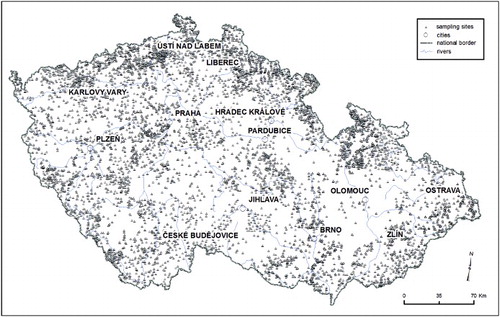
The Map of geochemical reactivity of rocks of the Czech Republic was compiled based on the Czech Geological Survey's geodatabase of regional geological maps at a scale of 1:50,000 of the Czech Republic (CitationGEOCR50) and a lithogeochemical database (CitationGürtlerová, Dušek, & Fikr, 1997; Lithogeochemical database of the Czech Republic, access date 15.1.2012). The geodatabase includes four main types of information: chronostratigraphical units, regional units, lithostratigraphical units, and lithological descriptions of rocks. The lithogeochemical database of the Czech Geological Survey (CitationLithogeochemical database of the Czech Republic), which currently contains analyses of 15,170 samples (), is the source of more than 13,000 silicate rock analyses that were used in this study's classification. Each sample has its coordinates and a lithological description of the rock. Fresh and unweathered samples predominantly taken from quarries or outcrops were collected for a complete silicate analysis of SiO2, TiO2, Al2O3, Fe2O3, FeO, MnO, MgO, CaO, SrO, BaO, Li2O, Na2O, K2O, P2O5, CO2, C, F, S, H2O+, H2O−. The size of samples depended on the grain size, from 1 kg to 5 kg for rocks with less than 10 mm to more than 30 mm grain sizes, respectively. Carbonate content and the coefficient of alkalinity were calculated for each sample from the lithogeochemical database. The coefficient of alkalinity was calculated as follows (after CitationAdamová, 1991; CitationDubánek, 1984).Carbonates were determined based on the content of calcium carbonates, magnesium carbonates or calcium-magnesium carbonates in the rock samples, calculated from the CO2, CaO, MgO content (mol*kg−1) in the silicate rock analysis.
Figure 1. Location of samples contained in the lithogeochemical database.
Rocks were classified into eight groups according to their carbonate content and the coefficient of alkalinity ().
Table 1. Categories of geochemical reactivity based on carbonate content and the coefficient of alkalinity and susceptibility to weathering.
The coefficient of alkalinity on its own shows how many cations are in the rock (see the map Alkali and alkaline earth metals content in rocks (Calk)). According to CitationOllier (1983), susceptibility to weathering depends on the number of cations replaceable with hydrogen in the minerals; however, rock type and lithology also play an important role. Rocks with the same amount of cations may differ in susceptibility to weathering, e.g. pyroclastic deposits of basalt weather faster than solid basalt rock. Therefore, based on empirical knowledge, the rocks were further classified according to rock type and lithology into the following classes: high, medium, and low susceptibility to weathering (). The geochemical reactivity is thus a combination of alkalinity and alkali earth metal content and susceptibility to weathering.
The lithogeochemical database was then joined to the regional geological map database, thereby supplementing the additional information about geochemical reactivity to the regional geological map. The legend of the map further differentiates the main rock types of the Czech Republic ().
The regional geological map database also contains the category of Quaternary sediments. This category represents a composite category of weathered, transported and sedimented material from the watershed (deluvial and/or fluvial sediments). All Quaternary sediments, except loess, were thus intersected with the watershed layer of the Czech Republic at a scale of 1:25,000; the same method was applied to bedrock with assigned reactivity. For each watershed, the average Calk was computed and then the average value was assigned to Quaternary sediments within the particular watershed. Loess was assigned its value based on the silicate rock analyses.
All polygons smaller than 15 ha were eliminated by merging them with neighboring polygons that had the largest area, using the eliminate function in ArcGIS.
4. Results and discussion
The Map of geochemical geactivity of rocks of the Czech Republic developed in this study reflects the chemistry and mineralogy of rocks in the Czech Republic, using the coefficient of alkalinity as an index of weathering. This index was computed for fresh unweathered samples only and thus reflects the proportion of cations in the rock. As CitationReiche (1943) suggests, the susceptibility of rock to weathering increases with the increasing proportion of alkali and alkaline earth metal content (see the map Alkali and alkaline earth metals content in rocks (Calk)). Therefore, the index compares the proportion of these elements in different rocks. Weathering indices are more commonly used for characterizing the degree of weathering in profiles and are plotted by depth (CitationPrice & Vebel, 2003). They essentially measure the degree of depletion of mobile components relative to immobile components during weathering (CitationHarnois, 1988) and on homogenous parent rock that changes systematically with depth (CitationPrice & Vebel, 2003).
The map presented here shows chemical differences and reflects the chronostratigraphical, lithostratigraphical and lithological differences between rocks within the country. It is clearly identifiable from the map which lithological units are rich in cations and which are cation poor, thereby providing land management practitioners with essential information on the susceptibility of soils and water to acidification and nutrient degradation. The process of soil acidification is a natural phenomenon, especially in the mountains as a result of higher precipitation, lower temperatures, slower chemical weathering, and accumulation of acidifying litter (CitationHédl, Petřík, & Boublík, 2011; CitationHruška & Cienciala, 2003; CitationOulehle et al., 2006). Natural acidification results from the formation of organic acids that occur in soils during the decomposition of organic matter; however inappropriate land use and land management can accelerate and intensify the process (CitationHédl et al., 2011; CitationHruška & Cienciala, 2003), e.g. from the input of strong acids from atmospheric deposition (CitationOulehle et al., 2006, Citation2011; CitationVeselý & Majer, 1996), and inappropriate forest management and agricultural practices (CitationBouman, Curtin, Campbell, Biederbeck, & Ukrainetz, 1995; CitationHédl et al., 2011). In terms of forest management, Spruce monocultures cause accelerated soil acidification through the decomposition of the Spruce litter in combination with increased acid deposition (CitationHruška & Cienciala, 2003). In terms of agriculture practices, the removal of nutrients from the soil taken up by crops and the application of nitrogen fertilizers are the predominant causes of acidification (CitationBouman et al., 1995). Areas at particular risk of increased soil acidification and nutrient degradation formed by Precambrian and/or Paleozoic (Moldanubian) metamorphites and Variscan intrusives are identified on the presented map, thus helping to identify areas at particular risk where inappropriate land use and land management practices should be avoided. Areas that are formed by Mesozoic, Paleogene and Neogene sediments are less susceptible to acidification and nutrient degradation.
5. Conclusion
Knowledge of the geochemical background of a landscape provides essential information for making well-informed management decisions. Even though total sulphur emissions in the Czech Republic have decreased to 10% of the concentration volumes which were present in the 1970s and 1980s, and nitrogen emissions have been reduced by 30%, current emissions are still at a level that makes autoregulation of the soil environment unlikely in many parts of the country. Therefore, we have provided landscape managers with crucial information on the geochemical background at the landscape level. The presented map of the geochemical reactivity of rocks provides information on the susceptibility of soils to acidification and nutrient degradation. This helps to provide clear information that is useful in improving land use management practices, such as the suitability of fertilizer applications to optimize the productivity of agricultural land, or the possibility of using other land management practices such as forest biomass harvesting (the removal of slash left over after harvesting). This is in line with the suggestion of CitationDrever and Clow (1995) that a reasonable objective in land management is to decrease the inputs of acidity such that they are equal to or less than the rate of neutralization by weathering in sensitive watersheds.
Software
All spatial analyses and visualization of the data as well as management of the geodatabase was completed using ESRI ArcGIS 9.3.
Main Map: Map of Geochemical Reactivity of Rocks of the Czech Republic
Download PDF (8.4 MB)Acknowledgements
The research was supported mainly by the research plan of the Czech Geological Survey (MZP0002579801), by the institutional resources of the Ministry of Education, Youth and Sports of the Czech Republic for the support of science and research and by CzechGlobe – Centre for Global Climate Change Impacts Studies, Reg. No. CZ.1.05/1.1.00/02.0073.
References
- Adamová, M. (1991). Geochemical reactivity of rocks – Important environmental factor. Geologický průzkum, 5, 139–140, (in Czech).
- Bouman, O. T., Curtin, D., Campbell, C. A., Biederbeck, V. O., & Ukrainetz, H. (1995). Soil acidification from long-term use of anhydrous ammonia and urea. Soil Science Society of America Journal, 59, 1488–1494. doi:10.2136/sssaj1995.03615995005900050039x doi: 10.2136/sssaj1995.03615995005900050039x
- Chuman, T., Hruška, J., Oulehle, F., Gürtlerová, P., & Majer, V. (2013). Does stream water chemistry reflects watershed characteristics? Environmental Monitoring and Assessment, 185, 5683–5701. doi:10.1007/s10661–012–2976–3. doi: 10.1007/s10661-012-2976-3
- Chuman, T., & Romportl, D. (2010). Multivariate classification analysis of cultural landscapes: An example from the Czech Republic. Landscape and Urban Planning, 98(3–4), 200–209. doi:10.1016/j.landurbplan.2010.08.003. doi: 10.1016/j.landurbplan.2010.08.003
- Churchman, G. J. (2000). The alteration and formation of soil minerals by weathering. In Sumner, M. E. (Ed.), Handbook of soil science (pp. F3–F76). Boca Raton, FL: CRC Press.
- Drever, J. I., & Clow, D. W. (1995). Weathering rates in catchments. In A. F. White & S. L. Brantley (Eds.), Chemical weathering rates of silicate minerals, reviews in mineralogy (pp. 463–481). Washington, DC: Mineralogical Society of America.
- Dubánek, V. (1984). Estimation of the geochemical reactivity of plutonic and volcanic rocks. Czech Geological Survey, Prague, (in Czech).
- Duzgoren-Aydin, N. S., Aydin, A., & Malpas, J. (2002). Re-assessment of chemical weathering indices: Case study on pyroclastic rocks of Hong Kong. Engineering Geology, 63, 99–119. doi:10.1016/S0013–7952(01)00073–4. doi: 10.1016/S0013-7952(01)00073-4
- GEOCR50 : Geological maps at a scale of 1:500,000 of the Czech Republic [geodatabase on-line]. Prague. Czech Geological Survey. Retrieved from http://www.geology.cz/extranet-eng/maps/online/mapserver/
- Goldich, S. S. (1938). A study in rock-weathering. Journal of Geology, 46, 17–58. doi: 10.1086/624619
- Gürtlerová, P., Dušek, P., & Fikr, Š. (1997). Lithogeochemical database of the Czech Geological Survey. Czech Geological Survey Report 10167, Prague, (in Czech).
- Harnois, L. (1988). The CIW Index: A new chemical index for weathering. Sedimentary Geology, 55, 319–322. doi:10.1016/0037-0738(88)90137-6. doi: 10.1016/0037-0738(88)90137-6
- Hédl, R., Petřík, P., & Boublík, K. (2011). Long-term pattern in soil acidification due to pollution in forests of the Eastern Sudetes Mountains. Environmental Pollution, 159, 2586–2593. doi:10.1016/j.envpol.2011.06.014. doi: 10.1016/j.envpol.2011.06.014
- Hruška, J., & Cienciala, E. (2003). Long-term acidification and nutrient degradation of forest soils – Limiting factor of forestry today. Ministry of the Environment of he Czech Republic. Prague, 165 p.
- Krám, P., & Hruška, J. (1994). Influence of bedrock geology on elemental fluxes in two forested catchments affected by high acidic deposition. Applied Hydrogeology, 2, 50–58. doi:10.1007/s100400050048. doi: 10.1007/s100400050048
- Krám, P., & Hruška, J. (2010). Streamwater chemistry in three contrasting monolithologic watersheds. In Birkle, P. & Torres-Alvarado, I. S. (Eds.), Water-Rock interaction (pp. 257–260). London: CRC Press/Balkema, Taylor & Francis Group.
- Kramer, J. R. (1968). Mineral-water equilibria in silicate weathering. 23rd International Geological Congress, Prague, Section 6,149–160.
- Lindell, L., Åström, M., & Öberg, T. (2010). Land-use change versus natural controls on stream chemistry in the Subandean Amazon, Peru. Applied Geochemistry, 25, 485–495. doi:10.1016/j.apgeochem.2009.12.013 doi: 10.1016/j.apgeochem.2009.12.013
- Lithogeochemical database of the Czech Republic [database online]. Prague. Czech Geological Survey. Retrieved from http://www.geology.cz/litogeochemie (in Czech).
- Mísař, Z. (1997). Czech Republic. In Moores, E. M. & FairbridgeW. (Eds.), Encyclopedia of European and Asian regional geology. Encyclopedia of earth sciences (pp. 171–182). London: Chapman and Hall.
- Nesbitt, H. W., & Young, G. M. (1982). Early proterozoic climates and plane motions inferred from major element chemistry of lutites. Nature, 279, 715–717. doi:10.1038/299715a0. doi: 10.1038/299715a0
- Ollier, C. D. (1983). Weathering or hydrothermal alteration. Catena, 10, 57–58. doi:10.1016/0341–8162(83)90007–3 doi: 10.1016/S0341-8162(83)80004-6
- Oulehle, F., Evans, C. D., Hofmeister, J., Krejci, R., Tahovska, K., Persson, T., Cudlin, P., & Hruska, J. (2011). Major changes in forest carbon and nitrogen cycling caused by declining sulphur deposition. Global Change Biology, 17(10), 3115–3129. doi:10.1111/j.1365–2486.2011.02468.x doi: 10.1111/j.1365-2486.2011.02468.x
- Oulehle, F., Hofmeister, J., Cudlín, P., & Hruška, J. (2006). The effect of reduced atmospheric deposition on soil and soil solution chemistry at a site subjected to long-term acidification, Načetín, Czech Republic. Science of the Total Environment, 370, 532–544. doi:10.1016/j.envpol.2011.06.014 doi: 10.1016/j.scitotenv.2006.07.031
- Parker, A. (1970). An index of weathering for silicate rocks. Geological Magazine, 107, 501–504. doi:10.1017/S0016756800058581. doi: 10.1017/S0016756800058581
- Price, J. R., & Vebel, M. A. (2003). Chemical weathering indices applied to weathering profiles developed on heterogenous felsic metamorphic parent tocks. Chemical Geology, 202, 397–416. doi:10.1016/j.chemgeo.2002.11.001 doi: 10.1016/j.chemgeo.2002.11.001
- Reiche, P. (1943). Graphic representation of chemical weathering. Journal of Sedimentary Research, 13, 58–68. doi: 10.1306/D4269198-2B26-11D7-8648000102C1865D.
- Romportl, D., Chuman, T., & Lipský, Z. (2013). Landscape typology of Czechia. Geografie, 118(1), 16–39.
- Skjelkvåle, B. L., Mannio, J., Wilander, A., & Andersen, T. (2001). Recovery from acidification of lakes in Finland, Norway and Sweden 1990–1999. Hydrology and Earth System Sciences, 5, 327–337. doi: 10.5194/hess-5-327-2001
- Sposito, G. (1989). The chemistry of soils. New York, NY: Oxford university press.
- Veselý, J., & Majer, V. (1996). The effect of pH and atmospheric deposition on concentrations of trace elements in acidified surface waters: A statistical approach. Water, Air, and Soil Pollution, 88, 227–246. doi:10.1007/BF00294103 doi: 10.1007/BF00294103
- Vogel, D. E. (1975). Precambrian weathering in acid metavolcanic rocks form the Superior Province, Villebon Township, South–Central Quebec. Canadian Journal of Earth Sciences, 12, 2080–2085. doi:10.1139/e75–183 doi: 10.1139/e75-183
- Williard, K. W. J., Dewalle, D. R., & Edwards, P. J. (2005). Influence of bedrock geology and tree species composition on stream nitrate concentrations in mid-appalachian forested watersheds. Water, Air, and Soil Pollution, 160, 55–76. doi:10.1007/s11270–005-3649-4
- Zoubek, J. et al. (1998). Atlas of the Czech Republic GEOCR 500. [CD-ROM]. Prague: Czech Geological Survey.