
Abstract
The map of lakes and selected glacier-related landforms in Huascarán National Park was created describing their spatial distribution and selected properties related to their development. This work presents additional information on previous lake inventories that was not available prior to its completion despite the fact that some of the newly collected information is important for glacial lake flood hazard assessment. The ongoing environmental changes documented in the national park are affecting the number, size, spatial distribution and development of the glacial lakes. Many of the lakes are also filled with sediment, as well as subject to outburst floods. The lake typology is based on the character of their dam, whilst moraine ridge types are defined with specific geomorphological features that affect their stability. Over 1250 moraine ridges (longer than 200 m) were mapped and classified along with 2370 lakes each with a specific dam type. This represents the most detailed inventory which can be used for future statistical analysis or hazard assessment.
1. Introduction
Huascarán National Park is located in the Cordillera Blanca mountain range, which is the most glaciated tropical mountain range (CitationAmes & Francou, 1995). It has been the subject of repeated glacial lake inventories and glacier extent mapping. The first complete glacier inventory of the Cordillera Blanca mountain range was prepared and published by CitationMárquez (1988). Glacier and glacial lake inventories were updated in 2010 (Unidad De Glaciología Y Recursos HídricosCitation, 2010) and 2012 (CitationANA, 2012), presenting a large amount of valuable descriptive data related to lake locations, areas and water volumes. Nevertheless, no region-wide mapping of glacier-related landforms (e.g. glacial lake dams) has been conducted to date despite their importance for glacial lake hazard assessment (CitationEmmer & Vilímek, 2013). This fact gains importance considering that only 6% of the glacial lakes in the Cordillera Blanca are being monitored (CitationANA, 2012) and glacier retreat may significantly affect lake dam stability conditions and lake volumes (CitationVilímek, Zapata, Klimeš, Patzelt, & Santillán, 2005).
Variations of glacier extent have been described in more detail by different scientific teams for selected periods. A schematic, general map of glacier extent for the period 2005–2007 was published by CitationCarey, French, and O'Brien (2012a). CitationSilverio and Jaquet (2005) cover the period 1987–1996 for glacial cover mapping using satellite imagery. They document the retreat of glaciers at a rate of 4.8 km2 per year and estimate a recession of 15% in 25 years. CitationGeorges (2004) summarized the twentieth-century glacier fluctuations in the Cordillera Blanca (strong deglaciation in the 1930s and 1940s and intermediate glacier recession from the mid-1970s). A comprehensive overview of changes in glacier extent resulting from changes in climatic variables for the Cordillera Blanca is provided by CitationRabatel et al. (2013). The glacier recession in the Yanamarey catchment with respect to significant altering of water availability was investigated by CitationBury et al. (2011), and paleogeographical fluctuations of ice margins based on geomorphological mapping and sample dating were studied by CitationRodbell and Selzer (2000). Original geomorphological maps have been created for smaller areas: for Cojup Valley by CitationVilímek et al. (2005); for Jeullesh and Tuco Valleys by CitationGlasser, Clemmens, Schnabel, Fenton, and McHargue (2009), and for the most recent mapping for Rajucolta and Pumahuaganga Valleys by CitationKlimeš (2012). These maps depict moraine crests among which the recessional moraines document the history of glacier retreat. Other local maps are vulnerability maps in connection with glacial hazards (CitationHegglin & Huggel, 2008) or avalanche paths and flooded areas for Lake 513 (CitationCarey, Huggel, Bury, Portocarrero, & Haeberli, 2012b) or for paleoavalanches from Mt Huascarán (CitationKlimeš, Vilímek, & Omelka, 2009). The recent evolution and degradation of the Jatunraju glacier is described by CitationEmmer, Loarte, Klimeš, and Vilímek (2015), where the ice-cored rock glacier and debris-covered glacier were delimited, showing relationships in their development. Geomorphological mapping along parts of the regional Cordillera Blanca fault was performed to evaluate neotectonic activity and its impact upon the relief (CitationVilímek & Zapata, 1998) and slope movements (CitationVilímek, Zapata, & Stemberk, 2000).
Research of glacial lakes in the Cordillera Blanca began 70 years ago and focused mainly on natural hazards. The first publications on this subject are from CitationBroggi (1942) and CitationOppenheim (1946). CitationBroggi (1942) identified lakes in direct contact with glaciers and lakes possibly affected by ice-fall as being dangerous. CitationOppenheim (1946) considered Lake Cojup (currently Lake Palcacocha) to be safe from catastrophic drainage; however, this was only a few years after the disastrous outburst in 1941. The glacier was also much longer compared to its current extent (see also CitationVilímek et al., 2005).
Not long after the 1940s, local authors published the first research. For instance, (CitationConcha, 1951) performed the first lake inventory at a scale of 1:100,000 and recognized 2302 lakes. CitationMorales (1966) inspected the area of Rajucolta in order to prepare a simple geological map with lakes, glaciers and glacial forms to help identify the main hazardous processes (avalanches into the nearby Lake Ahuac). Several publications were created by the team of the French glaciologist L. Liboutry (e.g. CitationLiboutry, Morales, Pautre, & Schneider, 1977). This mountain range has a large number of glacial lakes and those which are dammed by moraines often need to be stabilized by various remedial works (e.g. CitationReynolds, 2003) aiming to prevent dangerous glacial lake outburst floods (GLOFs). Therefore, the attention of Peruvian experts has always been focused on lake inventories. The most recent one was published in 2012 registering 1902 lakes in the Cordillera Blanca, from which 1072 have a surface area of less than 5000 m2 and were not described in the inventory (CitationANA, 2012). The majority of the lakes (63.2%) are in the Santa River catchment. Analysis of the most comprehensive GLOF database by CitationEmmer and Vilímek (2013) showed that the most frequent triggering mechanism of floods was ice-fall into the lake, making up 45% of all cases.
Ongoing climatic changes are particularly pronounced in this glaciated tropical mountain range; therefore, a large amount of research is focused on the effects of climatic changes on natural hazards, water management, and other environmental issues (e.g. CitationHubbard et al., 2005), as well as responses of local people, scientists, and government officials to glacier hazards (CitationCarey, 2005). Due to glacier retreat after the Little Ice Age which culminated between 1590 and 1720 (CitationRabatel et al., 2013) and less extensively from 1780 to 1880 (CitationSolomina et al., 2007; CitationThompson, Mosley-Thompson, & Henderson, 2000) with a re-advance in the 1920s (CitationGeorges, 2004), a large number of unstable glacial lakes started to evolve in the Cordillera Blanca (CitationEmmer, Vilímek, Klimeš, & Cochachin, 2014). According to the satellite data and (re)evaluation of former interpretations of aerial images and maps (CitationGeorges, 2004), the Cordillera Blanca's ice cover shrank from 850–900 km2 (1930) to 620 km2 (around 1990). CitationVuille et al. (2008) noted a figure of less than 600 km2 by the end of the twentieth century. They also analyzed temperature data in the Andes from 279 stations between 1° n.l. and 23° s.l. in the period between 1939 and 2006. They recognized an overall temperature increase of 0.68°C with decadal warming of 0.1°C. Previous work (CitationVuille & Bradley, 2000) suggests that the most significant temperature rise in the Pacific part of the Andes occurred at altitudes of up to 1000 m a.s.l. (0.4°C), whereas between 4000 and 5000 m a.s.l., the temperature rose only 0.16°C in the same period.
Ongoing deglaciation and a lack of regional geomorphological mapping led us to the idea of creating a map of selected glacier-related landforms and collect hitherto missing descriptive information (e.g. character of moraine ridges, glacial lake dam types) for these landforms and glacial lakes at a scale of 1:200,000. This required identifying all of the glacial lakes visible on available remotely sensed data in order to create a new glacial lake inventory. The map (Main Map) legend was compiled in order to provide not only an overview of the landforms but also information about conditions possibly affecting hazards related to the mapped landforms, which may be used for hazard zonation and other geomorphological or engineering geological studies. Our Main Map shows only some of the numerous characteristics important for hazard evaluation of specific lakes. The evaluation itself is a much more complex task (e.g. CitationEmmer & Cochachin, 2013; CitationHuggel, Haeberli, Kääb, Bieri, & Richardson, 2004) and is not attempted in this paper.
2. Study area
The study area is predominantly formed by Cordillera Blanca batholith located in the central part of the Cordillera Occidental. The main mountain crest (the watershed between the Santa and Marañon Rivers), which is also part of the main continental divide, stretches parallel to the main structural features of the Peruvian Andes (NW–SE). The creation of the batholith is dated shortly after Paleogene volcanism or in the Mio-Pliocene Era with the K/Ar age calculated as being 16 to 2.7 ± 0.4 M.A. (CitationWilson, Reyes, & Garayar, 1995). It is made up of coarse-grained granodiorite and tonalite rocks which are strongly foliated. In certain locations of the batholith, intrusive rocks gradually change to amphibolites. Dikes and sills of quartzite porfirs occur frequently in many locations of the batholith. The batholith is surrounded mainly by various different types of sandstones and conglomerates interbedded with argillites, limestones, and gypsum. Volcanic rocks can be found in several places in the Santa River Valley, containing either pyroclastic volcanic rocks or dacite rocks with columnar parting. These rocks are part of the neighboring Cordillera Negra mountain range.
Landscape development of the Cordillera Blanca is the result of two principal processes from a paleogeomorphological perspective: (1) neotectonic uplift and (2) Quaternary glaciation. The neotectonic uplift has been described by many authors (e.g. CitationDeverchér, Dorbath, & Dorbath, 1989; CitationSchwartz, 1988) and the uplift value is estimated to be up to 1000 m in general throughout the Quaternary, while the basin of the Callejón de Huaylas (the Santa River Valley) underwent subsidence during the Pliocene. Erosional and slope processes may be considered as secondary effects following the uplift and subsidence.
The climate of the Cordillera Blanca is typical of tropical highlands (CitationHastenrath, 1991) with seasonal temperature variation much less pronounced than the diurnal variations. Annual precipitation shows significant seasonal differences between the rainy season and the dry season with the most precipitation being between January and March. Mass accumulation on glaciers is connected with the wet season while ablation occurs throughout the whole of the year (CitationKasser, Ames, & Zamora, 1990). Glaciers can thus act as effective storage reserves to ‘buffer’ surface hydrology during the dry season (CitationMark, 2002).
3. Methods
The mapped area follows the administrative border of the Huascarán National Park (3400 km2), which was selected since no widely accepted geomorphological division of the Cordillera Blanca is available and the national park covers all of the glaciated mountain peaks within the Cordillera Blanca mountain range. Its border is also clearly marked in the terrain by high concrete poles. The defined border was not strictly followed and in places where mapped features crossed it, they were also mapped outside its limits.
Geomorphological mapping was performed using the most recent high-resolution satellite images available from GoogleEarth by the date of paper submission. Acquisition dates of the most recent images vary between 2012 and 2013 and, in some areas, are more than 10 years younger than the satellite images used for the CitationANA (2012) inventory. The images were licensed by Google from Digital Globe and Astrium and were acquired at sub-meter resolutions. Their spatial accuracy is difficult to determine, but previous work suggests that the absolute positional accuracy of GoogleEarth imagery has a root mean square error of less than 50 m (CitationPotere, 2008).
The images were interpreted based on extensive field experience from the Cordillera Blanca gained over 17 years of field work (e.g. CitationKlimeš et al., 2009; CitationVilímek et al., 2000). The individual mapped features were first recognized and marked directly in GoogleEarth using the full range of the available images; thus, the mapping resulted in a near complete inventory of the selected features. Mapped features were then classified according to the map legend and exported as KMZ files into Esri ArcGIS. Here, the original KMZ files were converted into SHP files with attribute information describing map legend classes. The resulting map was prepared by displaying the shapefiles over a shaded SRTM 30 (http://www2.jpl.nasa.gov/srtm/) digital elevation model. In order to produce a map at A1 size, the mapped features were cartographically generalized so that the map content is readable at the resulting scale of 1:200,000. Generalization includes: (1) displaying only moraine ridges longer than 200 m as lines and (2) visualization of small lakes (areas less than or equal to 100,000 m2). The latter are displayed as points (in color showing the type of dam) in locations where no other small lakes are present within a surrounding area of 0.5 km. If there are any small lakes, a group is made and displayed as a diagram in the center of all of the grouped lakes at a size representing the number of small lakes included in the group and a symbol showing their types. The lakes with an area greater than 100,000 m2 are shown as blue polygons taken from the geographic information system data compiled for the lake inventory (CitationANA, 2012). We did not identify any new lakes within this size category. Also, for all lakes in this size category, we added attribute information about the type of dams that was not previously available. All other landforms are displayed as polygons. Small lakes are not grouped in the two areas shown at the scale of 1:80,000.
Most of the lakes in the Cordillera Blanca are of glacial origin (99% – see ), as well as most of the categories in the typology (seven out of eight). This is why we use the word ‘glacial’ in the title of the paper, despite the fact that lakes with colluvial dams are included. The map shows forms (i) which are related to glacier and especially GLOF hazard assessment and (ii) which can be clearly identified on the available satellite images as well as on images which will be acquired in the future. In addition, hanging ice or icefalls were excluded from mapping because of the low-quality imagery for steeply inclined rock slopes and the fact that their identification may be obscured by possible snow cover.
Table 1. Mapped landforms and types of lakes.
Lake dam type and character are among the most important characteristics used in GLOF hazard assessment (CitationEmmer & Vilímek, 2013) where moraine dams are usually considered the most prone to failure. Therefore, we focused first on lake dam type and then on a detailed classification of moraines. We disregarded any lake dam remedial works in the inventory as they do not affect the presence of the lakes but rather the level of the resulting hazard, which is outside the scope of this article. From the other mapped features, fossil lake sediments provide evidence of the paleoenvironmental history of the valleys and may represent an important GLOF hazard as they could serve as natural retention dams (CitationKlimeš, Benešová, Vilímek, Bouška, & Cochachin, 2014). Rock glaciers and debris-covered glaciers represent specific landforms which are affected by climate change (CitationEmmer et al., 2015) and the latter are potential locations for the future development of supraglacial lakes.
Proglacial lakes were formed during glacier retreat and are usually dammed by moraines or bedrock. The character of the lake dam is important for GLOF hazard assessment and therefore it is also defined (see also CitationKlimeš et al., 2014). We also distinguish colluvium dammed lakes as they have different properties with respect to the moraine dams and may represent locations of possible future landslide occurrences. Supraglacial lakes are a specific class – even if they may be only several meters in diameter, they are the result of the dynamic evolution of the glacier and could be quickly drained (CitationEmmer et al., 2015). On the other hand, they may gradually merge together forming a new glacial lake storing a significant volume of water; thus, it is important to consider them in glacier and GLOF hazard assessment. Subglacial lakes, which are more typical for ice caps or ice sheets, could not be identified considering the optical characteristics of the satellite imagery. Some of the lakes are of combined origin (e.g. bedrock and moraine dammed – see ).
Moraine ridges are defined morphologically as elongate forms with positive relief (CitationGlasser & Jansson, 2008) and genetically as a result of glacier action and therefore ridges in moraine material formed by other processes (e.g. water erosion, gravitational movements) are not included. Also, moraine accumulations which do not form distinct ridges are not shown. Where possible, the group of moraine ridges is specified in more detail according to the state of their development which could be identified from satellite imagery and which may play an important role in assessing moraine stability conditions with possible implications for hazard assessment (see ). Therefore, we identified disrupted moraine ridges which are usually wide, without a distinct crest line, but with hummocky relief and depressions, suggesting that melting of buried ice has occurred there. This could vary the hydrological conditions of the moraine creating preferential underground water flows, which could lower moraine stability. It is not possible to exclude future buried ice melting, which may even decrease stability conditions. Obliterated moraine ridges have rounded tops without a clear crest, possibly indicating their long-term development and age. Fractured moraine ridges are disrupted by fault scarps crossing over them usually in a transverse direction. Double-crested moraine ridges are those where two or more closely spaced ridge crests were identified. These are usually side moraines of existing or past glacial lakes which could result from moraine development (CitationLucas & Sass, 2011) or through partial sliding of the moraine material on steep slopes. Ridge-top moraine ridges are located very close to glaciated mountain tops and have a specific morphology – their distal slope (facing toward the valley floor) is usually considerably longer and less steep than their proximal slope (facing the ridge tops). Debris flows frequently occur on these landforms, possibly resulting from buried ice melting (CitationKlimeš, 2012). Rock glaciers are defined according to CitationLucas and Trombotto (2012) as areas with hummocky relief with local ridges and depressions, suggesting that lobes elongated down slope, distinguishable from the surroundings usually by well visible ramparts on their limits. There is no clearly visible glacier or snow field on the slopes above the rock glaciers. It is important to distinguish these landforms from debris-covered glaciers. Debris-covered glaciers (CitationLucas & Trombotto, 2012) often look similar to rock glaciers, but it is assumed that there is a glacier below them and this drives their movement. They are directly connected to a glacier snout, which is completely covered by debris. It is sometimes possible to distinguish the part of debris-covered glaciers where the ice has already melted, but in many cases, this border is very difficult to identify. Fossil lakes represent basins presumably filled with lake sediments. They can be identified as the flat parts of valley floors (usually with different vegetation cover due to higher water availability) limited on the downstream side either by moraine ridges, alluvial fans, hard rock dams or landslide accumulations.
4. Results and discussion
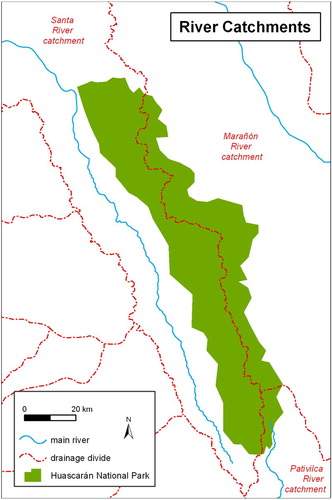
The total number of mapped features is shown in with respect to the main river catchments of the Cordillera Blanca mountain range (Santa River, Marañon and Pativilca catchments – see also ). Most of the lakes are located behind bedrock or moraine dams (581 and 588, respectively); moreover, an additional 500 lakes are of a combined origin (moraine + bedrock dam). Altogether this represents 1669 out of 2370 lakes (70%). The second largest group is made up of 582 supraglacial lakes (24%), which are the most unstable in terms of future evolution. Finally, other types of lakes represent only 6%
Figure 1. Huascarán national park divided into three catchments.
The majority of the shown moraine ridges (66%) belong to an unspecified class, while fractured moraines represent only 2% of the total and these were only identified in the Santa River catchment. Double-crested and ridge-top moraine ridges, which potentially represent the most unstable features, together represent 21%. We identified 81 fossil lakes filled with sediment, 38 debris-covered glaciers and only 5 rock glaciers in the whole study area.
The inventory of the above-mentioned landforms and lakes is the state of the art regarding the data sources of Google Earth available between May and December 2013. It can be expected that the accuracy of remotely sensed images will improve in the future and the inventory could be updated, particularly with respect to small lakes, showing changes through time. Use of the most recent information is important since many of the lakes and moraine ridges are undergoing intensive evolution due to ongoing deglaciation (e.g. CitationGeorges, 2004; CitationSilverio & Jaquet, 2005). This will be the subject of future research on this topic and will include an interpretation of the results on the genesis and spatial distribution of lakes with regard to altitude zones, and so on. Several small lakes, found mainly at lower altitudes, are also ephemeral as the rainy period is strongly pronounced in this area.
5. Conclusions
The map is based on an inventory of selected glacier-related landforms and glacial lakes prepared for the entire Huascarán National Park (Cordillera Blanca). From this perspective, it represents the most detailed and complete inventory with 2370 lakes and their dam types. In the Huascarán National Park, 24.5% of the lakes have bedrock dams while 24.8% are dammed by moraines. The other two classes that are significantly represented are supraglacial lakes (24.6%) and lakes with a combined type of dam (all together 24.1%). This spatially distributed information, along with the other two lake dam types, forms a region-wide database of one of the most important characteristics used in GLOF hazard assessment. Up to 1248 moraine ridges longer than 200 m were classified into six types, which were defined to provide useful information for future hazard studies. Additional landforms like rock glaciers, debris-covered glacier tongues and filled old lake basins are also shown on the map.
Software
Google Earth was used for the geomorphological mapping of selected features. The results were imported in to Esri ArcGIS 10.1 as shapefiles where all of the analyses, as well as the compilation of the final map, were performed.
GLACIER-RELATED LANDFORMS AND GLACIAL LAKES Huascarán National Park, Peru
Download PDF (35.8 MB)Funding
The authors would like to thank the Grant Agency of the Czech Republic for their scientific and financial support [Project GACR P209/11/1000], Ing. Alejo Cochachin, and others from the Autoridad Nacional del Agua (Huaraz). This work was also carried out thanks to the support of the long-term conceptual development research organization [RVO: 67985891].
Related Research Data
References
- Ames, A. M., & Francou, B. (1995). Cordillera Blanca – glaciares en la historia. Bulletin de l'Institut Français d'Etudes Andines, 24(3), 37–64.
- ANA. (2012). Inventario nacional de glaciares y lagunas – Inventario de lagunas de las Cordillera Blanca (Resumen). Lima: ANA, 31 pp.
- Broggi, J. A. (1942). Informe preliminar sobre la exploracion y estudio de las condiciones de estabilidad de las lagunas de la Cordiller Blanca. Lima. 14 pp. Unpublished Report.
- Bury, J. T., Mark, B. G., Mckenzie, J. M., French, A., Baraer, M., Huh, K. I., … Gómez López, R. J. (2011). Glacier recession and human vulnerability in the Yanamarey watershed of the Cordillera Blanca, Peru. Climatic Change, 105(1), 179–206.
- Carey, M. (2005). Living and dying with glaciers: People's historical vulnerability to avalanches and outburst floods in Peru. Global and Planetary Change, 47, 122–134.
- Carey, M., French, A., & O'Brien, E. (2012a). Unintended effects of technology on climate change adaptation: An historical analysis of water conflicts below Andean Glaciers. Journal of Historical Geography, 38(2), 181–191.
- Carey, M., Huggel, C., Bury, J., Portocarrero, C., & Haeberli, W. (2012b). An integrated socio-environmental framework for glacial hazard management and climate change adaptation: Lessons from lake 513, Cordillera Blanca, Peru. Climatic Change, 112, 733–767.
- Concha, J. F. (1951). Origen de las lagunas, Corporación Peruana del Santa, división de geología y seguridad de lagunas. Huaraz: Corporación Peruana del Santa. 4 pp. Unpublished Report.
- Deverchér, J., Dorbath, C., & Dorbath, L. (1989). Extension related to a high topography: Result from a microearthquake survey in the Andes of Peru and tectonic implications. Geophysical Journal International, 98, 281–292.
- Emmer, A., & Cochachin, A. R. (2013). The causes and mechanism of moraine-dammed lake failures in the Cordillera Blanca, North American Cordillera, and Himalayas. AUC Geographica, 48(2), 5–15.
- Emmer, A., Loarte, C. E., Klimeš, J., & Vilímek, V. (2015). Recent evolution and degradation of the bent Jatunraju glacier (Cordillera Blanca, Peru). Geomorphology, 228(1), 345–355.
- Emmer, A., & Vilímek, V. (2013). Review article: Lake and breach hazard assessment for moraine-dammed lakes: An example from the Cordillera Blanca (Peru). Natural Hazards and Earth System Science, 13, 1551–1565.
- Emmer, A., Vilímek, V., Klimeš, J., & Cochachin, A. R. (2014). Glacier retreat, lakes development and associated natural hazards in Cordilera Blanca, Peru. In W. Shan, Y. Guo, F. Wang, H. Marui, & A. Strom (Eds.), Landslides in cold regions in the context of climate change (pp. 231–252). Cham: Springer
- Georges, C. (2004). The 20th century glacier fluctuations in the tropical Cordillera Blanca, Peru. Arctic, Antarctic, and Alpine Research, 36, 100–107.
- Glasser, N. F., Clemmens, S., Schnabel, C. H., Fenton, C. R., & McHargue, L. (2009). Tropical glacier fluctuations in the Cordillera Blanca, Peru between 12.5 and 7.6 ka from cosmogenic 10Be dating. Quaternary Science Reviews, 28(27–28), 3448–3458.
- Glasser, N., & Jansson, K. (2008). The glacial map of southern South America. Journal of Maps, 175–195. doi:10.4113/jom.2008.1020.
- Hastenrath, S. (1991). Climate dynamics of the tropics. Dordrecht: Kluwer Academic.
- Hegglin, E., & Huggel, C. (2008). An integrated assessment of vulnerability to glacial hazards – a case study in the Cordillera Blanca, Peru. Mountain Research and Development, 28, 299–309.
- Hubbard, B., Heald, A., Reynolds, J. M., Quincey, D., Richardson, S. D., Zapata, M. L., … Hambrey, M. J. (2005). Impact of a rock avalanche on a moraine-dammed proglacial lake: Laguna Safuna Alta, Cordillera Blanca, Peru. Earth Surface Processes and Landforms, 30, 1251–1264.
- Huggel, C., Haeberli, W., Kääb, A., Bieri, D., & Richardson, S. (2004). An assessment procedure for glacial hazards in the Swiss Alps. Canadian Geotechnical Journal, 41, 1068–1083.
- Kasser, G., Ames, A., & Zamora, M. (1990). Glacier fluctuations and climate in the Cordillera Blanca, Peru. Annals of Glaciology, 14, 136–140.
- Klimeš, J. (2012). Geomorphology and Natural Hazards of the selected glacial valleys, Cordillera Blanca, Peru. AUC Geographica, 47(2), 25–31.
- Klimeš, J., Benešová, M., Vilímek, V., Bouška, P., & Cochachin, A. R. (2014). The reconstruction of a glacial lake outburst flood using HEC-RAS and its significance for future hazard assessments: An example from Lake 513 in the Cordillera Blanca, Peru. Natural Hazards, 71, 1617–1638.
- Klimeš, J., Vilímek, V., & Omelka, M. (2009). Implications of geomorphological research for recent and prehistoric avalanches and related hazards at Huascaran, Peru. Natural Hazards, 50(1), 193–209.
- Liboutry, L., Morales, B. A., Pautre, A., & Schneider, B. (1977). Glaciological problems set by the control of dangerous lakes in Cordillera Blanca, Peru. I. Historical failures of moranic dams, their causes and prevention. Journal of Glaciology, 18, 239–254.
- Lucas, S., & Sass, O. (2011). The formation of Alpine lateral moraines inferred from sedimentology and radar reflection patterns: A case study from Gornergletscher, Switzerland. In I. P. Martini, H. M. French, & A. Péréz Alberti (Eds.), Ice-marginal and periglacial processes and sediments (pp. 77–92). London: Geological Society, Special Publication 354.
- Lucas, R., & Trombotto, L. D. (2012). Glaciares de escombros fósiles en el Cordón Leleque, Noroeste del Chubut: Significado Paleoclimático y paleogeográfico. Revista de la Asociación Geológica Argentina, 69(3), 418–435.
- Mark, B. (2002). Observations of modern deglaciation and hydrology in the Cordillera Blanca. Acta Geodynamica et Geomaterialia, 19, 23–36.
- Marquez, A. A. (1988). Glacier inventory of Peru. Huaraz: auspiciada por el consejo nacional de ciencia y tecnologia CONCYTEC.
- Morales, B. A. (1966). Estudio de las lagunas Rajucolta y Cashan. Lima: Corporación Peruana del Santa, división de geología y seguridad de lagunas. 8 pp.
- Oppenheim, V. (1946). Sobre las lagunas de Huaráz. Boletin de la sociedad geologica del Peru 19, 68–80.
- Potere, D. (2008). Horizontal positional accuracy of Google Earth's high-resolution imagery archive. Sensors, 8, 7973–7981.
- Rabatel, A., Francou, B., Soruco, A., Gomez, J., ĆAceres, B., Ceballos, J. L., … Wagnon, P. (2013). Current state of glaciers in the tropical Andes: A multi-century perspective on glacier evolution and climate change. The Cryosphere, 7, 81–102.
- Reynolds, J. M. (2003). Development of glacial hazard and risk minimisation protocols in rural environments. Methods of glacial hazard assessment and management in the Cordillera Blanca, Peru. Flintshire: Reynolds Geo-Sciences. 72 pp.
- Rodbell, D. T., & Selzer, G. O. (2000). Rapid ice margin fluctuations during the younger Dryas in the Tropical Andes. Quaternary Research, 54, 328–338.
- Schwartz, D. P. (1988). Paleoseismicity & neotectonics of the Cordillera Blanca fault zone, Northern Peruvian Andes. Journal of Geophysical Research, 93, 4712–4730.
- Silverio, W., & Jaquet, J. M. (2005). Glacial cover mapping (1987–1996) of the Cordillera Blanca (Peru) using satellite imagery. Remote Sensing of Environment, 95, 342–350.
- Solomina, O., Jomelli, V., Kaser, G., Ames, A., Berger, B., & Pouyaud, B. (2007). Lichenometry in the Cordillera Blanca, Peru: “Little Ice Age” moraine chronology. Global and Planetary Change, 59, 225–235.
- Thompson, L., Mosley-Thompson, E., & Henderson, K. (2000). Ice-core paleoclimate records in tropical South America since the last glacial maximum. Journal of Quaternary Science, 15, 377–394.
- Unidad De Glaciología Y Recursos Hídricos. (2010). Inventario de glaciares, Cordillera Blanca, Peru. Huaraz: Autoridad Nacional del Agua. 81 pp.
- Vilímek, V., & Zapata, M. L. (1998). Geomorphological response of neotectonic activity along the Cordillera Blanca fault zone, Peru. In Rosenfeld Kalvoda (Eds.), Geomorphological hazards in high mountain areas (pp. 245–262). London: Kluwer Academic, 314 p.
- Vilímek, V., Zapata, M. L., Klimeš, J., Patzelt, Z., & Santillán, N. (2005). Influence of glacial retreat on natural hazards of the Palcacocha Lake area, Peru. Landslides, 2, 107–115.
- Vilímek, V., Zapata, M. L., & Stemberk, J. (2000). Slope movements in Callejón de Huaylas, Peru. Acta Universitatis Carolinae, Geographica, 35, 39–51.
- Vuille, M., & Bradley, R. S. (2000). Mean annual temperature trends and their vertical structure in the tropical Andes. Geophysical Research Letters, 27(23), 3885–3888.
- Vuille, M., Francou, B., Wagnon, P., Juen, I., Kaser, G., Mark, B. G., & Bradley, R. S. (2008). Climate change and tropical Andean glaciers: Past, present and future. Earth-Science Reviews, 89(3–4), 79–96.
- Wilson, J., Reyes, L., & Garayar, J. (1995). Geología de los cuadrángulos de Pallasca, Tayabamba, Corongo, Pomabamba, Carhuaz y Huari. Boletín No. 16–1967 Actualizado por la Dirección de la Carta Geológica Nacional a 1995, Boletín No. 60, Serie A Carta Geológica Nacional, INGEMET, Octubre 1995, Lima, p. 64.