

Abstract
In the contemporary technological environment, access to a multitude of data sources, such as digital elevation models (DEM), slope data, and other geological information, has become essential for augmenting remote sensing imagery in landslide analysis. These datasets enhance landslide identification capabilities, but existing methods often fail to fully leverage their unique characteristics due to oversimplified fusion strategies. To overcome this challenge, we introduce the Synergistic Fusion Network (SFNet), which is specifically designed to utilize the complementary nature of geological data to significantly improve the accuracy and efficiency of landslide segmentation. SFNet incorporates Multi-Source Fusion Modules (MSFM) and Reverse Feature Refinement Modules(RFRM), through an innovative network architecture, enhancing remote sensing imagery with integrated geological information. In our experiments, SFNet outperforms existing mainstream networks, demonstrating superior F1 scores, thereby showcasing its ability to effectively segment landslide regions with high precision. This advancement highlights the importance of considering the unique contributions of each data source, especially the complementary effects of geological information.
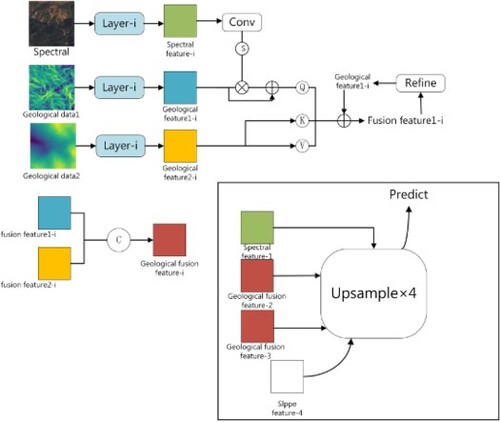
GRAPHICAL ABSTRACT
Disclosure statement
No potential conflict of interest was reported by the author(s).