
Digital Earth is a virtual representation of the planet, encompassing all its systems and forms, including human societies, manifested as a multidimensional, multiscale, multitemporal, and multilayer information facility (Goodchild et al. Citation2012). The Digital Earth vision envelops the vast array of technologies, information frameworks, organizational standards, along with applications across a spectrum of disciplines, and many educational and grassroots operational needs (Guo Citation2008).
A workshop on next generation Digital Earth (Craglia et al. Citation2012) attempted to describe what the vision is for taking Digital Earth into the future. First, it encompasses a diversity of information in time and space, including past, present, and future. It incorporates participation, interaction, and collaboration among users and needs to cater for a range of users and purposes. Secondly, it needs to provide information about relationships, information and workflows, networks and other activities that occur on our earth. In other words, it needs to provide the necessary technologies and information manipulated by appropriate analytical tools to diverse users who participate in activities and modeling of our earth.
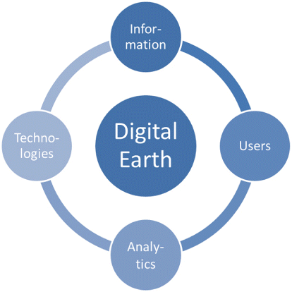
This Analytical Geospatial Digital Earth special journal issue gives a taste of this four-fold focus on Digital Earth: diverse information integration, participatory users, engaging analytical and visual capabilities and flexible, contextual technologies that enable this to happen (). The papers selected for this issue were invited and flowed on from many of the original submissions to the Second International Workshop on Web Mapping, Geoprocessing and Services held in Vancouver, Canada in August 2011. Collectively, the five papers in this edition identify 2D/3D visual comparative tools, adaptive profiles to cater for different users and technologies, exploratory and analytical framework for health geovisualization, mapping, and visualization of human ideas and concepts, and optimizing technology to enable collaboration in crisis situations.
Valentini, Brovelli, and Zamboni (Citation2012) present a multidimensional web mapping system that provides users with a 3D-virtual globe view in one frame alongside another frame with a 2D view. The views are synchronized to provide the user with traditional and immersive geovisual perspectives and the opportunity to navigate historical and cultural maps and digital cities over time. This integrated and synchronized environment provides historians and professional users with a rich experience to browse and visualize Digital Earth maps in space and time.
As an increasing number of users access virtual earth technologies, the diversity of devices and types of users provide a challenge for integrating them in a functional way. Delfos, Veenendaal, and Tan (Citation2013) outline a solution through the use of adaptive profiles that are aligned to cater for particular users and technical environments. Such contextual information applied to the user view of web mapping and Digital Earth technologies can enhance the user experience and be customized to a wide range of mobile devices used for compatible and adaptive access of web mapping systems.
Not only an increasing number of users, but also an increasing number of datasets is becoming available via the Web. Health information is critical to every place and person in our world, and the Digital Earth technologies create an excellent environment to visualize and explore the underlying trends and patterns relating to our health. Moncrieff et al. (Citation2013) describe an open source, server-side framework that provides a dynamic and flexible visualization and analysis of health data for health experts.
Our geographic landscapes can be identified, not just with physical properties or environmental properties such as health, but also with information captured from ideas and events posted throughout the Internet. Tsou et al. (Citation2013) describe how web information can be geolocated to produce a landscape map associated with specific keywords, concepts, ideas, or news. Obviously, such visualizations of our virtual earth can reveal interesting geospatial relationships, behaviors, and understandings not previously identified.
Access to information in space and time is particularly crucial in applications such as crisis mapping and disaster management. What happens when the fundamental information communications infrastructure fails in a disaster emergency area? Kawamura et al. (Citation2013) outline how they have utilized geographic information systems (GIS) to establish a ZigBee communications network system for the disaster-stricken region of Tsukuba City, Japan.
This special issue is devoted to the theme of web-based GIS, mapping services, and spatial analytics supporting Digital Earth technologies and applications. The five selected papers cover some aspects of the Digital Earth that cover the vast array of technologies, information frameworks, organizational standards, along with applications across a spectrum of disciplines, and many educational and grassroots operational needs. However, we trust that their contribution to this rapidly developing field will provide useful insights and stimulate more focused scientific discussions.
We would like to thank all contributing authors, including those whose papers were not selected for publication in this special issue. Special thanks go to the many anonymous reviewers, whose contributions are important to the publication of this special issue. Finally, we would like to extend our thanks to the Editor-in-Chief, Professor Huadong Guo, and the Executive Editor, Dr Changlin Wang, for their support and guidance.
Bert Veenendaal
Curtin University, Perth, WA, Australia
Songnian Li
Ryerson University, Toronto, ON, Canada
Suzana Dragicevic
Simon Fraser University, Burnaby, BC, Canada
Maria Antonia Brovelli
Politecnico di Milano, Como, Italy
References
- Craglia, M., K. de Bie, D. Jackson, M. Pesaresi, G. Remetey-Fülöpp, C. Wang, A. Annoni, et al. 2012. “Digital Earth 2020: Towards the Vision for the Next Decade.” International Journal of Digital Earth 5 (1): 4–21. doi:10.1080/17538947.2011.638500.
- Delfos, J., B. Veenendaal, and T. Tan. 2013. “Enhancing Accessibility to Web Mapping Systems with Technology-Aligned Adaptive Profiles.” International Journal of Digital Earth 1–23. doi:10.1080/17538947.2013.805260.
- Goodchild, M. F., H. Guo, A. Annoni, L. Bian, K. de Bie, F. Campbell, M. Craglia, et al. 2012. “Next-Generation Digital Earth.” Proceedings of the National Academy of Sciences of USA 109: 11088–11094. doi:10.1073/pnas.1202383109.
- Guo, H. 2008. “Founding International Journal of Digital Earth with Taylor & Francis.” International Journal of Digital Earth, Taylor & Francis, Editors’ Bulletin 4 (1): 9–12. April 2008.
- Kawamura, Y., A. M. Dewan, B. Veenendaal, M. Hayashi, T. Shibuya, I. Kitahara, H. Nobuhara, et al. 2013. “Using GIS to Develop a Mobile Communications Network for Disaster-Damaged Areas.” International Journal of Digital Earth 1–15. doi:10.1080/17538947.2013.808277.
- Moncrieff, S., G. West, J. Cosford, N. Mullan, and A. Jardine. 2013 “An Open Source, Server-Side Framework for Analytical Web Mapping and Its Application to Health.” International Journal of Digital Earth 1–22. doi:10.1080/17538947.2013.786143.
- Tsou, M.-H., I.-H. Kim, S. Wandersee, D. Lusher, L. An, B. Spitzberg, D. Gupta, et al. 2013. International Journal of Digital Earth 1–20. doi:10.1080/17538947.2013.781240.
- Valentini, L., M. A. Brovelli, and G. Zamboni. 2012. “Multi-Frame and Multi-Dimensional Historical Digital Cities: The Como Example.” International Journal of Digital Earth 1–15. doi:10.1080/17538947.2012.739662.