The National Council for Geographic Education GeoCamp Iceland is a unique field experience designed to energize, inspire, and edify experienced and novice geography teachers. The 2015 institute (nineteen participants from fourteen states) was designed for K–12 educators and in 2017 (twenty-one participants from eighteen states and Washington, DC) was broadened to include higher education faculty. The intentional mix of instructional levels and diverse subject-matter expertise enriches everyone's experience, and the learning activities draw on participants' creativity, instructional methods, and background knowledge. The institute provides a structure for exploring Iceland while learning geography through experiential learning and inquiry.
THE ORIGIN OF NCGE GEOCAMP ICELAND
Serendipity played a key role in the formation of the NCGE–GeoCamp Iceland partnership. In fall 2013, Zachary Dulli and Jacqueline Waite attended a special event at the home of Iceland's ambassador at the time, Guðmundur Árni Stefánsson. The agenda featured a presentation by Ólafur Jon Arnbjörnsson and his son, Arnbjörn Olafsson (note the Icelandic naming convention), describing a promising educational initiative offering Iceland as a classroom for students from all over the world. Arnbjörnsson was a friend of the ambassador and personally acquainted with many educators and other people in Iceland, including even the president at that time. Arnbjörnsson has built GeoCamp Iceland around field-based educational experiences dedicated to increasing knowledge through practical and active learning. The organization is structured to receive international study groups of secondary school students, college students, and teacher groups focusing primarily on geology, geography, natural sciences, and renewable energy. Dulli and Waite immediately saw GeoCamp Iceland as a once-in-a-lifetime professional development opportunity for geography educators.
Waite continued communicating with Arnbjörnsson to move the planning forward. She also contacted Robert Morrill to draw upon his experience as a teacher-educator and leader of international field experiences. A year after the presentation in Washington, DC, Waite, Morrill, and Dulli were in Iceland talking with Arnbjörnsson about contemporary education issues over lamb stew and Einstök beer like old friends. Arnbjörnsson's educational philosophy, many years of experience as a high school principal, dedication to field experience, and personal warmth fit naturally into the NCGE milieu. The reconnaissance in Iceland affirmed the importance of experiencing a place with local “geographers” who know the place intimately in all its dimensions. It is essential to learn directly from an insider's sense of place. Moreover, Arnbjörnsson was able to draw upon his web of professional and personal relationships to create a unique, cost-effective field-based learning experience. The first NCGE GeoCamp Iceland: Exploring Iceland's Changing Landscapes and Diverse Environments was launched in July 2015.
GROUNDING THE COURSE
Given the diversity of disciplines (e.g., environmental science, history, English language arts, and math) taught by the GeoCamp participants, a course frame was essential. NCGE GeoCamp Iceland introduced and reinforced the power of a geographic perspective by using Susan CitationHanson's (2004) “geographic advantage” as a centering source for seeing the world in spatial terms. She states succinctly and compellingly what geography brings to inquiries and reflections concerning changing conditions on Earth and the human condition in general. For her, “the geographic advantage” communicates the truth that geographers have something to offer that others do not. Geographic investigations are distinguished from approaches used in other disciplines. Geographers consider the following:
| 1. | Relationships between people and the environment Our planet and the people living on it are constantly changing. Identifying and understanding relationships between people and environments are critical to designing a sustainable future. | ||||
| 2. | The importance of spatial variability Geographers know and understand the importance of spatial variability and the place-dependence of processes. | ||||
| 3. | Processes operating at multiple and interlocking geographic scales Analysis of an issue or problem at different scales may assist geographers in understanding connections and patterns. For example, interesting shifts in the location of U.S. population may reveal new information when viewed at census tract, community, county, state, or regional scales. | ||||
| 4. | The integration of spatial and temporal analysis Geographers rely on historical and current records to analyze an issue or problem. Additional perspectives can provide a deeper, more accurate analysis of events in both physical and human systems. | ||||
“…using Susan CitationHanson's (2004) ‘geographic advantage’ as a centering source for seeing the world in spatial terms.”
Course objectives envisioned participants being able to:
| 1. | Explain “the geographic advantage” as a perspective for observing the world. | ||||
| 2. | Ask and answer geographic questions. | ||||
| 3. | Explicitly connect course curriculum to geography content, perspectives, and skills. | ||||
| 4. | Design inquiry-based geographic fieldwork and/or classroom activities for students and colleagues modeled on the experiences in Iceland. | ||||
The course focuses on inquiry in recognition that geography is best learned through developing and exploring compelling questions that are at the heart of issues directly relevant to our lives or are inherently interesting. Geographical inquiry applies an investigative, spatial thinking approach to knowledge and knowledge construction (CitationRoberts 2013, 9) where every question can be followed by a hypothesis or prediction. Good questions draw learners in and engage them in ownership of the learning process. They create a “need to know” that sustains the learner through inevitable challenges (see CitationNational Council for the Social Studies 2013). In this case, our course questions interrogated topics such as geothermal energy, natural hazards, Iceland's geopolitical position, and general geographic themes such as sense of place.
“…geography is best learned through developing and exploring compelling questions…”
Field courses allow for full emersion inquiry (CitationWiddowson and Parkinson 2013). We examined different ways to do geography and to be geographers while in the field. The participants traversed many environments by bus and on foot, gathering written notes, sound recordings, and photographic evidence of many things such as interesting patterns of economic development encouraged by a surplus of geothermal waste-water; the extent of vegetative growth (not much—why?) on millennia-old lava; the movement of people and products at a coastal fish-processing plant; the damp feel of traditional sod-rooved houses, and the layout and position of the former NATO base that served as the groups' home.
This collection of lessons and activities developed by GeoCamp participants touches on their experiences in Iceland and the impact it has had on their practice. Read how Dean Butzow's students at Lincoln Land Community College practice fieldwork through the simple act of observing clouds and keeping a cloud journal. Inspired by developing his own sense of place in Iceland, he asks students to respond to the following: “Please provide a brief factual description of the landscape you are currently experiencing with any or all senses. What is there? Where is it? How is it arranged? How did it make you feel? Why is it important to you?” (Butzow this issue). Students' responses show how developing a sense of place can provide context and meaning to the scientific concepts of weather and climate.
Tracy Law builds an engaging lesson asking students at The Summit Country Day School in Cincinnati, Ohio, to consider the bidirectional nature of human–environmental interaction. Students examine the role of earthquakes, volcanoes, and geothermal energy on Iceland's culture and economic development. Students also explore the relationship between climate and Icelandic architecture and building materials through the images Law captured on her trip.
Laura Price offers a way to connect the challenges of disposing of the waste we produce with the challenges of living in a geographically isolated location.
Jessica Parra develops a unit around the concept of energy, beginning each day with a compelling question or problem. Her elementary students practice researching their own energy use and are charged with evaluating alternative energy sources, all while practicing science and literacy skills.
Additional information
Notes on contributors

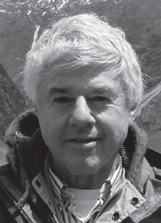
Robert W. Morrill
Robert W. Morrill, Professor Emeritus and Treasurer of the Virginia Geographic Alliance, is a primary author for Guidelines for Geographic Education (1984), Geography for Life: National Standards in Geography (1994), Lead Geography Writer for College, Career, and Civic Life (C3) Framework for Social Studies State Standards (2012–2013).

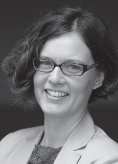
Jacqueline L. Waite
Jacqueline L. Waite formerly served as Co-CEO/Director of Educational Affairs at the National Council for Geographic Education, where she developed relationships with GeoCamp Iceland, leading to the first NCGE teacher institute. Dr. Waite currently teaches geography and international affairs part time at Trinity Washington University and volunteers as a North American representative of GeoCamp.
REFERENCES
- Hanson, S. 2004. Who are “we”? An important question for geography's future. Annals of the Association of American Geographers 94 (4): 715–722.
- National Council for the Social Studies. 2013. The College, Career, and Civic Life (C3) Framework for Social Studies State Standards: Guidance for Enhancing the Rigor of K12 Civic, Economics, Geography and History. Silver Spring, MD.
- Roberts, M. 2013. Geography Through Enquiry: Approaches to Teaching and Learning Geography. Sheffield, UK: The Geographical Association.
- Widdowson, J., and A. Parkinson 2013. Fieldwork Through Enquiry. Sheffield, UK: The Geographical Association.
