Article title: Human-Induced Resource Scarcity in the Colorado River Basin and Its Implications for Water Supply and the Environment in the Mexicali Valley
Transboundary Aquifer
Authors: J. Rubio-Velázquez, H. A. Loaiciga, and D. Lopez-Carr
Journal: Annals of the American Association of Geographers
DOI: https://doi.org/10.1080/24694452.2022.2162477
Following online first publication of this article, it was noticed that the Figure images and captions were not correctly aligned. The figure images and corresponding captions were amended in the PDF and XML version of the article online first and ahead of issue publication.
Figure 1 The Mexicali Valley (within red line) lies within the Colorado River delta. The perimeters of the Imperial Valley and of the Colorado River delta are respectively depicted within yellow and blue (dashed) lines. The aquifer studied in this work underlies the Mexicali Valley (within the red line).
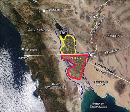
Figure 2 The binational Colorado River basin. The upper and lower basins are displayed in blue and pink colors, respectively.
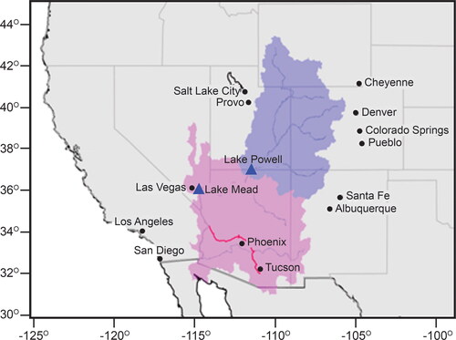
Figure 3 Annual Colorado River flow at Lees Ferry (1922–2020).
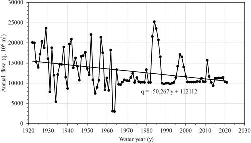
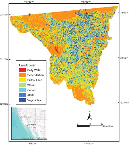
Figure 4 Map of the crop types and land cover determined for the Mexicali Valley.