Figures & data
Figure 1 Location map of Waka Nui-1 and some of the more modern seismic data (red lines) tied to the well.
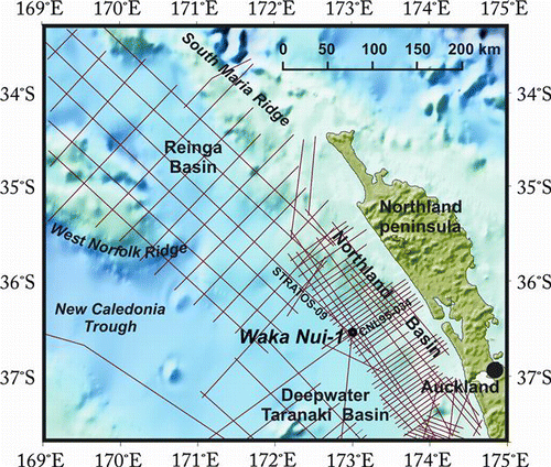
Figure 2 Summary of Waka Nui-1 well data showing gamma ray (GR), resistivity (LWD), density (RHOB) and neutron porosity (TNPH) logs, lithology and stratigraphy (from Waka Nui-1 Well Sheet 1:10,000, version 3.06.2008, Enclosure 1 of Stagpoole et al. 2009).
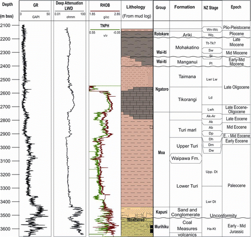
Figure 3 TWT–depth relationship for the Waka Nui-1 well (grey line connecting blue dots). Crosses show the stacking velocity data derived during processing of the seismic data on nearby seismic lines and the red line shows the interval velocities calculated from seismic or TWT–depth function.
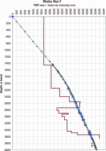
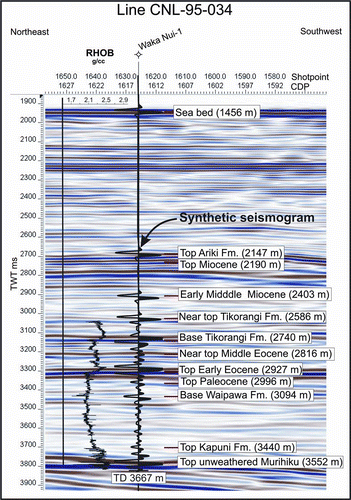
Figure 4 Seismic data from line CNL95-034 at the Waka Nui-1 well with overlays showing the density log (RHOB converted to TWT-left of well), a synthetic seismogram (overlaid on the well) and depths of formations (to the right of well).