Figures & data
Figure 1. Maps showing (a) the boundaries of Palmerston North city (x = central business district) and the location of two study areas (A = urban area; B = urban-rural fringe area) relative to the city boundaries, and locations of the poultry-positive (![]() ) and -negative (
) and -negative (![]() ) land parcels in mesh-blocks comprising (b) the urban area, and (c) urban-rural fringe area.
) land parcels in mesh-blocks comprising (b) the urban area, and (c) urban-rural fringe area.
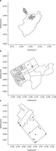
Table 1. Details of the total number of land parcels, the number of land parcels surveyed, and the number of surveyed land parcels with backyard poultry in urban and urban-rural fringe areas within and adjacent to the city of Palmerston North.
Table 2. Details of the number of birds kept, and management of backyard poultry in urban and urban-rural fringe areas within and adjacent to the city of Palmerston North.
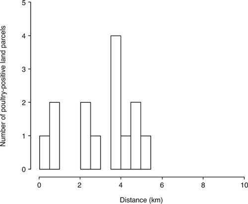
Figure 2. Frequency histogram for poultry-positive land parcels within specified distances of a commercial poultry enterprise within an urbanrural fringe area adjacent to the city of Palmerston North.
Supplemental material