Figures & data
Fig. 1 Map of the study area: Chaliyar watershed, India.
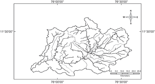
Fig. 2 Chaliyar watershed—land-use/land-cover classification (from SWAT).
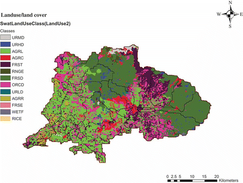
Fig. 3 Chaliyar watershed—soil texture classification (from SWAT).
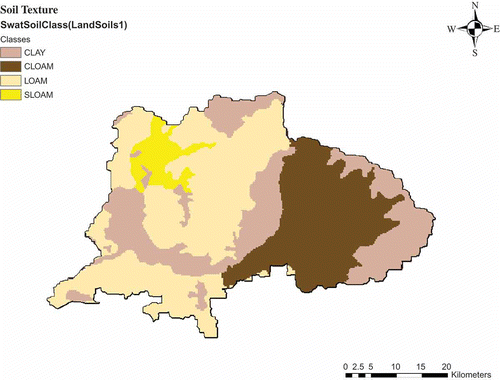
Fig. 4 Chaliyar watershed with weather stations and river gauge station (from SWAT).
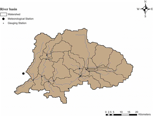
Fig. 5 DEM of the Chaliyar watershed in grid format.
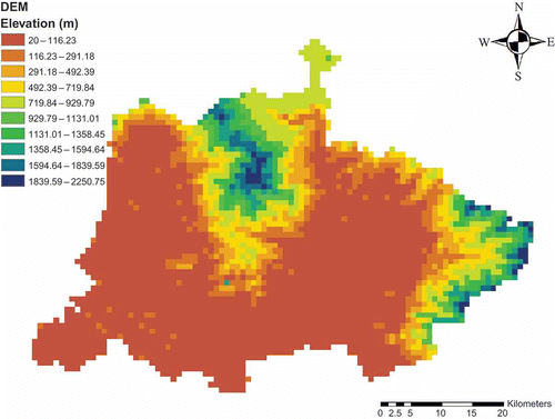
Table 1 Summary of input data for the SWAT model
Table 2 Details of land-use/land cover classifications from SWAT
Table 3 Crop growth values linked to SWAT database
Fig. 6 Location of Kerala and the Chaliyar River basin in the PRECIS domain.
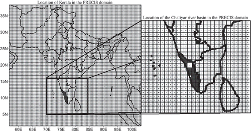
Fig. 7 Comparison of present and bias-corrected future scenario daily precipitation during the monsoon season.
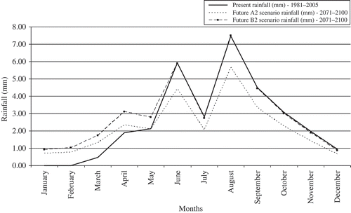
Fig. 8 Comparison of present and bias-corrected future scenario maximum and minimum temperatures.
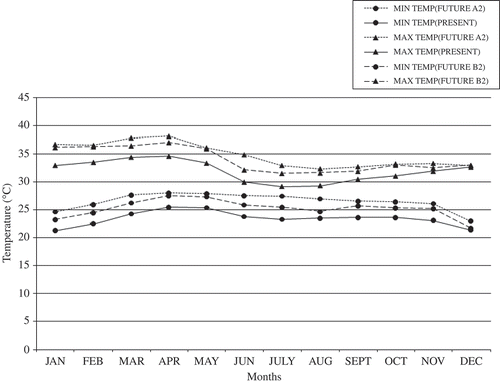
Fig. 9 Plots of (a) observed and (b) simulated streamflow for the calibration period.
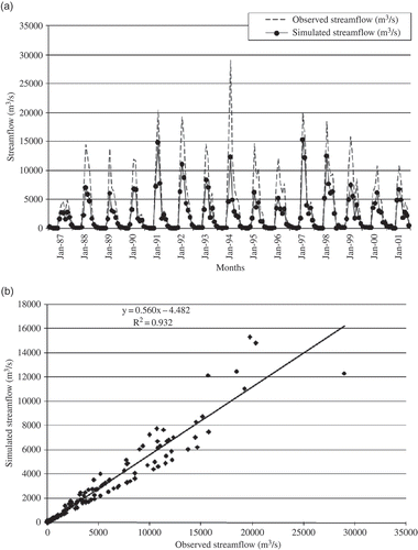
Fig. 10 Plots of (a) observed and (b) simulated streamflow for the validation period, 2002–2006.
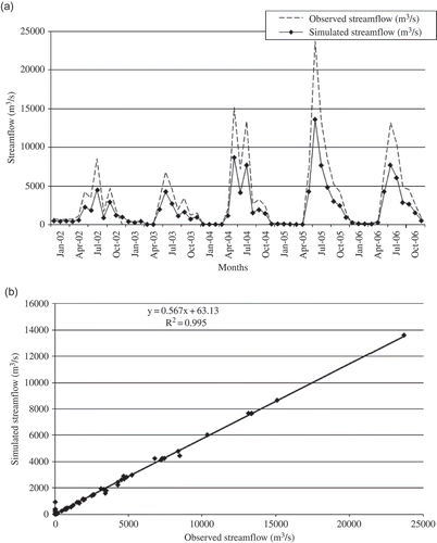
Table 4 Overview of parameter changes for calibration of SWAT
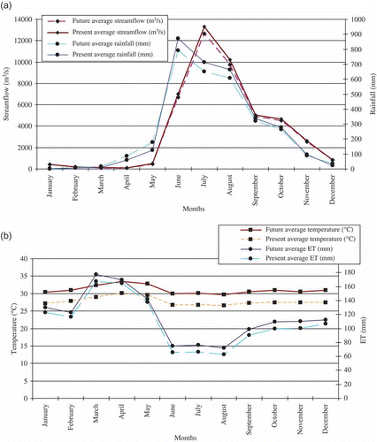
Fig. 11 (a) Observed and projected monthly streamflow and rainfall—A2 scenario; and (b) observed and projected monthly average temperature and ET—A2 scenario; average of 25 years.
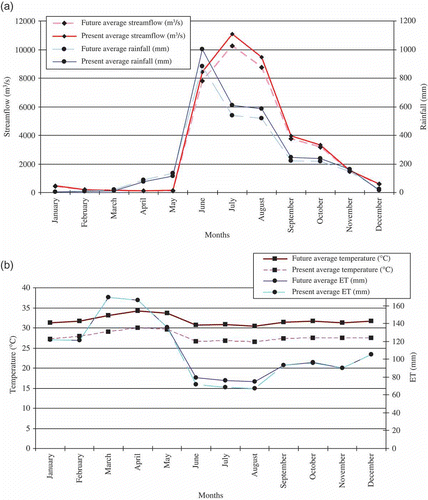
Fig. 12 (a) B2 scenario—observed and projected monthly streamflow and rainfall; and (b) observed and projected monthly average temperature and ET, average of 25 years.