
Figures & data
Fig. 1 Nineteen study reaches located in the Thomson, Broken, Goulburn and Loddon river catchments, Victoria, Australia (see for site details).
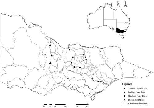
Table 1 Site characteristics: cross-sections, reach length, valley confinement and Köppen climate region.
Table 2 Streamflow statistics. All statistics underwent LN transformation unless otherwise noted (SQRT: square-root transformation; UT: untransformed).
Table 3 Principal component analysis.
Fig. 2 Area of bench inundation, Froude number, area of shallow water and area of deep water as a function of discharge in each survey reach of the Broken, Thomson, Loddon and Goulburn river systems.
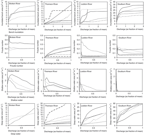
Fig. 3 Area of bench inundation, Froude number, area of shallow water and area of deep water as a function of discharge in each survey reach for lowland, midland and upland rivers.
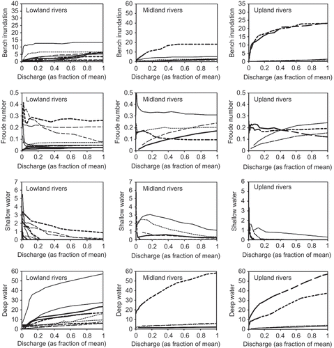
Fig. 4 Regression models for modelled vs calculated hydraulic features: (a) natural streamflow conditions and (b) alteration in streamflow statistics and hydraulic features. Symbols: × upland, ◊ midland and ☐ lowland sites.
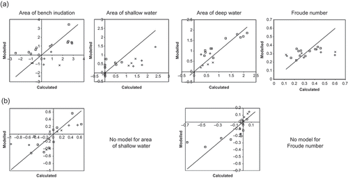
Table 4 Regression models, adjusted R2 and standard error of estimates for each hydraulic metric in the ‘natural’ and ‘alteration’ data sets.