Figures & data
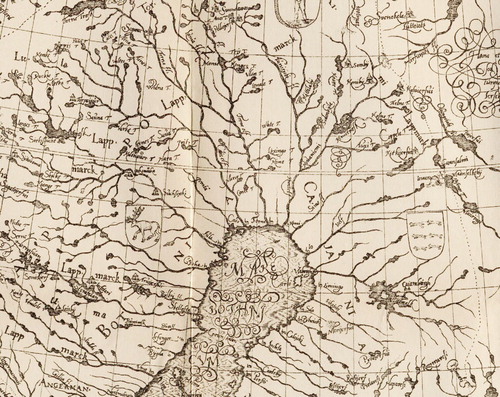
Figure 1. The Kola and White Sea areas in Simon van Salingen’s map of 1601. Source: Simon van Salingen’s map of Scandinavia (1601) (curtailed). The National Archive of Sweden, Stockholm.
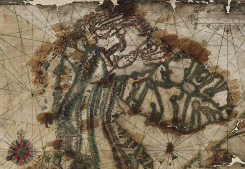
Figure 2. Detail from the copy of Simon van Salingen’s map of Scandinavia. Source: Digital copy of Simon van Salingen’s map of Scandinavia (1891) (curtailed). The A. E. Nordenskiöld collection, the National Library, Helsinki.
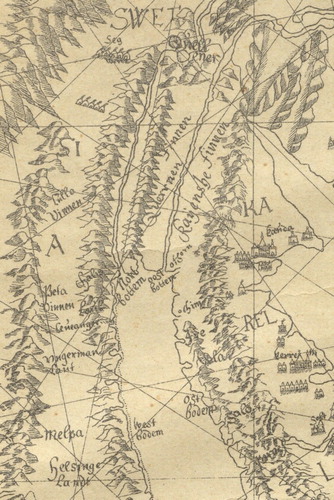
Figure 3. Anders Bureus’s Lapland map of 1611. Source: Ymer: Årgång 21:1901/Tafl. 2 (curtailed).