Figures & data
Figure 1. Relationships between residential location and travelling distance by motorized modes found in four urban regions. Sources: Nielsen (2002) (Aalborg); and data files from studies published in Næss (Citation2009) (Copenhagen Metropolitan Area); Næss et al. (Citation1995) (Greater Oslo); and Næss and Jensen (Citation2004) (Frederikshavn).
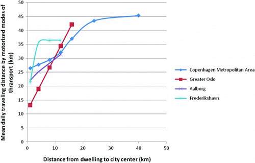
Table 1. Key urban structural, socioeconomic and health indicators for the 15 administrative districts of the municipality of Osloa
Figure 2. The 15 administrative districts of the municipality of Oslo. The downtown area is approximately equal to the district named Sentrum. “Marka” is the name of the continuous forest areas surrounding the city..
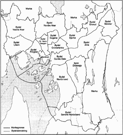
Figure 3. Expected remaining years of life among 50-year-old men (left) and women (right) within administrative districts of Oslo, with different income levels and different locations in the urban structure. Sources: Municipality of Oslo (2009) and Statistics Norway (2010a, 2010b).
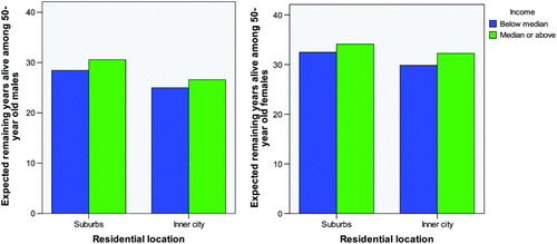
Figure 4. Number of patients per 10,000 inhabitants aged 50–79 years old treated for acute coronary infarctions in 2008 within the administrative districts of Oslo, having different income levels and different locations in the urban structure. Source: Municipality of Oslo (2009).
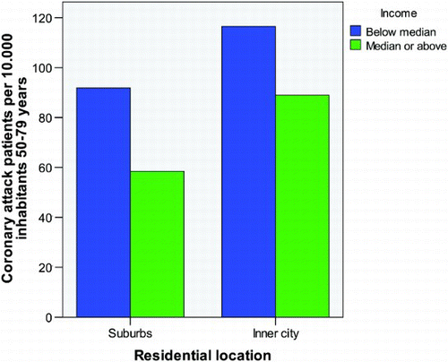
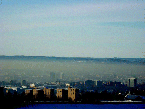
Figure 5. Smog covering the inner districts of Oslo on a calm winter day in 2011. Photograph by the author.