Figures & data
Figure 1. Three nested modeling domains for MM5 (solid square frame) and CMAQ (dashed square frame) models. (resolution is 36 km, 12 km, and 4 km, respectively) (b) The 4-km grid MM5 domain pointed with the main cities over Pearl River Delta region.
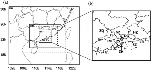
Figure 2. The emissions of (a) PM10, (b) SO2, and (c) NOx in 2004 in Guangdong province calculated by the SMOKE model.
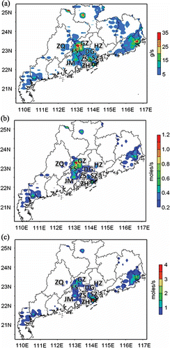
Figure 3. (a) Surface-weather chart in East Asia at 2:00 p.m. on October 11, 2004. (b) The distribution of air pollution index (API) in Guangdong province on October 11, 2004 (I: good; II: fair; III: polluted).
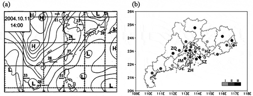
Table 1. Performance statistics of MM5 meteorological predictions during October 10–12, 2004, at Guangzhou station in different horizontal resolution
Figure 4. Temporal variations of simulated (by MM5) and observed 2-m temperature (T2), 2-m relative humidity (RH2), 10-m wind direction (WDR10), and 10-m wind speed (WSP10) at Guangzhou city during October 10–12, 2004.
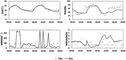
Figure 5. Simulated (by CMAQ) and observed temporal variations of PM2.5, SO2, NO, and O3 at Guangzhou site during October 10–12, 2004.
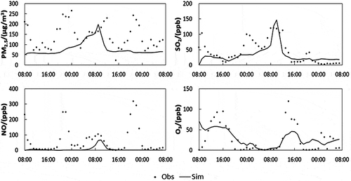
Table 2. The correlation coefficients between different cities calculated using eq 6
Figure 6. Simulated (by MM5) 10-m wind field (black arrows) and vertical velocity at 920 hPa (shaded) over PRD region at 10:00 a.m. on October 11, 2004.
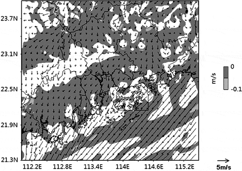
Figure 7. Classification of cities over PRD region. I. Large-emission group. II. The first downwind group. III. The second downwind group. IV. Small-emission group.
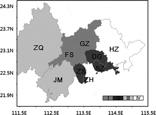
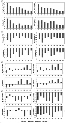
Figure 8. Hourly contributions of emissions (EMIS), dry deposition (DDEP), horizontal transport (HORI), and vertical transport (VERT) to the concentration change of PM10, PM2.5, SO2, and NOx predicted by CMAQ at (a) Guangzhou, (b) ZhongShan, (c) JiangMen, and (d) HuiZhou sites during October 10–12, 2004.
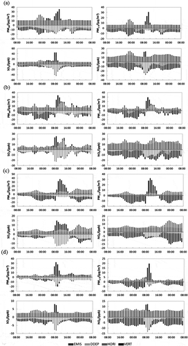
Figure 9. Average contributions of (a) emissions (EMIS), (b) dry deposition (DDEP), (c) horizontal transport (HORI), and (d) vertical transport (VERT) to the concentration change of PM10, PM2.5, SO2, and NOx predicted by CMAQ for nine cities over PRD during October 10–12, 2004.