Figures & data
Table 1. Description of case study villages
Figure 1. Study area in Rampur, Ramechhap. Maps: Google Earth.com
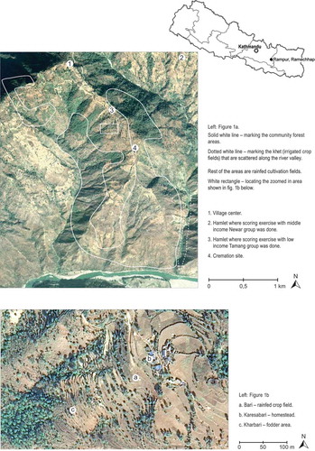
Figure 2. Study area in Silame Sakhajor, Sindhuli. Maps: Google Earth.com
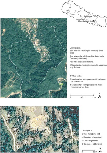
Table 2. Description of patches identified in Rampur and Silame Sakhajor. Categories in order of an assessed over all importance
Figure 3. The estimated proportion of different food crops, feeds, fuel wood and timber harvested in different land use patches in Rampur. Other constr. mtrl. - Other construction material
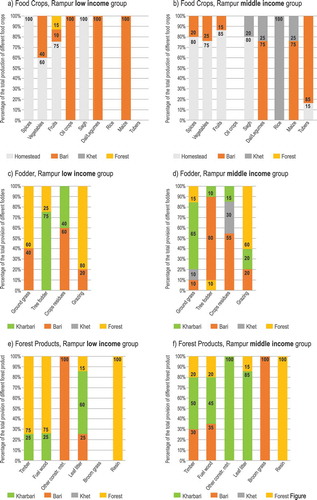
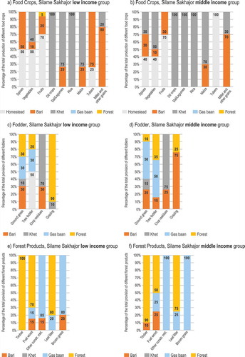
Figure 4. The estimated proportion of different food crops, feeds, fuel wood and timber harvested in different land use patches in Silame Sakhajor. Other constr. mtrl. - Other construction material