
Figures & data
Figure 1. Several perspectives on why we can read maps. a) the map is guided by reality; b) the effect of individual perception on maps is partly systematic in nature; c) maps are a medium meant to communicate information; d) the usage of a map guides how it looks like; e) contributors socially interact and align their efforts; and f) external actors influence and streamline the representations found in the map.
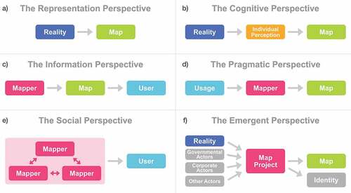
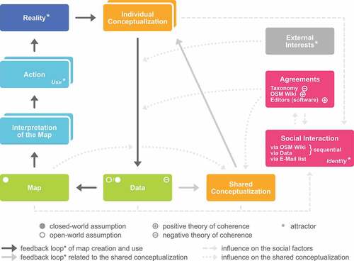
Figure 2. Simplified conceptual overview of map creation and use as a complex system. The magenta boxes (agreement and social interaction) exemplify social actors at the prototypical example of OpenStreetMap (OSM).
Data availability statement
Data sharing is not applicable to this article as no new data were created or analyzed in this study.