Figures & data
Table 1. Summary of land surface phenology studies.
Figure 1. The Mexican Yucatán Peninsula, with study area indicated in red. Circle markers show approximate location of litter measurement by Lawrence (Citation2005). Triangle marker shows the location of litter measurement by Whigham et al. (Citation1990).
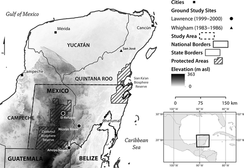
Table 2. Data used in the study.
Figure 2. Seasonal deciduousness map created using a Mahalanobis Typicality threshold for deciduousness in three Landsat TM and ETM– scenes from 2009 (16 February, 4 March, and 5April).
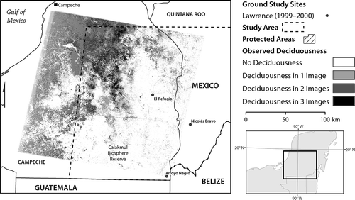
Table 3. EVI, precipitation, and temperature conditions observed during the study period, spatially extracted over the total study area (temp. = temporal).
Figure 3. Temporal profile of monthly EVI, TRMM precipitation and MODIS land surface temperature spatially averaged over the entire study area (left) and in two ˜21.5 km2 deciduous and non-deciduous target areas (right).
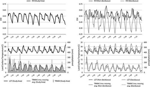
Figure 4. Spatial distribution of frequency of deciduousness (years out of 11) map for the study area. Locations of frequent deciduous dominance are concentrated in the northwest of the study area to the immediate northwest of regional uplands.
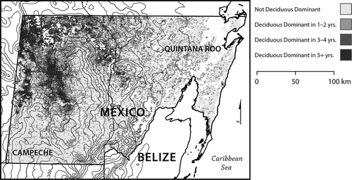
Table 4. Seasonal variability regression results, for both total-time-series and dry-season-only regressions.
Figure 5. ANOVA significance (p = 0.001) of multivariate regressions explaining EVI using same-month temperature and total precipitation in same month and prior 2 months.
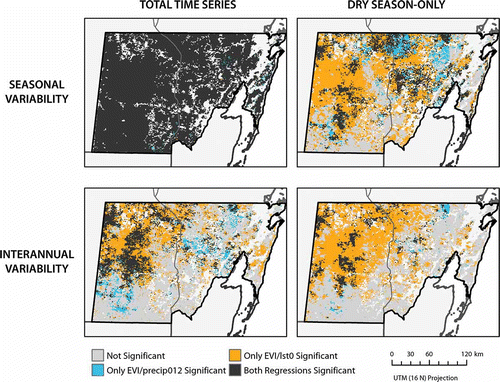
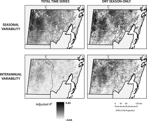
Figure 6. Spatial distribution of adjusted R 2 values for multivariate regressions explaining EVI using same-month temperature and total precipitation in same month and prior 2 months. Legend is scaled to the observed maximum and minimum adjusted R 2 values.