Figures & data
Table 1. Assessment of impervious surface estimation results from Landsat TM images for both study areas
Figure 1. Study areas – Santarém in Pará State and Lucas do Rio Verde in Mato Grosso State.
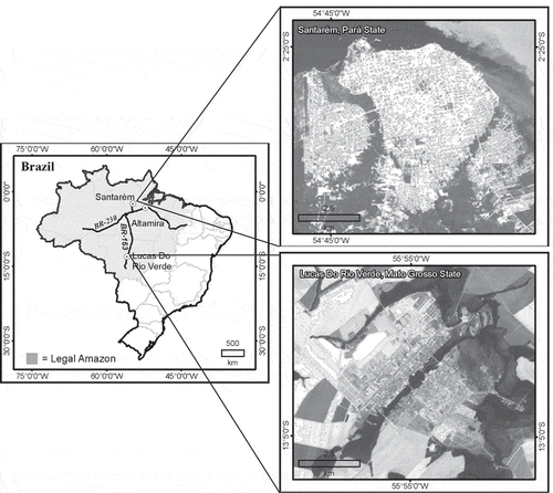
Figure 2. Strategy of mapping impervious surface distribution with Landsat TM images.
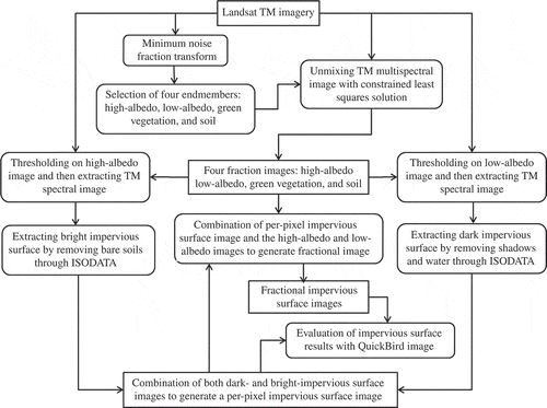
Figure 3. Four fraction images – high albedo, low-albedo, green vegetation, and soil in Santarém – a, b, c, d and in Lucas – e, f, g, h, which were developed from Landsat TM images with the spectral mixture analysis approach.
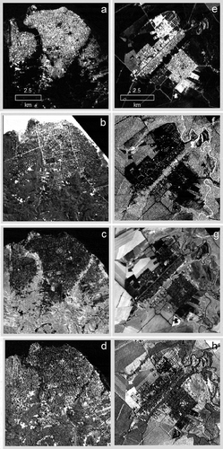
Figure 4. False-color composites from QuickBird images showing the complexity of impervious surface distribution in Santarém and Lucas.
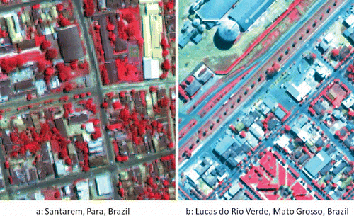
Figure 5. Impervious surface images in Santarém (a) and Lucas (b), which were developed from QuickBird images.
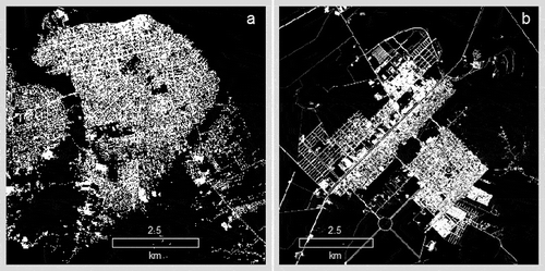
Figure 6. Impervious surface images in Santarém (a) and Lucas (b), which were developed from Landsat TM images using the fraction-based method.
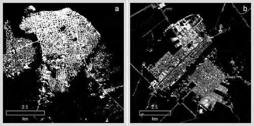
Figure 7. Comparison of residual distribution between fraction-based and per-pixel based methods for Santarém (Left) and Lucas (Right) study areas.
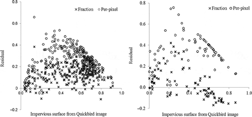
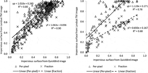
Figure 8. Relationship between estimates from Landsat TM image and reference data from QuickBird images for Santarém (Left) and Lucas (Right).