Figures & data
Table 1. Characteristics of ALOS/PALSAR images analyzed in this research
Table 2. Calibration factors of PALSAR images
Figure 1. Diagram used to classify sugarcane plots into parallel and perpendicular to the sensor's look direction.
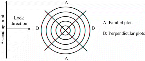
Figure 2. Average spaces between sugarcane planting rows (a) and between plants in the same row (b).
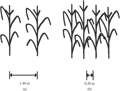
Figure 3. Mean σ° from the sugarcane plots, and rainfall data from the study area.Note: M – month.
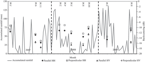
Table 3. A Mann–Whitney test was used to compare sugarcane's plots parallel and perpendicular to the satellite's look direction (α = 0.05) and the descriptive summary statistics (mean and standard deviation)
Figure 4. PALSAR HH-polarized image from 22 February 2008 (a), QuickBird optical image available in the Google EarthTM program from April 2008 (b) and a PALSAR HH-polarized image from 8 April 2008, (c) overpasses. Parallel plots are outlined in red, and perpendicular plots are outlined in green. The image scene is 2.9 km.
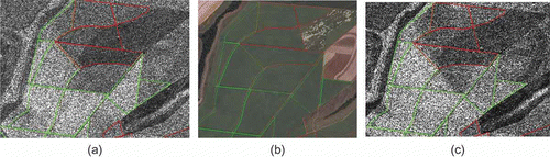
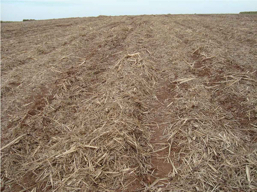
Figure 5. Panoramic field photo obtained on 14 May 2010, illustrating a typical directional terrain roughness found in the study area after sugarcane harvesting.