Figures & data
Table 1. Elevations, latitude, longitude, and land cover classifications of GHCN stations utilized in this study
Table 2. R 2 correlation coefficient between MODIS LST from Terra and Aqua satellites and minimum and maximum air temperature measured in study region
Figure 1. Mean absolute error of the NN spatial models for forecasting minimum daily air temperature (. The x-axis represents the average area represented by each sensor measurement.
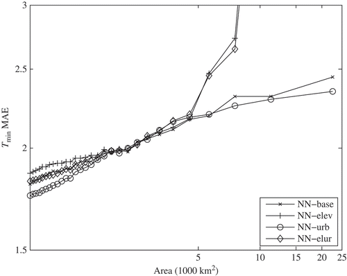
Figure 2. Mean absolute error of the IDW spatial models for forecasting minimum daily air temperature (. The x-axis represents the average area represented by each sensor measurement.
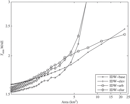
Figure 3. Mean absolute error of the remote sensing-based spatial models for forecasting minimum daily air temperature (. The x-axis represents the average area represented by each sensor measurement.
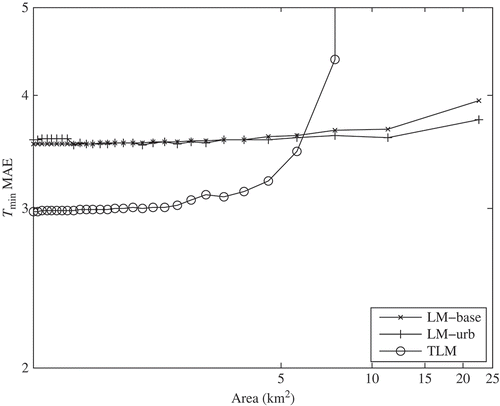
Figure 4. Mean absolute error of best performing models for minimum daily air temperature ( from each model group. The x-axis represents the average area represented by each sensor measurement.
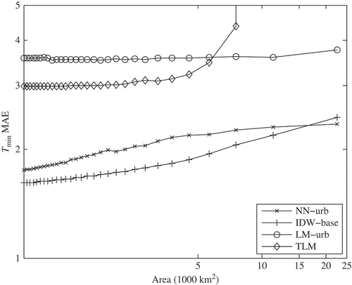
Figure 5. Mean absolute error of the NN spatial models for forecasting maximum daily air temperature (. The x-axis represents the average area represented by each sensor measurement.
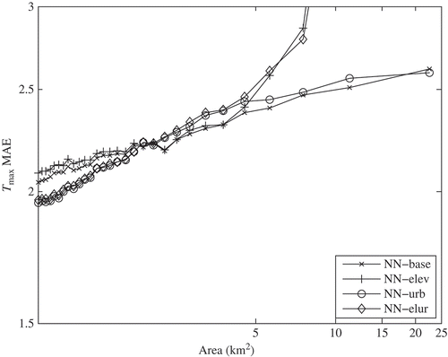
Figure 6. Mean absolute error of the IDW spatial models for forecasting maximum daily air temperature (. The x-axis represents the average area represented by each sensor measurement.
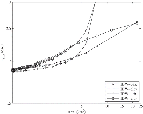
Figure 7. Mean absolute error of the remote sensing–based spatial models for forecasting maximum daily air temperature (. The x-axis represents the average area represented by each sensor measurement.
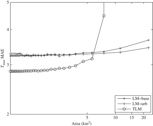
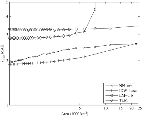
Figure 8. Mean absolute error of best performing models for maximum daily air temperature ( from each model group. The x-axis represents the average area represented by each sensor measurement.