Figures & data
Figure 1. A square detector with 24 × 24 or 576 cells.
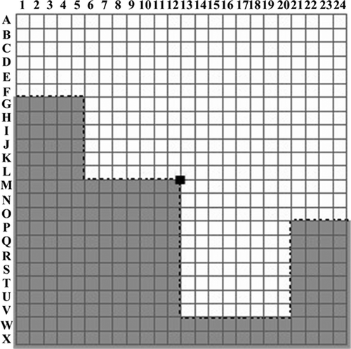
Figure 2. A simplification boundary plotted via cartographers' expertise. Dark grey represents the building to be simplified. The dotted line depicts the expected boundaries after simplification. A 24 × 24 detector is situated on the left side of the building.
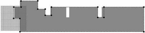
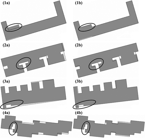
Figure 3. Basic (a) and extended (b) left turns.
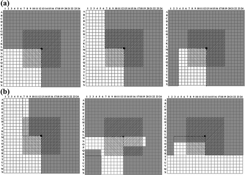
Figure 4. Basic (a) and extended (b) right turns.
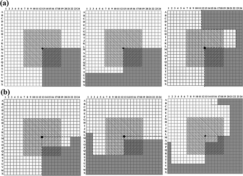
Figure 5. Basic (a) and extended (b) forward moves.
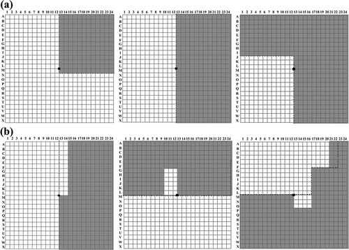
Table 1. Parameter settings in training
Figure 6. A BPNN simplification model.
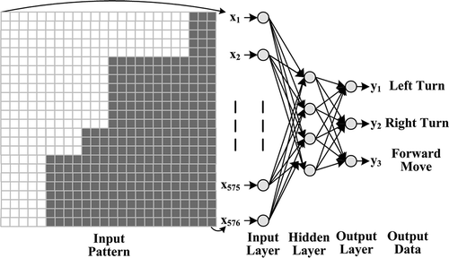
Figure 7. Buildings within a small part of the study area. (a) Before and (b) after the simplification.
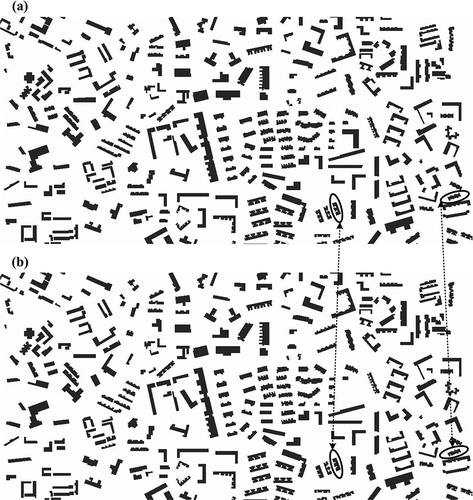
Figure 8. Two buildings extracted from Figure 7. The buildings before the simplification were in dark gray. The dotted lines outlined the buildings after the simplification.
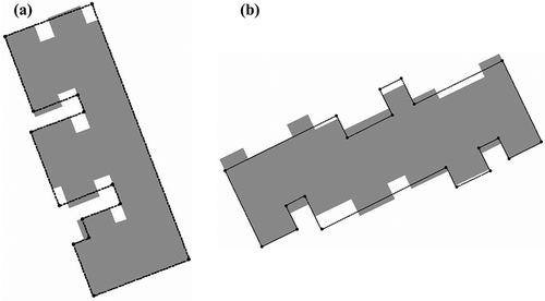
Table 2. Descriptive statistics of the degrees in similarity
Figure 9. Comparison of two detectors with 12 × 12 cells (a) and 24 × 24 cells (b).
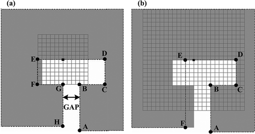
Figure 10. Comparison of simplification results generated by ESRI/ArcGIS® (a) and BPNN model (b).